world.wikisort.org - Netherlands
Schermerhorn is a village in the Dutch province of North Holland. It is a part of the municipality of Alkmaar, and lies about 9 km south of Heerhugowaard.
Schermerhorn | |
|---|---|
Village | |
 | |
 Flag  Coat of arms | |
 Schermerhorn Location in the Netherlands  Schermerhorn Location in the province of North Holland in the Netherlands | |
| Coordinates: 52°36′N 4°53′E | |
| Country | Netherlands |
| Province | North Holland |
| Municipality | Alkmaar |
| Area | |
| • Total | 6.30 km2 (2.43 sq mi) |
| Elevation | 0.2 m (0.7 ft) |
| Population (2021)[1] | |
| • Total | 1,275 |
| • Density | 200/km2 (520/sq mi) |
| Time zone | UTC+1 (CET) |
| • Summer (DST) | UTC+2 (CEST) |
| Postal code | 1636[1] |
| Dialing code | 072 |
History
The village was first mentioned in the 14th century as Den Horn, and means "corner (of the dike) in the Schermer (polder)".[3] Schermerhorn developed in the 13th century on the northern corner of the dike surrounding the former island Schermereiland. In 1635, it was connected to the main land and Alkmaar.[4]
The Dutch Reformed church is a three aisled basilica-like church with a slender tower and needle spire. The church was built between 1634 and 1635.[4] The are six polder mills and a wind mill museum in mill D in Schermerhorn. The museum has a glass floor in order to demonstrate the inner workings of a polder mill. In 1928, the pumping station Wilhelmina was built.[5]
Schermerhorn was home to 643 people in 1840.[5] It was a separate municipality until 1970, when it was merged with Schermer.[6] In 2015, it became part of the municipality of Alkmaar.[5]
Gallery
 view to the village
 Farm in Schermerhorn
 Wind mills
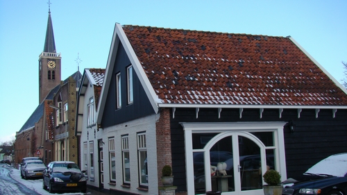
 Village view in Winter


References
- "Kerncijfers wijken en buurten 2021". Central Bureau of Statistics. Retrieved 28 April 2022.
- "Postcodetool for 1636VB". Actueel Hoogtebestand Nederland (in Dutch). Het Waterschapshuis. Retrieved 28 April 2022.
- "Schermerhorn - (geografische naam)". Etymologiebank (in Dutch). Retrieved 28 April 2022.
- Ronald Stenvert & Saskia van Ginkel-Meester (2006). "Schermerhorn" (in Dutch). Zwolle: Waanders. Retrieved 28 April 2022.
- "Schermerhorn". Plaatsengids (in Dutch). Retrieved 28 April 2022.
- Ad van der Meer and Onno Boonstra, Repertorium van Nederlandse gemeenten, KNAW, 2011.
External links
 Media related to Schermerhorn at Wikimedia Commons
This North Holland location article is a stub. You can help Wikipedia by expanding it. |
Другой контент может иметь иную лицензию. Перед использованием материалов сайта WikiSort.org внимательно изучите правила лицензирования конкретных элементов наполнения сайта.
WikiSort.org - проект по пересортировке и дополнению контента Википедии