world.wikisort.org - Netherlands
Hulst (Dutch pronunciation: [ɦʏlst] (![]() listen)) is a municipality and city in southwestern Netherlands in the east of Zeelandic Flanders.
listen)) is a municipality and city in southwestern Netherlands in the east of Zeelandic Flanders.
Hulst | |
|---|---|
City and Municipality | |
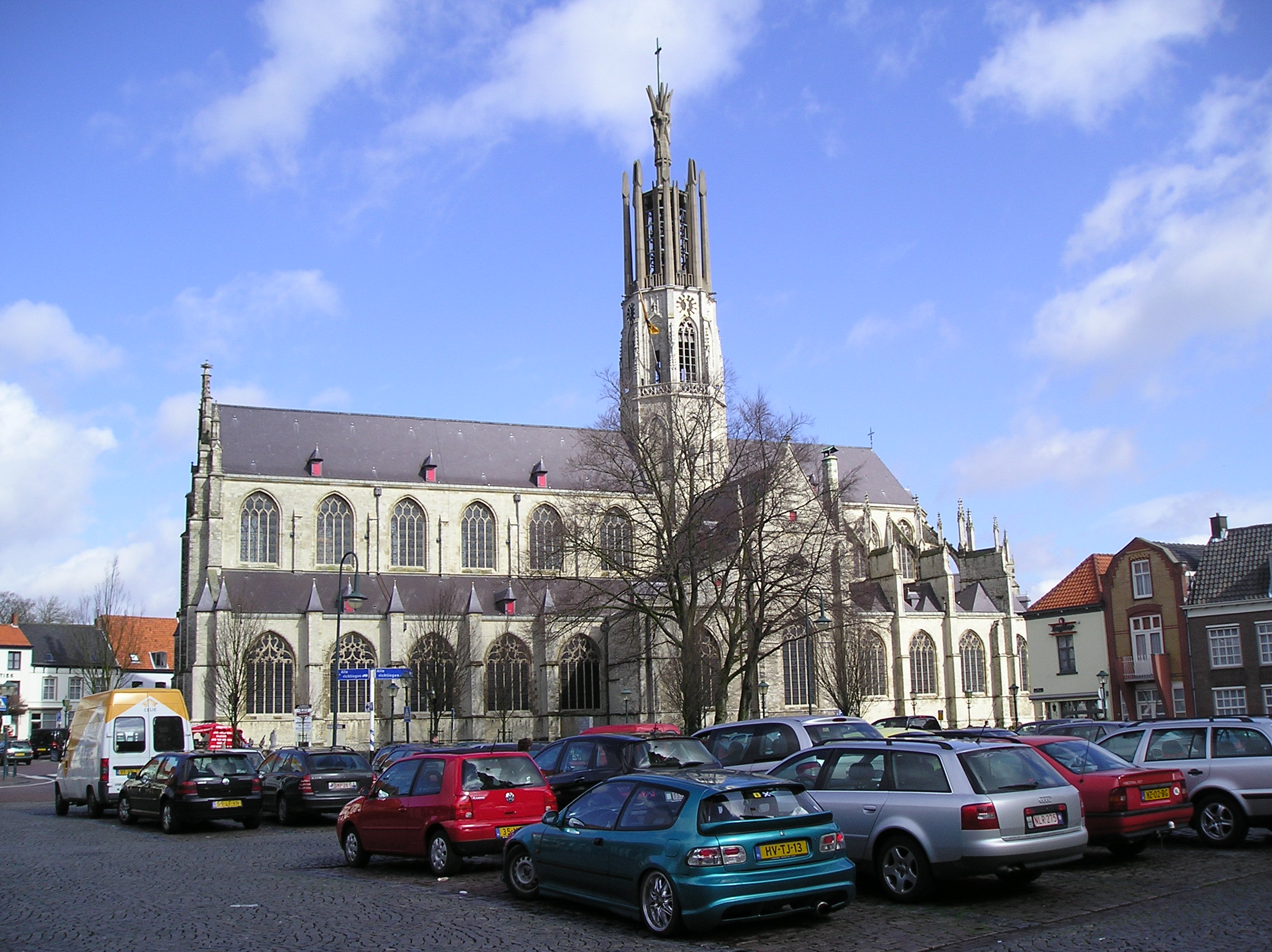 Basilica of Hulst in 2006 | |
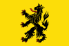 Flag  Coat of arms | |
 Hulst Location in the province of Zeeland in the Netherlands  Hulst Hulst (Netherlands) | |
| Coordinates: 51°17′N 4°3′E | |
| Country | Netherlands |
| Province | Zeeland |
| Government | |
| • Body | Municipal council |
| • Mayor | Jan-Frans Mulder (CDA) |
| Area | |
| • Total | 251.82 km2 (97.23 sq mi) |
| • Land | 201.71 km2 (77.88 sq mi) |
| • Water | 50.11 km2 (19.35 sq mi) |
| Elevation | 3 m (10 ft) |
| Population (January 2019)[4] | |
| • Total | 27,524 |
| • Density | 136/km2 (350/sq mi) |
| Demonym | Hulstenaar |
| Time zone | UTC+1 (CET) |
| • Summer (DST) | UTC+2 (CEST) |
| Postcode | 4560–4569, 4580–4589 |
| Area code | 0114 |
| Website | www |
History

Hulst received city rights in the 12th century.
Hulst was captured from the Spanish in 1591 by Maurice of Orange but was recaptured by Archduke Albert in 1596.
In 1640, the Dutch forces tried to conquer the city, but they were defeated in battle by the Spanish Army, and Frederick Henry was forced to retreat.
In 1645, the Siege of Hulst (to control the left bank of the Schelde river) occurred. It was led by Prince of Orange Frederick Henry, during the Eighty Years' War (1568–1648) with Spain.
A further siege took place in 1702, where General Menno van Coehoorn defended the town successfully for the Dutch and in 1747 when it was taken by the French after incompetent defence by Lt. General Pieter de la Rocque.[5]
In the seventeenth century, a star fort was constructed.[6] The fortifications, constructed during that time, are historic examples of Dutch fortress architecture.
The name Hulst (Holly in English) would appear to come from the shape of the battlements. Holly is depicted growing around the towns crest.
Geography

Hulst is located at 51°17′N 4°3′E in the south of the province of Zeeland in the southwest of the Netherlands. It is situated in the east of the region Zeelandic Flanders, which is connected by land only to Belgium, on the Dutch-Belgian border.
Hulst is neighbouring the municipalities of Terneuzen in the west, Stekene (Belgium) and Sint-Gillis-Waas (B) in the south, Beveren (B) in the east, and Reimerswaal in the north. The river Western Scheldt separates the land of Reimerswaal and Hulst.
The Drowned Land of Saeftinghe (Verdronken land van Saeftinghe) is a natural reserve in the north of the municipality. Its name refers to the Saeftinghe legend.
The population centers in the municipality are:
|
|
|
Government
The mayor of Hulst is Jan-Frans Mulder of the Christian Democratic Appeal.
Culture
Since June 2018, the city has its own letter artwork (a local variation on the capital's I Amsterdam). This work of art can be seen in turns at various locations in the municipality. The underlying idea is that the h at the beginning of a word is not pronounced in the Zeelandic / East Flemish dialect. By combining the letters n and h (in white and green) you can read the text in ulst in addition to i hulst. Under this concept in ulst, a campaign for and branding of the city of Hulst was launched simultaneously.

Letter artwork for the city of Hulst
International relations
Hulst is twinned with
|
Notable people

- Cornelius Jansen (1510 in Hulst – 1576) was a Catholic exegete and the first Bishop of Ghent
- Gillis Mostaert (the Elder) (1528 in Hulst – 1598) a Flemish Renaissance painter and draughtsman
- Frans Mostaert (1528 in Hulst – 1560) a Flemish Renaissance painter specializing in landscape paintings
- Valentin de Lannoy a Flemish military commander and governor of Hulst in 1623
- Cornelis de Vos (1584 in Hulst – 1651) a Flemish painter, draughtsman and art dealer
- Paul de Vos (ca.1591/92 in Hulst – 1678) a Flemish Baroque painter of animals, hunting scenes and still lifes
- Pieter Nuyts (1598 in Middelburg – 1655) a Dutch explorer, diplomat and politician
- Pieter Nuyts (1640 in Middelburg – 1709) a Dutch poet and dramatist
- Theo Middelkamp (1914 in Nieuw-Namen – 2005) a Dutch cyclist, world champion in 1947
Gallery
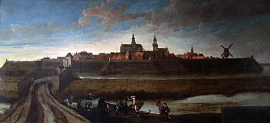 View of Hulst painted in 1628 by Cornelis de Vos
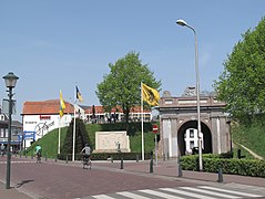 Gate (de Gentse Poort)
 View to a street: de Gentsestraat
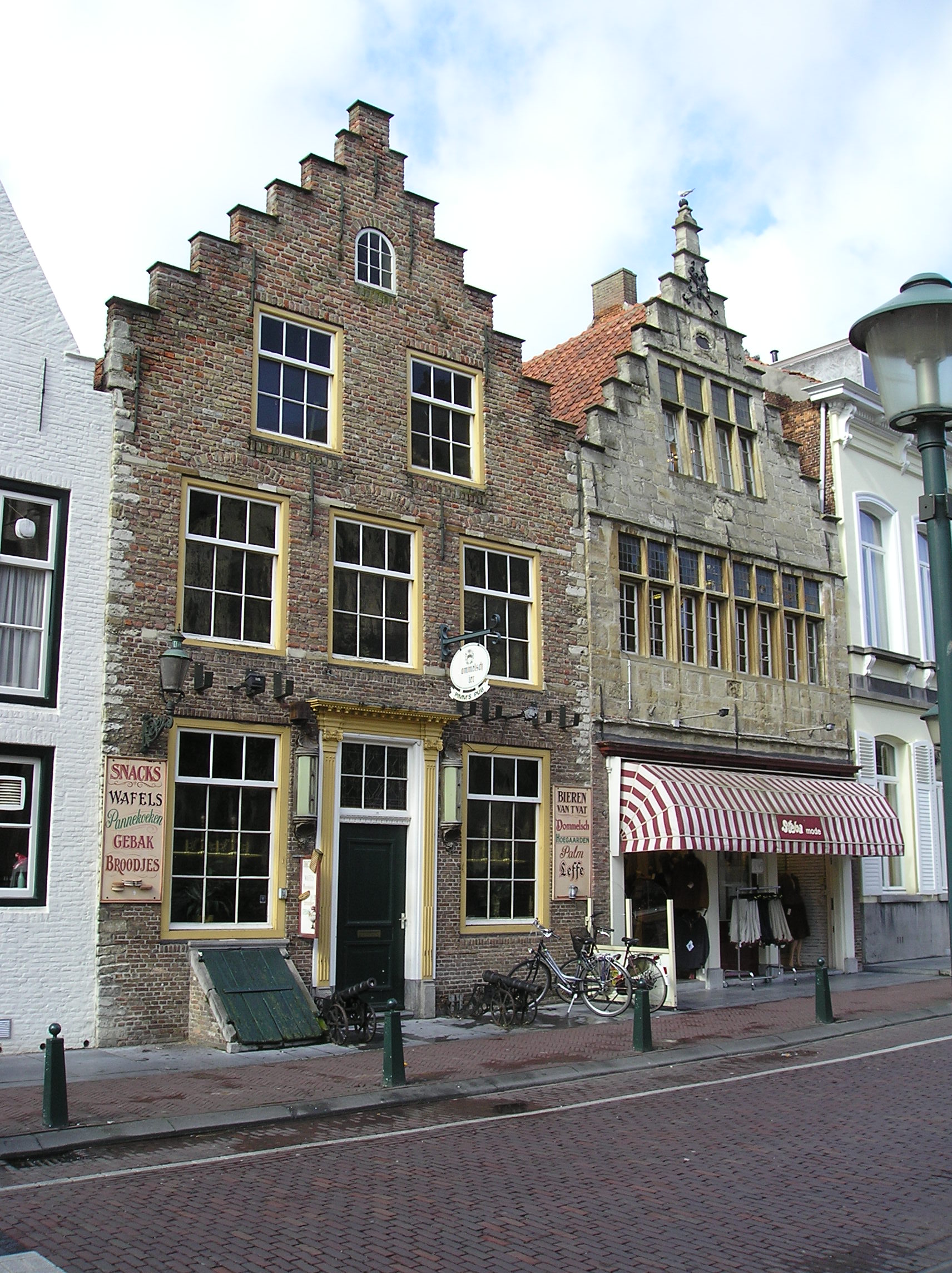
 Historical houses
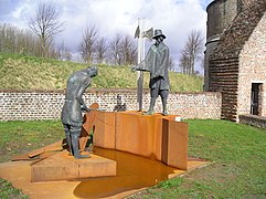 Monument on the defensive rampart of Hulst
 Artwork by Kris Ferket
 The museum De Vier Ambachten, former refugium of the Abbey Our Lady Ten Duinen
 Hulst Ravelijn


References
- "College van burgemeester en wethouders" [Board of mayor and aldermen] (in Dutch). Gemeente Hulst. Archived from the original on 11 December 2013. Retrieved 11 December 2013.
- "Kerncijfers wijken en buurten 2020" [Key figures for neighbourhoods 2020]. StatLine (in Dutch). CBS. 24 July 2020. Retrieved 19 September 2020.
- "Postcodetool for 4561EA". Actueel Hoogtebestand Nederland (in Dutch). Het Waterschapshuis. Archived from the original on 21 September 2013. Retrieved 11 December 2013.
- "Bevolkingsontwikkeling; regio per maand" [Population growth; regions per month]. CBS Statline (in Dutch). CBS. 1 January 2019. Retrieved 1 January 2019.
- "Further". Lowensteyn.com. Retrieved 2012-03-12.
- (in Dutch) Geschiedenis van Hulst Archived 2009-03-12 at the Wayback Machine. Hulst Vestingstad
External links
- Official website (in Dutch)
Places adjacent to Hulst | ||||||||||||||||
|---|---|---|---|---|---|---|---|---|---|---|---|---|---|---|---|---|
| ||||||||||||||||
Municipalities of Zeeland | ||
|---|---|---|
|  | |
| ||
Authority control | |
|---|---|
| General | |
| National libraries | |
| Other |
|
На других языках
[de] Hulst
Hulst ( anhören?/i) (seeländisch und ostflämisch Ulst) ist eine niederländische Gemeinde der Provinz Zeeland und hatte am 1. Januar 2022 laut Angabe des CBS 27.532 Einwohner.- [en] Hulst
[ru] Хюлст (община)
Хюлст (нидерл. Hulst) — община в провинции Зеландия (Нидерланды). Административный центр — город Хюлст. По данным на 1 апреля 2011 года население общины составляло 27.714 человек.Другой контент может иметь иную лицензию. Перед использованием материалов сайта WikiSort.org внимательно изучите правила лицензирования конкретных элементов наполнения сайта.
WikiSort.org - проект по пересортировке и дополнению контента Википедии