world.wikisort.org - Netherlands
Drouwenerveen is a village in the Dutch province of Drenthe. It is a part of the municipality of Borger-Odoorn and lies about 20 km east of Assen.
Drouwenerveen | |
|---|---|
Village | |
 Church | |
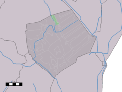 Drouwenerveen in the municipality of Borger-Odoorn. | |
 Drouwenerveen Location of the village in the province of Drenthe  Drouwenerveen Drouwenerveen (Netherlands) | |
| Coordinates: 52°58′N 6°51′E | |
| Country | Netherlands |
| Province | Drenthe |
| Municipality | Borger-Odoorn |
| Area | |
| • Total | 3.32 km2 (1.28 sq mi) |
| Elevation | 6 m (20 ft) |
| Population (2021)[1] | |
| • Total | 275 |
| • Density | 83/km2 (210/sq mi) |
| Time zone | UTC+1 (CET) |
| • Summer (DST) | UTC+2 (CEST) |
| Postal code | 9525[1] |
| Dialing code | 0599 |
The village was first mentioned in 1781 as "Gasselter en Drouwer Veenen", and means "the peat area belonging to Drouwen".[3] Drouwererveen started as a peat excavation village around 1820, and is a linear settlement along the road from Drouwen.[4]
Drouwenerveen was home to 305 people in 1840.[5] The Dutch Reformed church was built around 1915, and has become a residential house.[4]
References
- "Kerncijfers wijken en buurten 2021". Central Bureau of Statistics. Retrieved 10 April 2022.
- "Postcodetool for 9525TA". Actueel Hoogtebestand Nederland (in Dutch). Het Waterschapshuis. Retrieved 10 April 2022.
- "Drouwenerveen". Etymologiebank (in Dutch). Retrieved 10 April 2022.
- Ronald Stenvert (2001). Drouwenerveen (in Dutch). Zwolle: Waanders. p. 61. ISBN 90 400 9454 3. Retrieved 10 April 2022.
- "Drouwenerveen". Plaatsengids (in Dutch). Retrieved 10 April 2022.
Wikimedia Commons has media related to Drouwenerveen.
This Drenthe location article is a stub. You can help Wikipedia by expanding it. |
Текст в блоке "Читать" взят с сайта "Википедия" и доступен по лицензии Creative Commons Attribution-ShareAlike; в отдельных случаях могут действовать дополнительные условия.
Другой контент может иметь иную лицензию. Перед использованием материалов сайта WikiSort.org внимательно изучите правила лицензирования конкретных элементов наполнения сайта.
Другой контент может иметь иную лицензию. Перед использованием материалов сайта WikiSort.org внимательно изучите правила лицензирования конкретных элементов наполнения сайта.
2019-2026
WikiSort.org - проект по пересортировке и дополнению контента Википедии
WikiSort.org - проект по пересортировке и дополнению контента Википедии