world.wikisort.org - Netherlands
Eesergroen is a village in the Dutch province of Drenthe. It is a part of the municipality of Borger-Odoorn, and lies about 16 km northwest of Emmen.
Eesergroen | |
|---|---|
Village | |
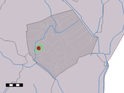 The village (dark red) and the statistical district (light green) of Eesergroen in the municipality of Borger-Odoorn. | |
 Eesergroen Location of the village in the province of Drenthe  Eesergroen Eesergroen (Netherlands) | |
| Coordinates: 52°53′N 6°47′E | |
| Country | Netherlands |
| Province | Drenthe |
| Municipality | Borger-Odoorn |
| Established | 1882 |
| Area | |
| • Total | 6.56 km2 (2.53 sq mi) |
| Elevation | 16 m (52 ft) |
| Population (2021)[1] | |
| • Total | 170 |
| • Density | 26/km2 (67/sq mi) |
| Time zone | UTC+1 (CET) |
| • Summer (DST) | UTC+2 (CEST) |
| Postal code | 9537[1] |
| Dialing code | 0599 |
The village was first mentioned in 1942 as "Eesergroen of Eesgroen", and means "trees belonging to Ees.[3] In 1882, the first house was built to cultivate the wilderness. In 1930, a canal was dug and the large scale cultivation of the area started.[4]
In 1917, the Maranatha chapel was built by the Rechtzinnig Hervormde Kerk, a Christian fundamentalist congregation. It was decommissioned in 1975 and is now used by an auto workshop. In 1956, a church was built by the Vrijzinnig Hervormde Kerk, a liberal Christianity congregation. It was decommissioned in 1969, and now serves as a holiday home.[4]
References
- "Kerncijfers wijken en buurten 2021". Central Bureau of Statistics. Retrieved 11 April 2022.
- "Postcodetool for 9537TA". Actueel Hoogtebestand Nederland (in Dutch). Het Waterschapshuis. Retrieved 11 April 2022.
- "Eesergroen - (geografische naam)". Etymologiebank (in Dutch). Retrieved 11 April 2022.
- "Eesergroen". Plaatsengids (in Dutch). Retrieved 11 April 2022.
This Drenthe location article is a stub. You can help Wikipedia by expanding it. |
Другой контент может иметь иную лицензию. Перед использованием материалов сайта WikiSort.org внимательно изучите правила лицензирования конкретных элементов наполнения сайта.
WikiSort.org - проект по пересортировке и дополнению контента Википедии