world.wikisort.org - Netherlands
Drouwenermond is a village in the Dutch province of Drenthe. It is a part of the municipality of Borger-Odoorn, and lies about 23 km north of Emmen.
Drouwenermond | |
|---|---|
 Church of Drouwenermond | |
 Drouwenermond in the municipality of Borger-Odoorn. | |
 Drouwenermond Location of the village in the province of Drenthe  Drouwenermond Drouwenermond (Netherlands) | |
| Coordinates: 52°59′N 6°54′E | |
| Country | Netherlands |
| Province | Drenthe |
| Municipality | Borger-Odoorn |
| Area | |
| • Total | 13.19 km2 (5.09 sq mi) |
| Elevation | 6 m (20 ft) |
| Population (2021)[1] | |
| • Total | 585 |
| • Density | 44/km2 (110/sq mi) |
| Time zone | UTC+1 (CET) |
| • Summer (DST) | UTC+2 (CEST) |
| Postal code | 9523[1] |
| Dialing code | 0599 |
The village was first mentioned in 1841 as "Drouwender-Mond of Drouwener-Mond", and means "(canal) which has its mouth (at a main canal) belonging to Drouwen". It refers to an eponymous canal which was dug in 1822 to excavate the peat in the area.[3] In 1817, the Province of Groningen permits Drenthe to transport peat through their province and dig canals towards the Stadskanaal.[4]
A church was built in 1920. In 2008, the building was decommissioned. Nobody was willing to buy the church and transform it into residential homes or offices. The neighbour only wanted the land, and the church was demolished in 2010.[4]
Drouwenermond was home to 170 people in 1840.[4]
Gallery
 Tulip field
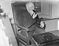 Grandpa Reiling (104) from Drouwenermond smokes his pipe


References
- "Kerncijfers wijken en buurten 2021". Central Bureau of Statistics. Retrieved 10 April 2022.
- "Postcodetool for 9523AX". Actueel Hoogtebestand Nederland (in Dutch). Het Waterschapshuis. Retrieved 10 April 2022.
- "Drouwenermond - (geografische naam)". Etymologiebank (in Dutch). Retrieved 10 April 2022.
- "Drouwenermond". Plaatsengids (in Dutch). Retrieved 10 April 2022.
This Drenthe location article is a stub. You can help Wikipedia by expanding it. |
Другой контент может иметь иную лицензию. Перед использованием материалов сайта WikiSort.org внимательно изучите правила лицензирования конкретных элементов наполнения сайта.
WikiSort.org - проект по пересортировке и дополнению контента Википедии