world.wikisort.org - Mali
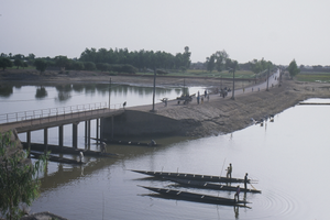
Djenné Cercle is an administrative subdivision of the Mopti Region of Mali. The administrative center (chef-lieu) is the town of Djenné. In the 2009 census the cercle had a population of 207,260 people.
Djenné Cercle | |
|---|---|
Cercle | |
 | |
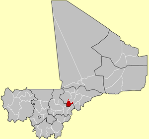 Location of the Cercle of Djenné in Mali | |
| Country | |
| Region | Mopti Region |
| Admin HQ | Djenné |
| Area | |
| • Total | 4,563 km2 (1,762 sq mi) |
| Population (2009 Census)[2] | |
| • Total | 207,260 |
| • Density | 45/km2 (120/sq mi) |
| Time zone | UTC+0 (GMT) |
Administrative subdivisions
The Djenné Cercle is divided into 12 communes:
References
- Synthèsis des Plans de Securité Alimentaire des Commune du Cercle de Djenné 2006-2010 (PDF) (in French), Commissariat à la Sécurité Alimentaire, République du Mali, USAID-Mali, 2006, archived from the original (PDF) on 2012-05-19.
- Resultats Provisoires RGPH 2009 (Région de Mopti) (PDF) (in French), République de Mali: Institut National de la Statistique, archived from the original (PDF) on 2012-09-19.
| Kayes Region |  | |
|---|---|---|
| Koulikoro Region | ||
| Sikasso Region | ||
| Ségou Region | ||
| Mopti Region | ||
| Tombouctou Region | ||
| Gao Region | ||
| Kidal Region | ||
| Bamako Capital District | ||
| Ménaka Region | ||
| Taoudénit Region | ||

This Mopti Region location article is a stub. You can help Wikipedia by expanding it. |
Текст в блоке "Читать" взят с сайта "Википедия" и доступен по лицензии Creative Commons Attribution-ShareAlike; в отдельных случаях могут действовать дополнительные условия.
Другой контент может иметь иную лицензию. Перед использованием материалов сайта WikiSort.org внимательно изучите правила лицензирования конкретных элементов наполнения сайта.
Другой контент может иметь иную лицензию. Перед использованием материалов сайта WikiSort.org внимательно изучите правила лицензирования конкретных элементов наполнения сайта.
2019-2026
WikiSort.org - проект по пересортировке и дополнению контента Википедии
WikiSort.org - проект по пересортировке и дополнению контента Википедии