world.wikisort.org - Japan
Nahari (奈半利町, Nahari-chō) is a town located in Aki District, Kōchi Prefecture, Japan. As of 1 January 2022[update], the town had an estimated population of 3,058 in 1665 households and a population density of 110 persons per km².[1]The total area of the town is 28.36 square kilometres (10.95 sq mi).
Nahari
奈半利町 | |
|---|---|
Town | |
 Nahari town hall | |
 Flag  Chapter | |
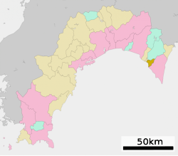
 Location of Nahari in Kōchi Prefecture | |
 | |
 Nahari Location in Japan | |
| Coordinates: 33°25′N 134°1′E | |
| Country | Japan |
| Region | Shikoku |
| Prefecture | Kōchi |
| District | Aki |
| Area | |
| • Total | 28.36 km2 (10.95 sq mi) |
| Population (January 1, 2022) | |
| • Total | 3,058 |
| • Density | 110/km2 (280/sq mi) |
| Time zone | UTC+09:00 (JST) |
| City hall address | 1659 Ōtsu, Nahari-chō, Aki-gun, Kōchi-ken 781-6402 |
| Website | Official website |
| Symbols | |
| Bird | Warbling white-eye |
| Tree | Sakura |

Geography
Nahari is located in southeastern Kōchi Prefecture on the island of Shikoku, with a coastline the Pacific Ocean to the southwest.
Neighbouring municipalities
Kōchi Prefecture
Climate
Nahari has a Humid subtropical climate (Köppen Cfa) characterized by warm summers and cool winters with light snowfall. The average annual temperature in Nahari is 16.2 °C. The average annual rainfall is 2541 mm with September as the wettest month. The temperatures are highest on average in January, at around 25.5 °C, and lowest in January, at around 6.7 °C.[2]
Demographics
Per Japanese census data,[3] the population of Nahari has been decreased steadily since the 1960s.
| Year | Pop. | ±% |
|---|---|---|
| 1920 | 4,848 | — |
| 1930 | 5,170 | +6.6% |
| 1940 | 4,975 | −3.8% |
| 1950 | 7,293 | +46.6% |
| 1960 | 6,914 | −5.2% |
| 1970 | 5,084 | −26.5% |
| 1980 | 4,874 | −4.1% |
| 1990 | 4,527 | −7.1% |
| 2000 | 4,027 | −11.0% |
| 2010 | 3,540 | −12.1% |
History
As with all of Kōchi Prefecture, the area of Nahari was part of ancient Tosa Province. The name of Aki District appears in Nara period . During the Edo period, the area was part of the holdings of Tosa Domain ruled by the Yamauchi clan from their seat at Kōchi Castle. The village of Nahari was established with the creation of the modern municipalities system on October 1, 1889. It was raised to town status on May 1, 1916.
Government
Nahari has a mayor-council form of government with a directly elected mayor and a unicameral town council of ten members. Nahari, together with the other municipalities of Aki District, contributes one member to the Kōchi Prefectural Assembly. In terms of national politics, the town is part of Kōchi 1st district of the lower house of the Diet of Japan.
Economy
Nahari's economy is centered on commercial fishing, horticulture, and small ship repair.
Education
Nahari has two public elementary schools and one public middle school operated by the village government. The town does not have a high school.
Transportation
Railway
Tosa Kuroshio Railway - Asa Line
Highways
 National Route 55
 National Route 493
References
- "Nahari town official statistics" (in Japanese). Japan.
- Nahari climate data
- Nahari population statistics
External links
 Media related to Nahari, Kōchi at Wikimedia Commons
- Nahari official website (in Japanese)
Kōchi (capital) | ||
| Core city |
| |
| Cities | ||
| Districts | ||
List of mergers in Kōchi Prefecture | ||
This Kōchi Prefecture location article is a stub. You can help Wikipedia by expanding it. |
На других языках
- [en] Nahari, Kōchi
[ru] Нахари
Нахари (яп. 奈半利町 Нахари-тё:) — посёлок в Японии, находящийся в уезде Аки префектуры Коти. Площадь посёлка составляет 28,32 км²[1], население — 3337 человек (1 августа 2014)[2], плотность населения — 117,83 чел./км².Другой контент может иметь иную лицензию. Перед использованием материалов сайта WikiSort.org внимательно изучите правила лицензирования конкретных элементов наполнения сайта.
WikiSort.org - проект по пересортировке и дополнению контента Википедии