world.wikisort.org - Japan
Muroto (室戸市, Muroto-shi) is a city located in Kōchi Prefecture, Japan. As of 30 June 2022[update], the city had an estimated population of 12,121 in 7079 households and a population density of 49 persons per km2.[1] The total area of the city is 248.18 square kilometres (95.82 sq mi).
Muroto
室戸市 | |
|---|---|
City | |
 View of the Pacific Ocean from Cape Muroto | |
 Flag  Emblem | |
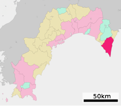
 Location of Muroto in Kōchi Prefecture | |
 | |
 Muroto Location in Japan | |
| Coordinates: 33°17′24″N 134°09′07″E | |
| Country | Japan |
| Region | Shikoku |
| Prefecture | Kōchi |
| Government | |
| • Mayor | Soichiro Ueta |
| Area | |
| • Total | 248.18 km2 (95.82 sq mi) |
| Population (June 30, 2022) | |
| • Total | 12,121 |
| • Density | 49/km2 (130/sq mi) |
| Time zone | UTC+09:00 (JST) |
| City hall address | 25-1 Ukitsu, Muroto-shi, Kōchi-ken 781-7185 |
| Climate | Cfa |
| Website | Official website |
| Symbols | |
| Bird | Japanese white-eye |
| Flower | Hamayū |
| Tree | Ubamegashi (Quercus phillyraeoides) |


Geography
Muroto is located in the southeastern tip of Kōchi Prefecture on the island of Shikoku. It occupies Cape Muroto which juts out into the Pacific Ocean. Parts of the city are within the borders of the Muroto-Anan Kaigan Quasi-National Park. The entire territory of Muroto is "Muroto Global Geopark" which is a member of the Japanese Geoparks Network and Global Geoparks Network since 2011 on account of its outstanding geological heritage, educational programs and projects, and promotion of geotourism.[2]
Geology
Cape Muroto is made up of Oligocene to Pleistocene-aged sedimentary rocks and loose Holocene-aged alluvial deposits. The rocks belong to the Shimanto Supergroup, represented in the peninsula as mudstone, and the Tonohama Group made up of chiefly of sandstone and gravel.[3] Several active, WNW-dipping, thrust faults are exposed at the western coast and southern tip of the peninsula. Off-shore west of the Cape Muroto, tip of the peninsula, there faults dips to the west.[3]
There are uplifted marine terraces at Muroto. Dating of these terraces reveal that since their formation in an interval 123 to 96 thousand years ago (k B.P.), in an epoch corresponding to the Eemian interglacial. Since then land in the tip of the peninsula has risen 1.2–1.6 meters every thousand years (m/kyr). Closer to the mainland the uplift rate has been in the order of 0.3–0.7 m/kyr.[3] While these are long-term averages individual large non-megathrust earthquakes are known to have uplifted the coast around one meter. These earthquakes are more rare than megathrust ones occurring every 1000 to 2000 years.[3] Uplift of the coast has left fossil tube worm colonies attached to rocks on land.[2]
Neighbouring municipalities
Kōchi Prefecture
Climate
Muroto has a humid subtropical climate (Köppen climate classification Cfa) with hot, humid summers and cool winters. There is significant precipitation throughout the year, especially during June and July. The average annual temperature in Muroto is 16.9 °C (62.4 °F). The average annual rainfall is 2,465.0 mm (97.05 in) with June as the wettest month. The temperatures are highest on average in August, at around 26.3 °C (79.3 °F), and lowest in January, at around 7.7 °C (45.9 °F).[4] The highest temperature ever recorded in Muroto was 35.0 °C (95.0 °F) on 30 July 1942; the coldest temperature ever recorded was −6.6 °C (20.1 °F) on 26 February 1981.[5]
| Climate data for Cape Muroto, Muroto (1991−2020 normals, extremes 1920−present) | |||||||||||||
|---|---|---|---|---|---|---|---|---|---|---|---|---|---|
| Month | Jan | Feb | Mar | Apr | May | Jun | Jul | Aug | Sep | Oct | Nov | Dec | Year |
| Record high °C (°F) | 20.8 (69.4) |
21.1 (70.0) |
22.9 (73.2) |
25.8 (78.4) |
28.2 (82.8) |
30.1 (86.2) |
35.0 (95.0) |
34.5 (94.1) |
32.9 (91.2) |
29.5 (85.1) |
26.4 (79.5) |
22.0 (71.6) |
35.0 (95.0) |
| Average high °C (°F) | 10.6 (51.1) |
11.4 (52.5) |
14.3 (57.7) |
18.2 (64.8) |
21.7 (71.1) |
23.9 (75.0) |
27.6 (81.7) |
29.0 (84.2) |
26.5 (79.7) |
22.2 (72.0) |
17.7 (63.9) |
13.0 (55.4) |
19.7 (67.4) |
| Daily mean °C (°F) | 7.7 (45.9) |
8.2 (46.8) |
11.0 (51.8) |
15.2 (59.4) |
18.8 (65.8) |
21.5 (70.7) |
25.0 (77.0) |
26.3 (79.3) |
24.0 (75.2) |
19.8 (67.6) |
15.1 (59.2) |
10.2 (50.4) |
16.9 (62.4) |
| Average low °C (°F) | 5.1 (41.2) |
5.4 (41.7) |
8.1 (46.6) |
12.5 (54.5) |
16.5 (61.7) |
19.6 (67.3) |
23.2 (73.8) |
24.4 (75.9) |
22.0 (71.6) |
17.6 (63.7) |
12.7 (54.9) |
7.7 (45.9) |
14.6 (58.2) |
| Record low °C (°F) | −5.4 (22.3) |
−6.6 (20.1) |
−3.5 (25.7) |
2.2 (36.0) |
7.1 (44.8) |
12.6 (54.7) |
16.5 (61.7) |
17.9 (64.2) |
14.4 (57.9) |
6.8 (44.2) |
1.8 (35.2) |
−2.1 (28.2) |
−6.6 (20.1) |
| Average precipitation mm (inches) | 89.5 (3.52) |
113.8 (4.48) |
177.4 (6.98) |
203.2 (8.00) |
240.6 (9.47) |
330.8 (13.02) |
267.9 (10.55) |
210.2 (8.28) |
322.3 (12.69) |
251.8 (9.91) |
164.3 (6.47) |
93.3 (3.67) |
2,465 (97.05) |
| Average snowfall cm (inches) | 0 (0) |
0 (0) |
0 (0) |
0 (0) |
0 (0) |
0 (0) |
0 (0) |
0 (0) |
0 (0) |
0 (0) |
0 (0) |
0 (0) |
0 (0) |
| Average precipitation days (≥ 1.0 mm) | 6.5 | 7.6 | 10.6 | 10.1 | 10.6 | 13.9 | 11.1 | 10.9 | 11.9 | 10.0 | 8.0 | 6.1 | 117.3 |
| Average snowy days (≥ 1 cm) | 0 | 0 | 0 | 0 | 0 | 0 | 0 | 0 | 0 | 0 | 0 | 0 | 0 |
| Average relative humidity (%) | 61 | 63 | 67 | 71 | 78 | 87 | 89 | 86 | 80 | 72 | 68 | 63 | 74 |
| Mean monthly sunshine hours | 179.0 | 172.1 | 194.7 | 199.7 | 196.1 | 132.3 | 177.8 | 227.9 | 171.2 | 178.5 | 169.3 | 180.4 | 2,178.9 |
| Source: Japan Meteorological Agency[5][4] | |||||||||||||
Demographics
Per Japanese census data, the population of Muroto in 2020 is 11,742 people.[6] Muroto has been conducting censuses since 1920.
| Year | Pop. | ±% |
|---|---|---|
| 1920 | 22,207 | — |
| 1925 | 23,851 | +7.4% |
| 1930 | 26,103 | +9.4% |
| 1935 | 25,967 | −0.5% |
| 1940 | 25,081 | −3.4% |
| 1945 | 30,227 | +20.5% |
| 1950 | 32,667 | +8.1% |
| 1955 | 32,878 | +0.6% |
| 1960 | 30,498 | −7.2% |
| 1965 | 28,746 | −5.7% |
| 1970 | 27,445 | −4.5% |
| 1975 | 26,660 | −2.9% |
| 1980 | 26,086 | −2.2% |
| 1985 | 25,309 | −3.0% |
| 1990 | 23,308 | −7.9% |
| 1995 | 21,430 | −8.1% |
| 2000 | 19,472 | −9.1% |
| 2005 | 17,490 | −10.2% |
| 2010 | 15,210 | −13.0% |
| 2015 | 13,524 | −11.1% |
| 2020 | 11,742 | −13.2% |
| Muroto population statistics[6] | ||
History
As with all of Kōchi Prefecture, the area of Muroto was part of ancient Tosa Province. During the Edo period, the area was part of the holdings of Tosa Domain ruled by the Yamauchi clan from their seat at Kōchi Castle. Following the Meiji restoration, the village of Muroto was established within Aki District, Kōchi with the creation of the modern municipalities system on October 1, 1889. In 1934, a typhoon caused tremendous devastation, killing 3,000 people. Muroto merged with the towns of Murotomisaki, Kiragawa, Sakihama and Hane and was elevated to city status on March 1, 1951.
Government
Muroto has a mayor-council form of government with a directly elected mayor and a unicameral city council of 12 members. Muroto, together with the town of Tōyō, contributes one member to the Kōchi Prefectural Assembly. In terms of national politics, the city is part of Kōchi 1st district of the lower house of the Diet of Japan.
Economy
Commercial fishing dominates the local economy of Muroto. The city is suffering from depopulation due to the decline of the fishery industry.
Education
Muroto has five public elementary schools and four public middle schools operated by the city government and one public middle school operated by the Kōchi Prefectural Department of Education.
Transportation
Railway
Muroto has no passenger railway service. The nearest train station is Nahari Station on the Tosa Kuroshio Railways Asa Line. Plans to extend the line from Nahari to Muroto have been floated since 1971, but no action has been taken.
Highways
 National Route 55
Local attractions
- Cape Muroto
- Hotsumisaki-ji, 24th temple on the Shikoku Pilgrimage
- Shinshō-ji, 25th temple on the Shikoku Pilgrimage
- Kongōchō-ji, 26th temple on the Shikoku Pilgrimage
References
- "Muroto city official statistics" (in Japanese). Japan.
- Muroto Global Geopark
- Matsu'ura, Tabito (2015). "Late Quaternary uplift rate inferred from marine terraces, Muroto Peninsula, southwest Japan: Forearc deformation in an oblique subduction zone". Geomorphology. 234: 133–150. Bibcode:2015Geomo.234..133M. doi:10.1016/j.geomorph.2015.01.012.
- 気象庁 / 平年値(年・月ごとの値). JMA. Retrieved April 17, 2022.
- 観測史上1~10位の値(年間を通じての値). JMA. Retrieved April 17, 2022.
- Muroto population statistics
External links
- Muroto City official website (in Japanese)
- Muroto Global Geopark in English
- Muroto-Anan Coast Quasi-National Park in English
 Geographic data related to Muroto, Kōchi at OpenStreetMap
Kōchi (capital) | ||
| Core city |
| |
| Cities | ||
| Districts | ||
List of mergers in Kōchi Prefecture | ||
Authority control | |
|---|---|
| General | |
| National libraries | |
| Scientific databases | |
| Other |
|
This Kōchi Prefecture location article is a stub. You can help Wikipedia by expanding it. |
На других языках
[de] Muroto
Muroto (japanisch 室戸市 -shi) ist eine Stadt in der Präfektur Kōchi in Japan.- [en] Muroto, Kōchi
[ru] Мурото
Мурото (яп. 室戸市 Мурото-си) — город в Японии, находящийся в префектуре Коти. Площадь города составляет 248,30 км²[1], население — 13 710 человек (1 августа 2014)[2], плотность населения — 55,22 чел./км².Другой контент может иметь иную лицензию. Перед использованием материалов сайта WikiSort.org внимательно изучите правила лицензирования конкретных элементов наполнения сайта.
WikiSort.org - проект по пересортировке и дополнению контента Википедии