world.wikisort.org - Japan
Kuroshio (黒潮町, Kuroshio-chō) is a town located in Hata District, Kōchi Prefecture, Japan. As of 31 July 2022[update], the town had an estimated population of 10,504 in 5443 households, and a population density of 56 persons per km².[1] The total area of the town is 188.59 square kilometres (72.82 sq mi). The residents speak a distinct dialect of Japanese known as Hata-ben.
Kuroshio
黒潮町 | |
|---|---|
Town | |
 Kuroshio Town Office | |
 Flag  Emblem | |
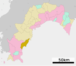
 Location of Kuroshio in Kōchi Prefecture | |
 | |
 Kuroshio Location in Japan | |
| Coordinates: 33°1′N 133°1′E | |
| Country | Japan |
| Region | Shikoku |
| Prefecture | Kōchi |
| District | Hata |
| Area | |
| • Total | 188.59 km2 (72.82 sq mi) |
| Population (July 31, 2022) | |
| • Total | 10,504 |
| • Density | 56/km2 (140/sq mi) |
| Time zone | UTC+09:00 (JST) |
| City hall address | 5893 Irino, Kuroshio-chō, Hata-gun, Kōchi-ken 789-1992 |
| Climate | Cfa |
| Website | Official website |
| Symbols | |
| Bird | Kentish plover, Warbling white-eye |
| Flower | Lily, Camellia japonica |
| Tree | Pinus thunbergii |

Geography
Kuroshio is located in southwestern Kōchi Prefecture on the island of Shikoku. It has a long coastline facing the Pacific Ocean to the southeast. Kuroshio is located two hours (by car or train) west of Kōchi City.
Neighbouring municipalities
Kōchi Prefecture
Climate
Kuroshio has a humid subtropical climate (Köppen climate classification Cfa) . The average annual temperature in Kuroshio is 16.6 °C (61.9 °F). The average annual rainfall is 2,812.9 mm (110.74 in) with June as the wettest month. The temperatures are highest on average in August, at around 26.9 °C (80.4 °F), and lowest in January, at around 6.4 °C (43.5 °F).[2] The highest temperature ever recorded in Kuroshio was 38.6 °C (101.5 °F) on 25 July 2013; the coldest temperature ever recorded was −7.3 °C (18.9 °F) on 27 February 1981.[3] Winter (late November through to mid March) can be very dry and chilling with many homes and schools using kerosene heaters to keep warm. Temperatures average 13 °C (55 °F) in the daytime and 2 °C (36 °F) at night. It occasionally snows in the winter though often does not last the day due to the town's close proximity to the coast.[2] The summer months (July - September) are hot and humid. The temperature in summer can reach an average of 32 °C (90 °F) in the day and about 24 °C (75 °F) at night. Rainy season is in June and generally lasts three weeks. Kochi experiences a typhoon season which lasts from July until September.[2] Spring and autumn are mild months with some wet and windy days.
| Climate data for Kuroshio (1991−2020 normals, extremes 1977−present) | |||||||||||||
|---|---|---|---|---|---|---|---|---|---|---|---|---|---|
| Month | Jan | Feb | Mar | Apr | May | Jun | Jul | Aug | Sep | Oct | Nov | Dec | Year |
| Record high °C (°F) | 21.6 (70.9) |
23.7 (74.7) |
27.2 (81.0) |
29.3 (84.7) |
34.0 (93.2) |
35.4 (95.7) |
38.6 (101.5) |
38.1 (100.6) |
35.1 (95.2) |
32.1 (89.8) |
26.8 (80.2) |
23.0 (73.4) |
38.6 (101.5) |
| Average high °C (°F) | 11.7 (53.1) |
12.7 (54.9) |
15.9 (60.6) |
20.0 (68.0) |
23.7 (74.7) |
25.9 (78.6) |
29.9 (85.8) |
30.7 (87.3) |
28.2 (82.8) |
24.1 (75.4) |
19.1 (66.4) |
13.9 (57.0) |
21.3 (70.4) |
| Daily mean °C (°F) | 6.4 (43.5) |
7.4 (45.3) |
10.7 (51.3) |
15.1 (59.2) |
19.1 (66.4) |
22.2 (72.0) |
26.1 (79.0) |
26.9 (80.4) |
24.0 (75.2) |
19.0 (66.2) |
13.6 (56.5) |
8.4 (47.1) |
16.6 (61.8) |
| Average low °C (°F) | 1.8 (35.2) |
2.6 (36.7) |
5.7 (42.3) |
10.3 (50.5) |
14.8 (58.6) |
19.0 (66.2) |
23.0 (73.4) |
23.7 (74.7) |
20.7 (69.3) |
15.0 (59.0) |
9.2 (48.6) |
3.9 (39.0) |
12.5 (54.5) |
| Record low °C (°F) | −6.1 (21.0) |
−7.3 (18.9) |
−4.9 (23.2) |
−0.1 (31.8) |
6.1 (43.0) |
11.1 (52.0) |
15.5 (59.9) |
17.3 (63.1) |
9.2 (48.6) |
3.9 (39.0) |
−0.6 (30.9) |
−5.0 (23.0) |
−7.3 (18.9) |
| Average precipitation mm (inches) | 79.2 (3.12) |
118.7 (4.67) |
204.3 (8.04) |
234.9 (9.25) |
282.3 (11.11) |
424.5 (16.71) |
282.3 (11.11) |
274.8 (10.82) |
408.8 (16.09) |
256.0 (10.08) |
153.5 (6.04) |
93.7 (3.69) |
2,812.9 (110.74) |
| Average precipitation days (≥ 1.0 mm) | 7.0 | 8.0 | 11.0 | 10.4 | 10.7 | 15.1 | 12.3 | 12.5 | 13.4 | 9.6 | 7.9 | 7.0 | 124.9 |
| Mean monthly sunshine hours | 184.1 | 174.8 | 192.5 | 201.0 | 199.2 | 134.2 | 198.1 | 221.4 | 161.9 | 177.7 | 166.0 | 180.9 | 2,191.9 |
| Source: Japan Meteorological Agency[3][2] | |||||||||||||
Demographics
Per Japanese census data, the population of Kuroshio in 2020 is 10,262 people.[4] Kuroshio has been conducting censuses since 1960.
| Year | Pop. | ±% |
|---|---|---|
| 1960 | 19,623 | — |
| 1965 | 17,522 | −10.7% |
| 1970 | 15,881 | −9.4% |
| 1975 | 15,744 | −0.9% |
| 1980 | 16,116 | +2.4% |
| 1985 | 16,009 | −0.7% |
| 1990 | 15,395 | −3.8% |
| 1995 | 15,024 | −2.4% |
| 2000 | 14,208 | −5.4% |
| 2005 | 13,437 | −5.4% |
| 2010 | 12,370 | −7.9% |
| 2015 | 11,217 | −9.3% |
| 2020 | 10,262 | −8.5% |
| Kuroshio population statistics[4] | ||
History
As with all of Kōchi Prefecture, the area of Kuroshio was part of ancient Tosa Province. During the Edo period, the area was part of the holdings of Tosa Domain ruled by the Yamauchi clan from their seat at Kōchi Castle. Following the Meiji restoration, the village of Saga (佐賀村) was established within Hata District, Kōchi with the creation of the modern municipalities system on October 1, 1889. Saga was raised to town status on November 3, 1940. On March 20, 2006, Saga merged with the neighboring town of Ōgata to form the town of Kuroshio.
Government
Kuroshio has a mayor-council form of government with a directly elected mayor and a unicameral town council of 14 members. Kuroshio contributes one member to the Kōchi Prefectural Assembly. In terms of national politics, the town is part of Kōchi 2nd district of the lower house of the Diet of Japan.
Economy
The local economy is dominated by commercial fishing, notably pole-and-line fishing for Tosa skipjack tuna, and by agriculture, including shiitake mushrooms and greenhouse horticulture, flowers, and paddy rice. In recent years, sun-dried salt has become a representative specialty product. Seasonal tourism, particularly in the summer for camping and surfing is playing an increasing role in the local economy.
Education
Kuroshio has eight public elementary schools and two public middle schools operated by the town government, and one public high school operated by the Kōchi Prefectural Board of Education. The town participates in the JET Programme, employing two representatives who regularly visit the junior high schools and elementary schools to teach English.
Every year in late August, during the summer vacation, twelve third year students chosen from Kuroshio's two junior high schools travel to Hamilton, New Zealand. There they participate in a homestay with families of students who attend Hamilton's Fairfield Intermediate School. The Kuroshio students are accompanied by a Kuroshio Board of Education representative, two teachers and one of the JET participants (usually a New Zealander). The students participate in school activities and ESL classes while at Fairfield Intermediate. Occasionally Fairfield Intermediate have sent a group of students and teachers to visit Kuroshio. The relationship between the two schools began in 1999.
Transportation
Railway
Tosa Kuroshio Railway - Nakamura Line
- Kaina - Iyoki - Tosa-Saga - Saga-Kōen - Tosa-Shirahama - Ariigawa - Tosa-Kamikawaguchi - Uminoōmukae - Ukibuchi - Tosa-Irino - Nishi-Ōgata
Highways
 Kōchi Expressway
 National Route 56
Local attractions
- Irino Matsubara, National Place of Scenic Beauty. Baby turtles can be seen entering the water at sunrise from August through September on Irino Beach. Local volunteers help to protect the nests and the young turtles from birds and the trampling feet of beach goers. The volunteers are happy to include early morning spectators in the task of preparing and protecting the newly hatched turtles for their first experience of the open sea. During Golden Week (Japan) Kuroshio's Seaside Gallery hosts the annual T-shirt Art Exhibition on Irino beach. Many entries are made from both within Japan and internationally and draw a great number of tourists to the area.
- Kobushinosata onsen is located on Japan National Route 56, ten minutes east of Saga. Many pilgrims on the Shikoku Pilgrimage stop at this onsen.
Noted people from Kuroshio
- Akatsuki Kambayashi, author
References
- "Kuroshio town official statistics" (in Japanese). Japan.
- 気象庁 / 平年値(年・月ごとの値). JMA. Retrieved April 18, 2022.
- 観測史上1~10位の値(年間を通じての値). JMA. Retrieved April 18, 2022.
- Kuroshio population statistics
External links
 Media related to Kuroshio, Kōchi at Wikimedia Commons
- Kuroshio official website (in Japanese)
Kōchi (capital) | ||
| Core city |
| |
| Cities | ||
| Districts | ||
List of mergers in Kōchi Prefecture | ||
На других языках
- [en] Kuroshio, Kōchi
[es] Kuroshio (Kōchi)
Kuroshio (黒潮町, Kuroshio-chō?) es un pueblo localizado en la prefectura de Kōchi, Japón. En junio de 2019 tenía una población estimada de 10.443 habitantes y una densidad de población de 55,4 personas por km². Su área total es de 188,59 km².[ru] Куросио (посёлок)
Куросио (яп. 黒潮町 Куросио-тё:) — посёлок в Японии, находящийся в уезде Хата префектуры Коти. Площадь посёлка составляет 188,47 км²[1], население — 11 333 человека (1 августа 2014)[2], плотность населения — 60,13 чел./км².Другой контент может иметь иную лицензию. Перед использованием материалов сайта WikiSort.org внимательно изучите правила лицензирования конкретных элементов наполнения сайта.
WikiSort.org - проект по пересортировке и дополнению контента Википедии