world.wikisort.org - Japan
Manazuru (真鶴町, Manazuru-machi) is a town located in Kanagawa Prefecture, Japan. As of 1 June 2022[update], the town had an estimated population of 6,949 and a population density of 1000 persons per km².[1] The total area of the town is 7.02 square kilometres (2.71 sq mi).
Manazuru
真鶴町 | |
|---|---|
Town | |
 Manazuru Town Hall | |
 Flag  Seal | |
 Location of Manazuru in Kanagawa Prefecture | |
 Manazuru | |
| Coordinates: 35°09′N 139°08′E | |
| Country | Japan |
| Region | Kantō |
| Prefecture | Kanagawa |
| District | Ashigarashimo |
| Area | |
| • Total | 7.02 km2 (2.71 sq mi) |
| Population (May 1, 2021) | |
| • Total | 7,061 |
| • Density | 1,000/km2 (2,600/sq mi) |
| Time zone | UTC+9 (Japan Standard Time) |
| - Tree | Cinnamomum camphora |
| - Flower | Crinum asiaticum |
| - Bird | Blue Rock-thrush |
| Phone number | 0465-68-1131 |
| Address | 244-1 Iwa, Manazuru-machi, Ashigarashimo-gun, Kanagawa-ken 259-0202 |
| Website | Official website |
Geography
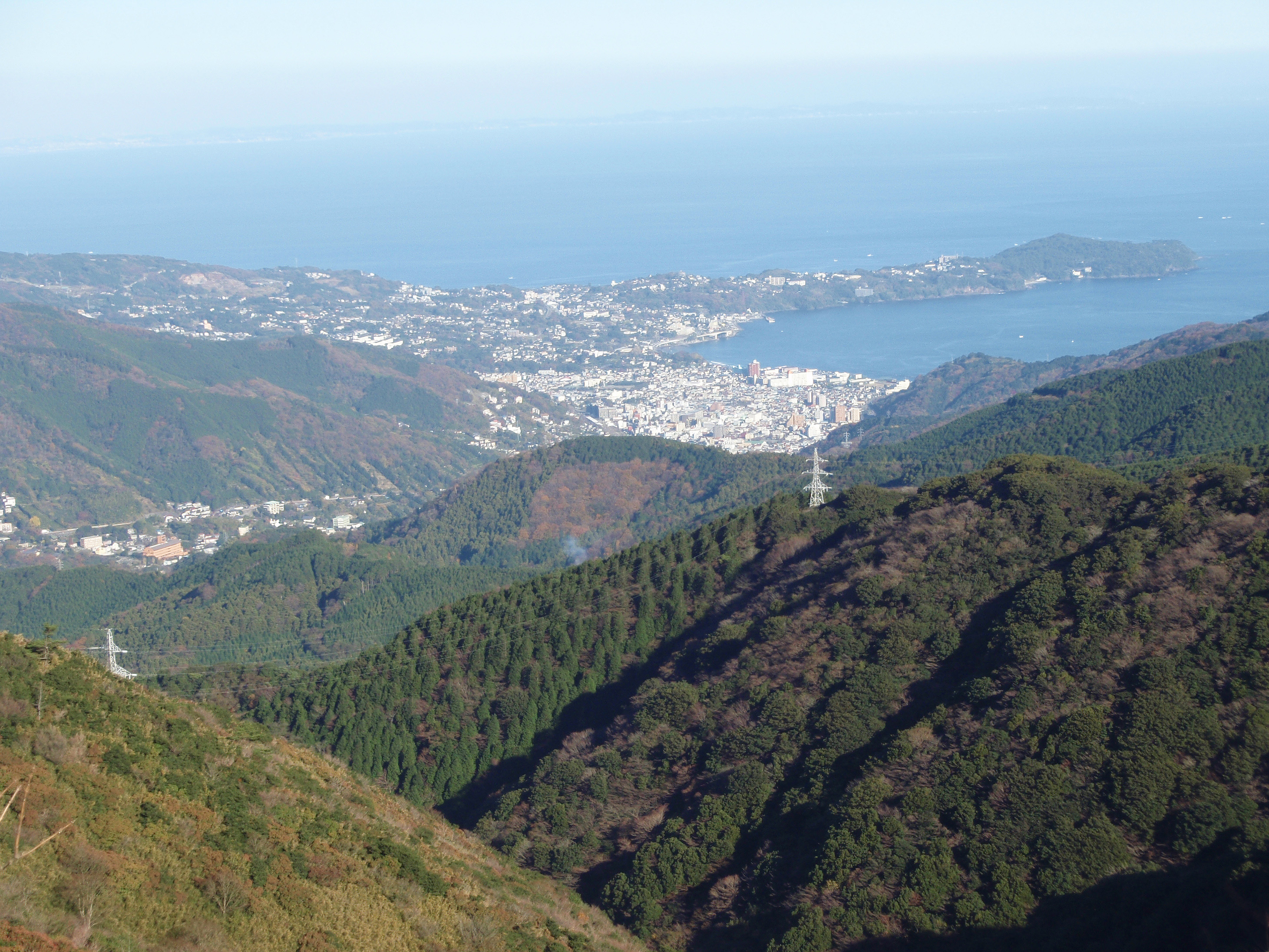
Located in the southeast of Mount Hakone, the consists of the small Manazuru Peninsula, which extends into Sagami Bay from the southeast to the northwest, sandwiched between Odawara City in the north and Yugawara Town in the south. The Manazuru Peninsula is a lava plateau with a steep coast and The town area is generally rugged with few flat areas. The urban area is at the base of the peninsula, with Manazuru Station to the northwest, Iwa Fishing Port and Iwo Beach to the east, and Manazuru Port to the southeast. There are many quarries in the mountains north of the city. Mandarin oranges are cultivated in the hills along the northern coast. The northwestern part of the town is part of a mountainous area that extends to the outer ring of the Hakone volcano. The town is within the Manazuru Hantō Prefectural Natural Park.
Surrounding municipalities
Kanagawa Prefecture
- Odawara
- Yugawara
Climate
Manazuru has a Humid subtropical climate (Köppen Cfa) characterized by warm summers and cool winters with light to no snowfall. The average annual temperature in Manazuru is 14.2 °C. The average annual rainfall is 2144 mm with September as the wettest month. The temperatures are highest on average in August, at around 24.7 °C, and lowest in January, at around 4.2 °C.[2]
Demographics
Per Japanese census data,[3] the population of Manazuru peaked around the year 1970, and is now slightly declining.
| Year | Pop. | ±% |
|---|---|---|
| 1920 | 5,097 | — |
| 1930 | 5,511 | +8.1% |
| 1940 | 6,169 | +11.9% |
| 1950 | 8,657 | +40.3% |
| 1960 | 9,141 | +5.6% |
| 1970 | 10,284 | +12.5% |
| 1980 | 9,968 | −3.1% |
| 1990 | 9,588 | −3.8% |
| 2000 | 9,075 | −5.4% |
| 2010 | 8,215 | −9.5% |
History
As with the rest of Ashigarashimo District, the area now comprising modern Manazuru was part of Sagami Province under control of the later Hōjō clan in the Sengoku period, and part of Odawara Domain during the Edo period. During this time, it was known for high quality stones for construction. After the Meiji Restoration, Manazuru was established as a village in 1889 with the establishment of the modern municipalities system. On October 1, 1927 Manazuru village was elevated to town status. On September 30, 1956, neighboring Iwa village was merged into Manazuru. A proposal to merge Manazuru into neighboring Yugawara was overwhelmingly rejected by a citizen's referendum in 2005.
Government
Manazuru has a mayor-council form of government with a directly elected mayor and a unicameral town council of 11 members. Manazuru, together with neighboring Yugawara, contributes one member to the Kanagawa Prefectural Assembly. In terms of national politics, the town is part of Kanagawa 16th district of the lower house of the Diet of Japan.
Economy

Traditionally, the industry characterizing Manazuru was the mining of Komatsu stone (ja) dating back to Middle Ages. The economy of Manazuru is now based on tourism, and as a summer resort area, promoting itself as the "Japanese Riviera", claiming to losely resembles the Mediterranean coast of France and Italy.[4][5] The town also functions as a bedroom community for nearby Odawara. The hilly, stony peninsula is not suited for agriculture, but cultivation of mikan and commercial fishing also contribute to the local economy.
Education
Manazuru has one public elementary school and one public middle school operated by the town government. The town does not have a high school.
Transportation
Railway
![]() JR East – Tōkaidō Main Line
JR East – Tōkaidō Main Line
Highway
 National Route 135
Area attractions
- Iwa Beach (ja)
- Dōsojin (ja)
- Ryumonji (ja)
- The monument of Stonemason's ancestors (ja)
- Manazuru Hantō Prefectural Natural Park
- Kibune jinja Shrine (ja)
- Kibune Festival which is designated as an important intangible folk cultural asset designated as a country and is considered one of Japan’s three major festivals. Held two days from 27 to 28 July.
- Nakagawa Kazumasa art Museum (ja)
- Kuroda Nagamasa memorial tower (ja)
- Shitodo-no-iwaya Hidden Cave (ja)
- This historic site near Manazuru Port is associated with Minamoto no Yoritomo. After losing a battle with the Taira clan at Mt. Ishibasiyama in 1180, Minamoto no Yoritomo fled into the Fuji-Hakone-Izu National Park, stayed in this cave, then escaped to Awa (south of present-day Chiba).
- Odaiba memorial tower
- Manazuru Industrial vitalization Centre(Satoumi Base)(ja)
- Sakanaza
- Setomichi - The back streets of Manazuru
 Iwa-bridge
 Dōsojin
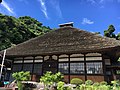 Ryumonji
 The monument of Maiden's ancestors
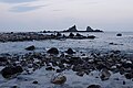 Manazuru Hantō Prefectural Natural Park
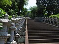 Kibune jinja Shrine
 Kibune Festival
(Mikoshi)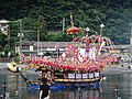 Kibune Festival
(Kobayabune) Kibune Festival
(Hayashibune) Nakagawa Kazumasa art Museum
 Kuroda Nagamasa memorial tower
 Shitodo-no-iwaya Hidden Cave
 Odaiba memorial tower
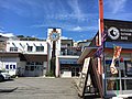 Manazuru Industrial vitalization Centre(Satoumi Base)
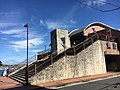 Sakanaza
 Setomichi
 Sashimi boat


Sister city relations
 - Azumino, Nagano, since September 15, 1995
- - Hinohara, Tokyo, since March 28, 2014
- - Ama, Shimane, since July 10, 2017
References
- "Manazuru town official statistics" (in Japanese). Japan.
- Manazuru climate data
- Manazuru population statistics
- "真鶴まちなーれ2017|真鶴". Archived from the original on 2017-10-08. Retrieved 2017-10-14.
- http://www.city.odawara.kanagawa.jp/field/lifelong/youth/takengakusyuu/chiikisedaiwokoetataikenngakusyuuhoukokuh27.html 小田原市 平成27年度「あれこれ体験in片浦」開催内容の紹介
External links
- Official Website (in Japanese)
Yokohama (capital) | ||||
| Yokohama |
| |||
| Kawasaki |
| |||
| Sagamihara |
| |||
| Core city | ||||
| Special cities | ||||
| Cities | ||||
| Districts | ||||
| ||||
Authority control | |
|---|---|
| General | |
| National libraries | |
| Scientific databases | |
На других языках
[de] Manazuru
Manazuru (japanisch 真鶴町, -machi, wohl nach der Form der Halbinsel, die an den Kopf des Weißnackenkranichs (jap.: manazuru) im Flug erinnert) ist eine Kleinstadt auf der japanischen Hauptinsel Honshū im Landkreis Ashigarashimo in der Präfektur Kanagawa.- [en] Manazuru, Kanagawa
[ru] Манадзуру
Манадзуру (яп. 真鶴町 Манадзуру-мати) — посёлок в Японии, находящийся в уезде Асигарасимо префектуры Канагава. Площадь посёлка составляет 7,02 км²[1], население — 7572 человека (1 августа 2014)[2], плотность населения — 1078,63 чел./км².Другой контент может иметь иную лицензию. Перед использованием материалов сайта WikiSort.org внимательно изучите правила лицензирования конкретных элементов наполнения сайта.
WikiSort.org - проект по пересортировке и дополнению контента Википедии