world.wikisort.org - Japan
Itakura (板倉町, Itakura-machi) is a town located in Gunma Prefecture, Japan. As of 1 September 2020[update], the town had an estimated population of 14,323 in 5717 households[1] and a population density of 340 persons per km². The total area of the town is 41.86 square kilometres (16.16 sq mi). Itakura's animal mascot is the catfish. It is represented in a bronze statue at Raiden Shrine, as a mikoshi in Itakura's summer festival, and also is emblazoned on the town's manhole covers. Itakura is one of the few places in Japan where catfish dishes are a local delicacy.
Itakura
板倉町 | |
|---|---|
Town | |
 Itakura town hall | |
 Flag  Emblem | |
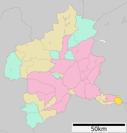 Location of Itakura in Gunma Prefecture | |
 Itakura | |
| Coordinates: 36°13′22.6″N 139°36′37.1″E | |
| Country | Japan |
| Region | Kantō |
| Prefecture | Gunma |
| District | Ōra |
| Area | |
| • Total | 41.86 km2 (16.16 sq mi) |
| Population (September 2020) | |
| • Total | 14,323 |
| • Density | 340/km2 (890/sq mi) |
| Time zone | UTC+9 (Japan Standard Time) |
| - Tree | Osmanthus |
| - Flower | Sakura |
| - Bird | Skylark |
| Phone number | 0276-82-1111 |
| Address | 2067 Itakura, Itakura-machi, Gunma-ken 374-0132 |
| Website | Official website |

Geography
Itakura is located in the northern Kantō Plains in the extreme southern corner of Gunma prefecture, bordered by Saitama Prefecture to the south and Tochigi Prefecture to the north. The Tone River flows through the town, and the Watarase River forms its northern border.
Surrounding municipalities
Gunma Prefecture
- Hanyu
- Kazo
- Sano
- Tochigi
Climate
Itakura has a Humid continental climate (Köppen Cfa) characterized by hot summers and cold winters. The average annual temperature in Itakura is 14.3 °C. The average annual rainfall is 1303 mm with September as the wettest month. The temperatures are highest on average in August, at around 26.6 °C, and lowest in January, at around 3.3 °C.[2]
Demographics
Per Japanese census data,[3] the population of Itakura has declined over the past 70 years.
| Year | Pop. | ±% |
|---|---|---|
| 1920 | 15,199 | — |
| 1930 | 16,126 | +6.1% |
| 1940 | 16,162 | +0.2% |
| 1950 | 20,048 | +24.0% |
| 1960 | 18,189 | −9.3% |
| 1970 | 16,290 | −10.4% |
| 1980 | 16,024 | −1.6% |
| 1990 | 15,948 | −0.5% |
| 2000 | 15,946 | −0.0% |
| 2010 | 15,710 | −1.5% |
| 2020 | 14,083 | −10.4% |
History
The villages of Nishiyada, Ebise, Ōgano and Inara were created within Ōra District, Gunma Prefecture on April 1, 1889 with the creation of the modern municipalities system after the Meiji Restoration. On February 1, 1955, the four villages merged to form the town of Itakura. Meiwa was raised to town status on October 1, 1998.
Government
Itakura has a mayor-council form of government with a directly elected mayor and a unicameral town council of 12 members. Itakura, together with the other municipalities in Ōra District contributes three members to the Gunma Prefectural Assembly. In terms of national politics, the town is part of Gunma 3rd district of the lower house of the Diet of Japan.
Economy
Itakura is largely a bedroom community for Tokyo and nearly Tatebayashi. About 55% of the town's area is farmland, and Itakura's main agricultural products include rice and cucumbers, though many other crops are grown locally.
Education
Itakura has two public elementary schools and one public middle schools operated by the town government, and one public high school operated by the Gunma prefecture Board of Education. Toyo University has a branch campus in Itakura.
Transportation
Railway
![]() Tōbu Railway – Tōbu Nikkō Line
Tōbu Railway – Tōbu Nikkō Line
Highway
 National Route 122
Local attractions
- Raiden Jinja
- Watarase-yusuichi, a UNESCO designated Ramsar Site
- Takatori Tenmangū
- Itakura Golf Course
- Gunma's Waterways
References
- "Itakura Town official statistics" (in Japanese). Japan.
- Itakura climate data
- Itakura population statistics
External links
![]() Media related to Itakura, Gunma at Wikimedia Commons
Media related to Itakura, Gunma at Wikimedia Commons
- Official Website (in Japanese)
Maebashi (capital) | ||
| Core cities | ||
| Special cities | ||
| Cities | ||
| Districts | ||
List of mergers in Gunma Prefecture | ||
Authority control | |
|---|---|
| General | |
| National libraries | |
На других языках
- [en] Itakura, Gunma
[es] Itakura
Itakura (板倉町, Itakura-machi?) es un pueblo en la prefectura de Gunma, Japón, localizado en la parte central de la isla de Honshū, en la región de Kantō. El 1 de marzo de 2021 tenía una población estimada de 14 039 habitantes y una densidad de población de 335 personas por km².[5][ru] Итакура
Итакура (яп. 板倉町 Итакура-мати) — посёлок в Японии, находящийся в уезде Ора префектуры Гумма. Площадь посёлка составляет 41,84 км²[1], население — 15 478 человек (1 июля 2014)[2], плотность населения — 369,93 чел./км².Другой контент может иметь иную лицензию. Перед использованием материалов сайта WikiSort.org внимательно изучите правила лицензирования конкретных элементов наполнения сайта.
WikiSort.org - проект по пересортировке и дополнению контента Википедии