world.wikisort.org - Japan
Higashiagatsuma (東吾妻町, Higashiagatsuma-machi) is a town located in Gunma Prefecture, Japan. As of 31 July 2020[update], the town had an estimated population of 13,349 in 2467 households,[1] and a population density of 53 persons per km2. The total area of the town is 253.91 square kilometres (98.04 sq mi).
Higashiagatsuma
東吾妻町 | |
|---|---|
Town | |
 Higashiagatsuma town office | |
 Flag  Emblem | |
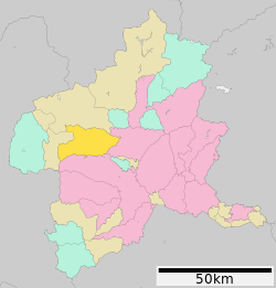 Location of Higashiagatsuma in Gunma Prefecture | |
 Higashiagatsuma | |
| Coordinates: 36°34′17″N 138°49′32″E | |
| Country | Japan |
| Region | Kantō |
| Prefecture | Gunma |
| District | Agatsuma |
| Area | |
| • Total | 253.91 km2 (98.04 sq mi) |
| Population (September 2020) | |
| • Total | 13,349 |
| • Density | 53/km2 (140/sq mi) |
| Time zone | UTC+9 (Japan Standard Time) |
| - Tree | Keyaki |
| - Flower | Narcissus (plant) |
| - Bird | Green pheasant |
| Phone number | 0279-68-2111 |
| Address | 594-3 Haramachi, Higashiagatsuma-machi, Agatsuma-gun, Gunma-ken 377-0892 |
| Website | Official website |
Geography
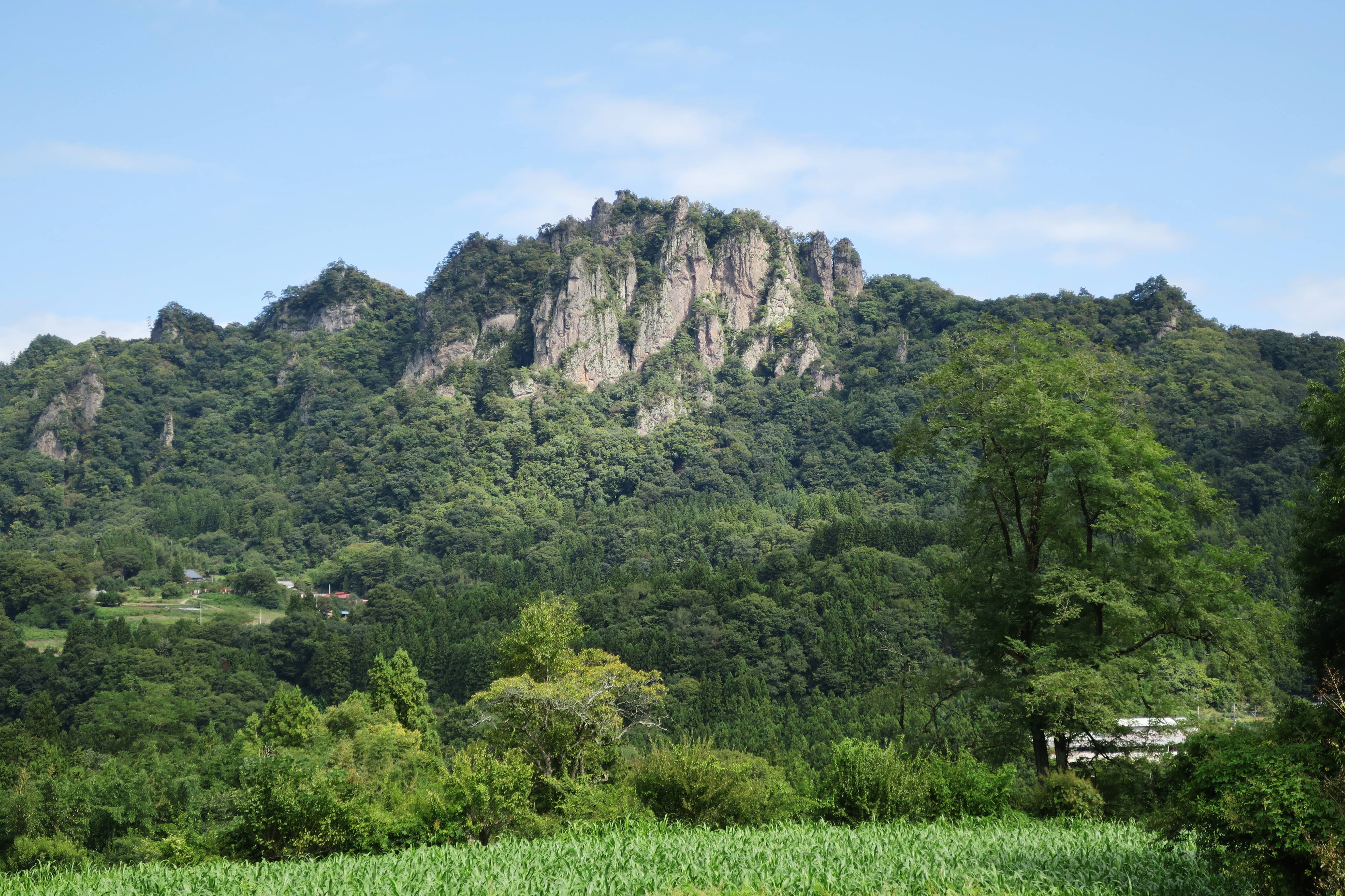
Located in the northwestern portion of Gunma Prefecture, Higashiagatsuma is surrounded by high peaks, including Mount Iwabitsu (802.6 meters). The town hall is 619 meters above sea level.
- Mountains: Mount Iwabitsu, Yakushidake, Sugamine
- Rivers: Agatsuma River, Ishikami River
- Lakes: Lake Haruna
Surrounding municipalities
Gunma Prefecture
Climate
Higashiagatsuma has a Humid continental climate (Köppen Cfa) characterized by warm summers and cold winters with heavy snowfall. The average annual temperature in Higashiagatsuma is 10.8 °C. The average annual rainfall is 1213 mm with September as the wettest month. The temperatures are highest on average in August, at around 23.7 °C, and lowest in January, at around -1.4 °C.[2]
Demographics
Per Japanese census data,[3] the population of Higashiagatsuma has declined considerably over the past 70 years.
| Year | Pop. | ±% |
|---|---|---|
| 1920 | 19,164 | — |
| 1930 | 20,564 | +7.3% |
| 1940 | 21,051 | +2.4% |
| 1950 | 30,082 | +42.9% |
| 1960 | 24,624 | −18.1% |
| 1970 | 20,801 | −15.5% |
| 1980 | 19,975 | −4.0% |
| 1990 | 19,169 | −4.0% |
| 2000 | 17,689 | −7.7% |
| 2010 | 15,624 | −11.7% |
| 2020 | 12,728 | −18.5% |
History
During the Edo period, the area around Higashiagatsuma was part of the hatamoto-administered territory within Kōzuke Province.
With the creation of the modern municipalities system after the Meiji Restoration on April 1, 1889, the town of Hara and the villages of Ota, Iwasaki and Sananoue and Azuma were created within Agatsuma District of Gunma Prefecture. The first three villages merged into Hara in 1965, which was renamed Agatsuma Town in February 1956.
Higashiagatsuma was created on March 27, 2006, by the merger of the town of Agatsuma, and the village of Azuma, both from Agatsuma District.
Government
Higashiagatsuma has a mayor-council form of government with a directly elected mayor and a unicameral town council of 14 members. Higashiagatsuma collectively with the other municipalities in Agatsuma District, contributes two members to the Gunma Prefectural Assembly. In terms of national politics, the town is part of Gunma 5th district of the lower house of the Diet of Japan.
Economy
The economy of Higashiagatsuma is heavily dependent on agriculture and seasonal tourism. Noted local crops include garlic and myoga production. Tourism from ski resorts and onsen hot springs also contribute to the local economy. Mount Ajara was a venue for the 2003 Asian Winter Games.
Education
Higashiagatsuma has five public elementary schools and five public middle schools operated by the town government, and one public high schools operated by the Gunma Prefectural Board of Education.
Transportation
Railway
![]() JR East – Agatsuma Line
JR East – Agatsuma Line
Highway
 National Route 145
 National Route 406
Local attractions
- Iwabitsu Castle - A castle ruin of Sanada clan.
- Agatsuma Gorge, National Place of Scenic Beauty
- Tarusawa Tunnel
References
External links
![]() Media related to Higashiagatsuma, Gunma at Wikimedia Commons
Media related to Higashiagatsuma, Gunma at Wikimedia Commons
- Official Website (in Japanese)
Maebashi (capital) | ||
| Core cities | ||
| Special cities | ||
| Cities | ||
| Districts | ||
List of mergers in Gunma Prefecture | ||
На других языках
- [en] Higashiagatsuma, Gunma
[es] Higashiagatsuma
Higashiagatsuma (東吾妻町, Higashiagatsuma-machi?) es un pueblo en la prefectura de Gunma, Japón, localizado en la parte central de la isla de Honshū, en la región de Kantō. El 1 de marzo de 2021 tenía una población estimada de 12 356 habitantes y una densidad de población de 49 personas por km².[5][ru] Хигасиагацума
Хигасиагацума (яп. 東吾妻町 Хигасиагацума-мати) — посёлок в Японии, находящийся в уезде Агацума префектуры Гумма. Площадь посёлка составляет 253,65 км²[1], население — 15 359 человек (1 июля 2014)[2], плотность населения — 60,55 чел./км².Другой контент может иметь иную лицензию. Перед использованием материалов сайта WikiSort.org внимательно изучите правила лицензирования конкретных элементов наполнения сайта.
WikiSort.org - проект по пересортировке и дополнению контента Википедии