world.wikisort.org - Italy
Mühlwald (German pronunciation: [ˈmyˑlvalt]; Italian: Selva dei Molini [ˈselva dei moˈliːni]) is a comune (municipality) in South Tyrol, a province in northern Italy, located about 60 kilometres (37 mi) northeast of Bolzano, on the border with Austria.
Mühlwald | |
|---|---|
Comune | |
| Gemeinde Mühlwald Comune di Selva dei Molini | |
 | |
Location of Mühlwald  | |
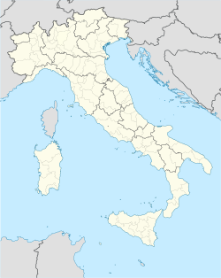  Mühlwald Location of Mühlwald in Italy  Mühlwald Mühlwald (Trentino-Alto Adige/Südtirol) | |
| Coordinates: 46°53′N 11°52′E | |
| Country | Italy |
| Region | Trentino-Alto Adige/Südtirol |
| Province | South Tyrol (BZ) |
| Frazioni | Außermühlwald, Lappach (Lappago) |
| Government | |
| • Mayor | Paul Niederbrunner |
| Area | |
| • Total | 104.7 km2 (40.4 sq mi) |
| Elevation | 1,229 m (4,032 ft) |
| Population (Dec. 2015)[2] | |
| • Total | 1,447 |
| • Density | 14/km2 (36/sq mi) |
| Demonym(s) | German: Mühlwaldner |
| Time zone | UTC+1 (CET) |
| • Summer (DST) | UTC+2 (CEST) |
| Postal code | 39030 |
| Dialing code | 0474 |
| Website | Official website |
Geography
As of 31 December 2015, it had a population of 1,442 and an area of 104.7 square kilometres (40.4 sq mi).[3]
The municipality of Mühlwald contains the frazioni of (subdivisions, mainly villages and hamlets) Außermühlwald and Lappach (Lappago).
Mühlwald borders the following municipalities: Sand in Taufers, Kiens, Pfalzen, Finkenberg (Austria), Gais, Terenten, Pfitsch, Ahrntal, and Vintl.
History
Coat-of-arms
The emblem represents four fir-trees, touching the edge at the top and a water wheel on the bottom, all on a silver background. The trees symbolize the forest and the wheel the mill depicting the name of the place. The emblem was adopted in 1967.[4]
Society
Linguistic distribution
According to the 2001 census, 98.90% of the population speak German, 0.90% Italian and 0.21% Ladin as first language.[5]
Demographic evolution

References
- "Superficie di Comuni Province e Regioni italiane al 9 ottobre 2011". Italian National Institute of Statistics. Retrieved 16 March 2019.
- "Popolazione Residente al 1° Gennaio 2018". Italian National Institute of Statistics. Retrieved 16 March 2019.
- All demographics and other statistics: Italian statistical institute Istat.
- Heraldry of the World: Mühlwald
- "Volkszählung 2011/Censimento della popolazione 2011". astat info. Provincial Statistics Institute of the Autonomous Province of South Tyrol (38): 6–7. June 2012. Retrieved 2012-06-14.
External links
- (in German and Italian) Homepage of the municipality
 Media related to Mühlwald at Wikimedia Commons


На других языках
- [en] Mühlwald
[es] Selva dei Molini
Selva dei Molini es una localidad y comune italiana de la provincia de Bolzano, región de Trentino-Alto Adigio, con 1.473 habitantes.[ru] Сельва-деи-Молини
Сельва-деи-Молини[1] (итал. Selva dei Molini) — коммуна в Италии, располагается в регионе Трентино — Альто-Адидже, в провинции Больцано.Другой контент может иметь иную лицензию. Перед использованием материалов сайта WikiSort.org внимательно изучите правила лицензирования конкретных элементов наполнения сайта.
WikiSort.org - проект по пересортировке и дополнению контента Википедии