world.wikisort.org - Ireland
Castlecove (Irish: Cuan an Chaisleáin) is a village in County Kerry, Ireland, located on the Iveragh peninsula on the N70 road which forms part of the Ring of Kerry.[1] It is situated on the southwestern side of the peninsula. "Cuan an Chaisleáin" in Irish means the same as "Castlecove", but an officially recognised Irish name for the town is "An Siopa Dubh".[2]
Castlecove
An Siopa Dubh | |
|---|---|
Village | |
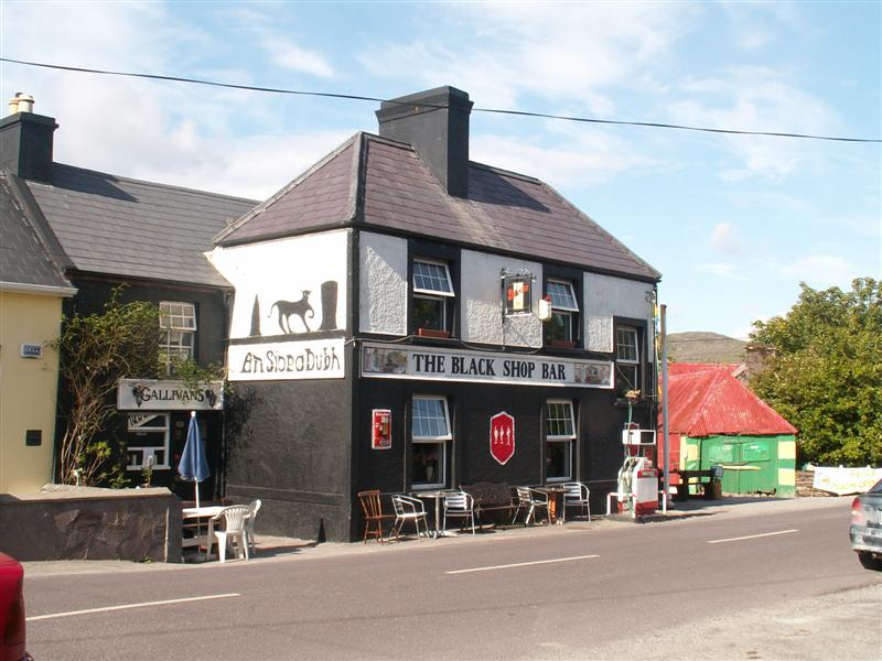 A shop (An Siopa Dubh) in Castlecove | |
 Castlecove Location in Ireland | |
| Coordinates: 51°46′46″N 10°02′11″W | |
| Country | Ireland |
| Province | Munster |
| County | County Kerry |
| Time zone | UTC+0 (WET) |
| • Summer (DST) | UTC-1 (IST (WEST)) |
| Irish Grid Reference | V592605 |
An Siopa Dubh, which translates to The Black Shop, is the name of a pub/shop in Castlecove. Historic map from 1897-1913 labels the village as Blackshop.[1]
References
- "Maps of Castlecove (select map series)". Ordnance Survey of Ireland. Archived from the original on 29 August 2012. Retrieved 19 October 2012.
- "Placenames Database of Ireland". Retrieved 19 October 2012.
See also
- List of towns and villages in Ireland
Places in County Kerry | ||
|---|---|---|
County town: Tralee | ||
| Towns |
|  |
| Parishes, Villages and Townlands |
| |
| Islands | ||
| ||
На других языках
- [en] Castlecove
[ru] Каслков
Каслков[1] (англ. Castlecove; ирл. Cuan An Caislean)[2] — деревня в Ирландии, находится в графстве Керри (провинция Манстер).Текст в блоке "Читать" взят с сайта "Википедия" и доступен по лицензии Creative Commons Attribution-ShareAlike; в отдельных случаях могут действовать дополнительные условия.
Другой контент может иметь иную лицензию. Перед использованием материалов сайта WikiSort.org внимательно изучите правила лицензирования конкретных элементов наполнения сайта.
Другой контент может иметь иную лицензию. Перед использованием материалов сайта WikiSort.org внимательно изучите правила лицензирования конкретных элементов наполнения сайта.
2019-2026
WikiSort.org - проект по пересортировке и дополнению контента Википедии
WikiSort.org - проект по пересортировке и дополнению контента Википедии