world.wikisort.org - Iran
Shahr-e Kord (Persian: شهركرد, also Romanized as Shahrekord and Shahr Kord[2]) is the capital city of Chaharmahal and Bakhtiari Province, Iran. It is the largest city in the province, and is 90 km away from Iran's third largest city, Isfahan. At the time of the 2006 census, Shahrekord had a population of about 148,464 and the Shahrekord metropolitan area had a population of 380,312.[3]
Shahr-e Kord
شهركرد Ancient names: Dezh Gord, Deh Kord | |
|---|---|
City | |
 Panoramic | |
| Nickname(s): The city of kindness, Bam e Iran (Roof of Iran) | |
 Shahr-e Kord Shahr-e Kord (Zagros) in Iran | |
| Coordinates: 32°19′32″N 50°51′52″E | |
| Country | Iran |
| Province | Chaharmahal and Bakhtiari |
| County | Shahrekord |
| Bakhsh | Central |
| Elevation | 2,070 m (6,790 ft) |
| Population (2016 Census) | |
| • Urban | 190,441 [1] |
| Time zone | UTC+3:30 (IRST) |
| • Summer (DST) | UTC+4:30 (IRDT) |
The city is populated by Persians, Lurs and Turkic people.[4][5]
Etymology
Shahr-e Kord, at face value, seems to mean "City of the Kurds". In antiquity, the place had been called "Dezh Gord" (دژگرد), where dezh (دژ) means "fortress" and gord (گرد) means "hero".[6] After the Muslim conquest of Persia, the name changed to "Deh Kord" (Persian: دهكرد); dezh was reinterpreted as deh (ده) meaning "village" and gord became kord because the Arabic alphabet lacks the letters "g" (گ), and "zh" (ژ).[7] Other examples of cities whose names changed partly due to the influence of the Arabic language are Chamgordan, Boroujerd and Dezful, which were called Chamgord, Borougord and Dezhpol, respectively, before the Islamic conquest. In 1935, the name was finally changed to its present form with deh being replaced with shahr (شهر) meaning "city", which better reflects the size of Shahr-e Kord.[8] On the other side, Lurs have been known as Kurds in the post Islamic conquest literature. Michael M. Gunter states that Lurs are closely related to the Kurds but that they "apparently began to be distinguished from the Kurds 1,000 years ago."[9]
History
This section needs expansion. You can help by adding to it. (November 2022) |
Coins have been found in Shahr-e Kord dating back to the Sassanian and Parthian era.[10]
Notable people from Shahr-e Kord include artist Arghavan Khosravi.[11]
Language
The linguistic composition of the city:[12]
Geography
Shahr-e Kord (Zagros) is located about 90 km (56 mi) southwest of Isfahan and 512 km (318 mi) of Tehran. It is topographically situated in the north of the Zagros Mountains. Being located 2,070 m (6,790 ft) above the sea level, Shahr-e Kord (Zagros) is the most elevated among the centers of the provinces of Iran, known as the Roof of Iran.
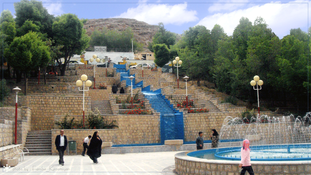
 Mellat Park, Shahr-e Kord
 Bazaar Intersection, core of the City
 Abi Square
 Ferdowsi Square
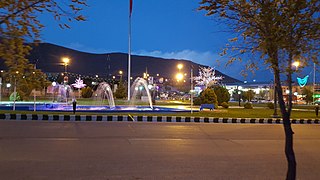 Imam Hossein Square


Climate
Shahr-e Kord (Zagros) enjoys a humid continental climate (Dsa, according to the Köppen climate classification) with hot summer days, mild summer nights, cool winter days and cold winter nights. The annual average temperature in Shahr-e Kord (Zagros) is about 11 °C but the minimum and maximum absolute temperatures recorded in Shahr-e Kord (Zagros) during the last 30 years have been -32 °C and 42 °C,[citation needed] respectively. January is the coldest month and July is the hottest month. Although the humidity level is moderate or high in winter, the amount of rainfall is close to zero in planting seasons, except for April and May.
Business and industry
- Barfab Company manufactures home appliances including Evaporative cooler, Gas/ Kerosene/ Electric Water Heaters, Gas Space Heater, Refrigerator - Freezer and Twin-Tub Washing Machine. Hiring about 1400 people within the firm, Barfab is the biggest private unit in the province.
- Shahrekord (Zagros) cement Co is located in the center of the mountain range of Zagros, 35 km away from Shahr-e Kord (Zagros) city.
- Shahr-e Kord (Zagros) Zagros Steel Company engages in the manufacturing of cast iron.
- Farokh Shahr Steel Industries is a tinplate producer. It is located 10 km away from Shahr-e Kord (Zagros) city.
- Shahrekord (Zagros) Carbon Dioxde Corp. is the largest producer of CO2 and Dry Ice in Iran.
- Shahrekord (Zagros) Textile Industries Co founded in Shahr-e Kord (Zagros) in 1991, is a fabric retail store which specializes in clothing fabrics, polyester viscose and black Chador.
- PAK PAY CO founded in Shahr-e Kord (Zagros) in 1991, is a dairy factory which produces pasteurized milk, flavored milk, cheese and yogurt. In 1996, Pak Dairy Co bought approximately 99% of company's stock.
- Photonic and Optoelectronic Research Group founded in Shahr-e Kord (Zagros) in 2014. This research group is managed by Dr. Hamed Saghaei, one of the prominent researchers in this field of study. The research group focused on design and fabrication of Micro and Nano-Photonic devices including photonic crystal fibers and waveguides, photonic chips based on optofluidic approach, etc. This research group is supported by Islamic Azad University, Shahr-e Kord Branch (best university among 6 universities in Shahrekord)
Transportation
The Shahr-e Kord Bus Organization has 150 buses in its fleet which operate different routes throughout the city.
Shahrekord Airport is a domestic airport located to the south of the city. It currently has flights to and from two cities: Tehran and Mashhad.
Education


There are three universities in the city of Shar-e Kord, Public and state university is Shahr-e Kord University(SKU) with 5,713 students. The other universities are Shahr-e Kord University of Medical Sciences (SKUMS) with 1,690 students and Islamic Azad University of Shahr-e Kord Branch (IAUSHK) with 7,400 students that is the one of most popular universities in Iran with talented faculty members and students.
Sister cities
 Dushanbe, Tajikistan[13]
References
- "Statistical Center of Iran > Home".
- Shahr-e Kord can be found at GEOnet Names Server, at this link, by opening the Advanced Search box, entering "-3084174" in the "Unique Feature Id" form, and clicking on "Search Database".
- "Census of the Islamic Republic of Iran, 1385 (2006)" (Excel). Statistical Center of Iran. Archived from the original on 2011-11-11.
- "Language distribution: Chahar Mahal va Bakhtiari Province". Iran Atlas. Retrieved 25 March 2021.
{{cite web}}: CS1 maint: url-status (link) - Anonby, Erik. "Atlas of the Languages of Iran: A working classification". Iran Atlas. Retrieved 27 March 2021.
{{cite web}}: CS1 maint: url-status (link) - ?
- ":::سازمان تبلیغات اسلامی چهارمحال و بختیاری:::کلیات استان:::". Archived from the original on 2012-03-24. Retrieved 2011-05-18.
- ?
- Gunter, Michael M. (2011). Historical Dictionary of the Kurds (2nd ed.). Scarecrow Press. p. 203. ISBN 978-0810867512.
- http://www.sh-shahrekord.ir/user/Index.jsp?SID=39&lang=Fap [dead link]
- Fenstermaker, Will (October 30, 2019). "Facing Duality: Arghavan Khosravi". BOMB Magazine. Retrieved 2022-11-03.
- "Language distribution: Chaharmahal and Bakhtiari Province". Iran Atlas. Retrieved 25 September 2021.
{{cite web}}: CS1 maint: url-status (link) - http://www.farsnews.ir/newstext.php?nn=13900612000453 [dead link]
External links
| Capital |
|  |
|---|---|---|
| Counties and cities | ||
| Landmarks |
| |
| populated places |
| |
| Capital |
| ||||||||||||||||||||||||||||||||||||||||
|---|---|---|---|---|---|---|---|---|---|---|---|---|---|---|---|---|---|---|---|---|---|---|---|---|---|---|---|---|---|---|---|---|---|---|---|---|---|---|---|---|---|
| Districts |
| ||||||||||||||||||||||||||||||||||||||||
Authority control | |
|---|---|
| General |
|
| National libraries | |
На других языках
[de] Schahr-e Kord
Schahr-e Kord (persisch شهرکرد) ist eine Stadt im Westen des Iran und die Hauptstadt der Provinz Tschahār Mahāl und Bachtiyāri. Die Stadt liegt 107 km südwestlich von Isfahan und 521 km südlich der Landeshauptstadt Teheran. Die Stadt hat eine Bevölkerung von 142.585 (Berechnungsstand 2012), von denen die meisten sesshafte Bachtiyāri sind.- [en] Shahr-e Kord
[ru] Шехре-Корд
Ше́хре-Корд[1] или Ше́хркорд[1][2] (перс. شهرکرد — «Город курдов») — город в центральном Иране, административный центр провинции Чехармехаль и Бахтиария. Население — 126 746 человек[3]. Производство строительных материалов, одежды. Климат — сухой, холодные зимы, лето — тёплое. Один из наиболее высокогорных городов Ирана. В пригородах Шехре-Корда расположен горнолыжный курорт.Другой контент может иметь иную лицензию. Перед использованием материалов сайта WikiSort.org внимательно изучите правила лицензирования конкретных элементов наполнения сайта.
WikiSort.org - проект по пересортировке и дополнению контента Википедии