world.wikisort.org - Indonesia
East Lampung Regency is a regency (kabupaten) of Lampung Province, Sumatra, Indonesia. It has an area of 5,325.03 km2 and a population of 951,639 people at the 2010 census[2] and 1,110,340 at the 2020 census.[3] The regency seat is at the town of Sukadana.
East Lampung Regency
Kabupaten Lampung Timur | |
|---|---|
Regency | |
 The regent's office in Sukadana | |
 Coat of arms | |
| Motto(s): Bumei Tuwah Bepadan (Prosperity by people's consensus) | |
 Location within Lampung | |
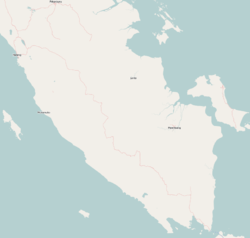 East Lampung Regency Location in Southern Sumatra, Sumatra and Indonesia  East Lampung Regency East Lampung Regency (Sumatra)  East Lampung Regency East Lampung Regency (Indonesia) | |
| Coordinates: 5.1027°S 105.6800°E | |
| Country | Indonesia |
| Province | Lampung |
| Regency seat | Sukadana |
| Government | |
| • Regent | M. Dawam Rahardjo |
| • Vice Regent | Azwar Hadi |
| Area | |
| • Total | 5,325.03 km2 (2,056.01 sq mi) |
| Population (2020 census)[1] | |
| • Total | 1,110,340 |
| • Density | 210/km2 (540/sq mi) |
| Time zone | UTC+7 (IWST) |
| Area code | (+62) 725 |
| Website | lampungtimurkab |
It contains the Way Kambas National Park and Satwa Elephant Eco Lodge.[4]
History
In 1989, the Islamist civilians in Talangsari village of East Lampung Regency were massacred by Indonesian Army troops, in an event known as Talangsari incident.
In January 2010 an outbreak of bird flu occurred in East Lampung Regency.[5]
In the Coastal area there are several descendants who came from Kepaksian Pernong Sekala Brak, in the early days of its spread the Five Punggawa from the year 768 Hijriyah conspiracy which was later enshrined as the name of the coastal area, namely Penggawa lima, son of umpu Jasi from his second wife, depati khaja suttan, migrated to the forest opened a village that had been abandoned for a long time, after a long time in the 19th century AD 1824 AD it develoved into a city and clan, at that time kepaksian paksi pak sekala brak was divided by the Dutch government into representatives, namely Negeri ratu tenumbang, South Beach, West Coast, Sukadana, Labyhan Maringgai, Mount Sugih.[6]
Then the five Sai Batin clans, Talang Padang, Benawang clans, Belunguh clans, Pematang Sawa clans, Ngarip clans, Way Lima, each clan led by a Pasirah who oversees several villages.[7]
East Lampung Regency was formed based on Law Number 12 of 1999 concerning the Establishment of Way Kanan Level II Regency, East Lampung Regency Level II and Metro Level II Municipality, inaugurated on 27 April 1999, with the capital city in Sukadana[8]
Administrative districts
East Lampung Regency is divided into twenty-four administrative districts (kecamatan), tabulated below with their areas and their populations at the 2010 census[9] and the 2020 census.[10] They are grouped for convenience into three geographical zones which have no administrative significance. The table also includes the locations of the district administrative centres, the number of administrative villages (rural desa and urban kelurahan) in each district and its post code.
| Name | Area in km2 | Pop'n census 2010 | Pop'n census 2020 | Administrative centre | No. of vill. | Post code |
|---|---|---|---|---|---|---|
| Metro Kibang | 76.78 | 20,707 | 24,250 | Kibang | 7 | 34331 -34335 |
| Batanghari | 148.88 | 54,601 | 60,038 | Banar Joyo | 17 | 34381 |
| Sekampung | 148.34 | 59,819 | 67,301 | Sumber Gede | 17 | 34382 |
| Margatiga | 250.73 | 43,395 | 50,196 | Tanjung Harapan | 13 | 34386 |
| Western group | 624.73 | 178,522 | 201,785 | 54 | ||
| Sekampung Udik (Upriver Sekampung) | 339.12 | 68,093 | 77,051 | Pugung Raharjo | 15 | 34385 |
| Jabung | 267.85 | 46,550 | 54,851 | Negara Batin | 15 | 34384 |
| Pasir Sakti | 193.94 | 34,410 | 43,425 | Mulyo Sari | 8 | 34387 |
| Waway Karya | 211.07 | 34,454 | 42,461 | Sumber Rejo | 11 | 34376 |
| Marga Sekampung | 177.32 | 26,035 | 29,256 | Peniangan | 8 | 34383 |
| Labuhan Maringgai (a) | 194.99 | 61,158 | 76,849 | Labuhan Maringgai | 11 | 34198 |
| Mataram Baru | 79.56 | 26,672 | 31,547 | Mataram Baru | 7 | 34199 |
| Bandar Sribhawono | 185.71 | 46,133 | 51,396 | Sribhawono | 7 | 34389 |
| Melinting | 139.30 | 24,630 | 29,858 | Wana | 6 | 34377 |
| Gunung Pelindung | 78.52 | 21,052 | 24,565 | Negeri Agung | 5 | 34388 |
| Way Japara | 229.27 | 51,073 | 57,946 | Braja Sakti | 16 | 34396 |
| Braja Slebah | 247.61 | 21,733 | 26,824 | Braja Harjosari | 7 | 34196 |
| Southern group | 2,344.26 | 461,993 | 546,029 | 116 | ||
| Labuhan Ratu | 485.51 | 41,386 | 51,979 | Labuhan Ratu | 11 | 34375 |
| Sukadana | 756.76 | 64,093 | 74,830 | Sukadana | 20 | 34194 |
| Bumi Agung | 73.17 | 16,931 | 20,478 | Donomulyo | 7 | 34182 |
| Batanghari Nuban | 180.69 | 40,992 | 47,712 | Sukaraja Nuban | 13 | 34372 |
| Pekalongan | 100.13 | 45,209 | 53,015 | Pekalongan | 12 | 34391 |
| Raman Utara (North Raman) | 161.37 | 35,760 | 41,314 | Kota Raman | 11 | 34371 |
| Purbolinggo | 222.03 | 40,152 | 45,768 | Taman Fajar | 12 | 34192 |
| Way Bungur (b) | 376.38 | 22,058 | 26,330 | Tambah Subur | 8 | 34373 |
| Northern group | 2,356.04 | 306,581 | 361,426 | 94 | ||
| Totals | 5,325.03 | 951,639 | 1,110,340 | Sukadana | 264 |
Notes: (a) including 3 offshore islands - Pulau Gosongsekopong, Pulau Segama Besar and Pulau Segama Kecil.
(b) formerly Purbolinggo Utara (or North Purbolinggo).
References
- Badan Pusat Statistik, Jakarta, 2021.
- Biro Pusat Statistik, Jakarta, 2011.
- Badan Pusat Statistik, Jakarta, 2021.
- "Way Kambas Elephants Safari – Lampung". Indonesian Rainforest. Retrieved 22 February 2011.
- "Bird Flu Outbreak Kills Fowl". Jakarta Post. 29 January 2011. Retrieved 22 February 2011.
- http://lampungtimurkab.go.id/informasi/aspek
- https://www.tanggamus.go.id/index.php/profil/sejarah
- http://lampungtimurkab.go.id/informasi/sejarah#:~:text=Kabupaten%20Lampung%20Timur%20dibentuk%20berdasarkan,dengan%20ibu%20kota%20di%20Sukadana.
- Biro Pusat Statistik, Jakarta, 2011.
- Badan Pusat Statistik, Jakarta, 2021.
Regencies and cities of Lampung | ||
|---|---|---|
Capital: Bandar Lampung | ||
| Regencies | ||
| Cities | ||
На других языках
[de] Lampung Timur
Lampung Timur ist ein indonesischer Regierungsbezirk (Kabupaten) in der indonesischen Provinz Lampung auf der Insel Sumatra. Stand 2020 leben hier circa 1.130.000 Menschen.[1] Der Regierungssitz des Kabupaten Lampung Timur ist Sukadana.- [en] East Lampung Regency
Другой контент может иметь иную лицензию. Перед использованием материалов сайта WikiSort.org внимательно изучите правила лицензирования конкретных элементов наполнения сайта.
WikiSort.org - проект по пересортировке и дополнению контента Википедии