world.wikisort.org - India
Tiruchanur (also known as Alamelu Mangapuram) is a suburb and neighbourhood of Tirupati and is located in Tirupati district of the Indian state of Andhra Pradesh.[2] It is a part of Tirupati urban agglomeration.[2] It is the mandal headquarters of Tirupati (rural) mandal.[4] It is a religious destination for Hindu pilgrims due to the presence of Padmavathi Temple.[5] It falls in the jurisdictional limit of Tirupati Urban Development Authority.
Tiruchanur | |
|---|---|
Neighborhood of Tirupati city | |
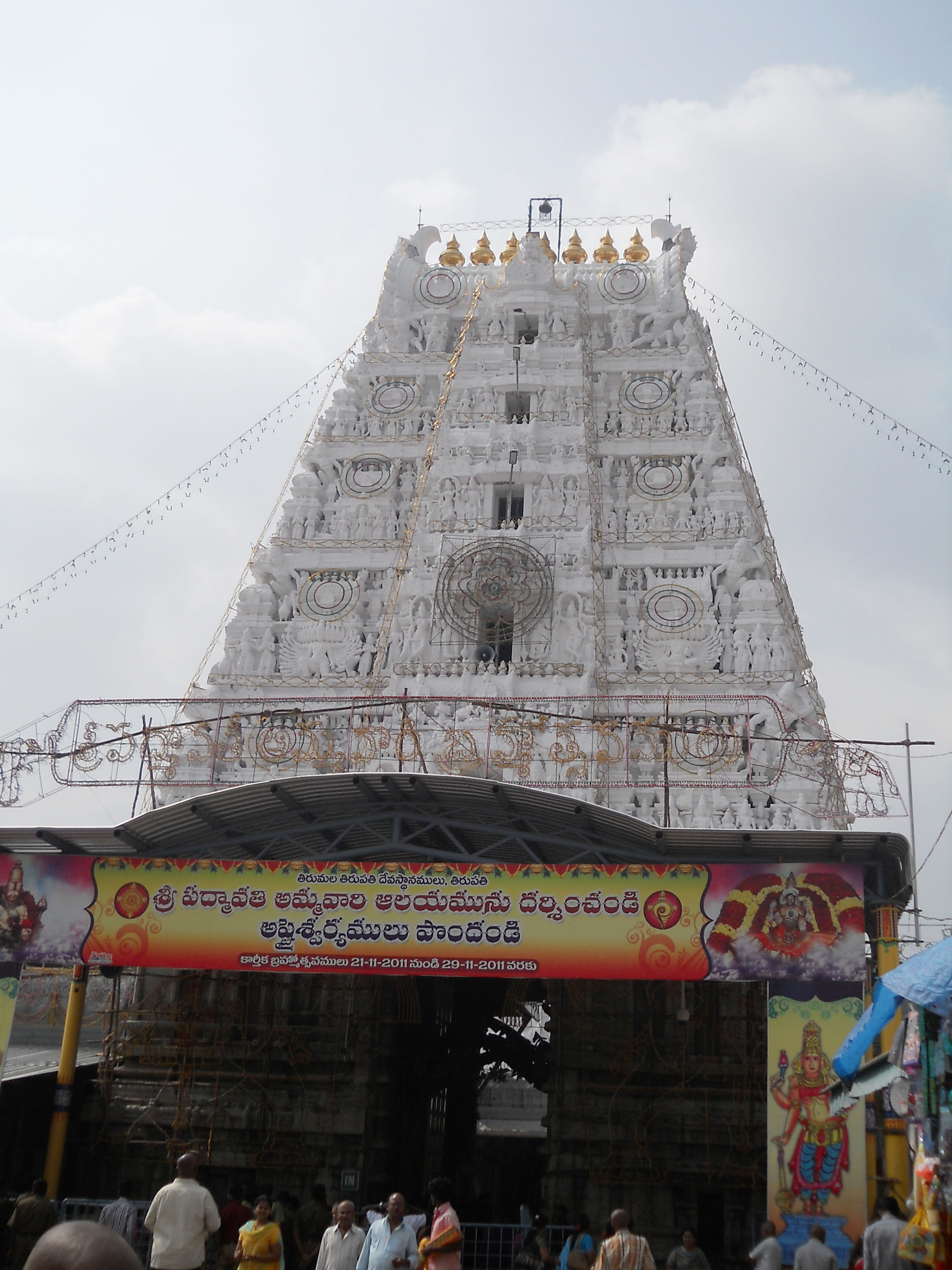 Padmavathi Ammavari Temple | |
 Tiruchanur Location in Andhra Pradesh, India | |
| Coordinates: 13°36′28.15″N 79°27′4.17″E | |
| Country | India |
| State | Andhra Pradesh |
| District | Tirupati |
| Government | |
| • Type | Tirupati Rural |
| • Body | Tiruchanur |
| Area | |
| • Total | 6.85 km2 (2.64 sq mi) |
| Elevation | 17 m (56 ft) |
| Population (2011)[2] | |
| • Total | 22,963 |
| • Density | 3,400/km2 (8,700/sq mi) |
| Languages | |
| • Official | Telugu |
| Time zone | UTC+5:30 (IST) |
Etymology
It is originally called as AlarMelMangai Puram as we see from thousands of inscriptions in and around Tirupathi, much later corrupted to Alamelu Mangapuram Hence, it got the name as Alamelu Mangapuram.[6]
History
Tiruchanoor formed a part of Tiruvenkatam under the rule of Pallavas and was a part of Rajendra Cholamandalam, under the Cholas.[citation needed].
Transport
Alamelu mangapuram is located about 4 km from Tirupati central bus station and Tirupati Main railway station. Tiruchanur provides rail connectivity and is one of the satellite railway station for Tirupati,[7] which is under process of upgradation to a B category station.[8] Tiruchanur is famous for Kalyanamandapams/Function halls. People believe that it’s very auspicious to get married at Tiruchanur. TTD owns some function halls in Tollappa Gardens. Plenty of home stays/service apartments are also available for economical stay. Several restaurants are also available for the pilgrims.
Education
The primary and secondary school education is imparted by government, aided and private schools, under the School Education Department of the state.[9][10]
References
- "Kolakaluru Village Panchayat". National Panchayat Portal. Retrieved 6 May 2016.
- "District Census Handbook – Guntur" (PDF). Census of India. The Registrar General & Census Commissioner. pp. 19, 226. Retrieved 13 May 2016.
- "Maps, Weather, and Airports for Tiruchanur, India". fallingrain.com.
- "Chittoor District Mandals" (PDF). Census of India. pp. 451, 510. Retrieved 19 June 2015.
- "Tiruchanur Sri Padmavathi Ammavaru Temple Kumkumarchana Timings". Tirumala Tirupati Online. Tirumala Tirupati Online. Retrieved 18 August 2018.
- Madhavan, A. D. (25 January 2011). Google book-Core of Karnatic Music, meaning of alamelu in Telugu. ISBN 9789381699003.
- "Sixth platform works begin in Tirupati railway station". The Hans India. Retrieved 6 July 2017.
- "Tiruchanur zooms into big league". The Hindu. Retrieved 6 July 2017.
- "School Education Department" (PDF). School Education Department, Government of Andhra Pradesh. Archived from the original (PDF) on 7 November 2016. Retrieved 7 November 2016.
- "The Department of School Education - Official AP State Government Portal | AP State Portal". www.ap.gov.in. Archived from the original on 7 November 2016. Retrieved 7 November 2016.
Hindu holy cities | ||||||||||||||||||||||||||||||||||||||
|---|---|---|---|---|---|---|---|---|---|---|---|---|---|---|---|---|---|---|---|---|---|---|---|---|---|---|---|---|---|---|---|---|---|---|---|---|---|---|
| India |
| |||||||||||||||||||||||||||||||||||||
| Out of India |
| |||||||||||||||||||||||||||||||||||||
Другой контент может иметь иную лицензию. Перед использованием материалов сайта WikiSort.org внимательно изучите правила лицензирования конкретных элементов наполнения сайта.
WikiSort.org - проект по пересортировке и дополнению контента Википедии