world.wikisort.org - India
Raipur is a village in Rohaniya block of Rae Bareli district, Uttar Pradesh, India.[2] It is located 38km from Raebareli, the district headquarters.[3] As of 2011, it has a population of 1,256 people, in 242 households.[2] It has one primary school and no healthcare facilities, and it does not host a permanent market or a weekly haat.[2]
Raipur
Rāipur | |
|---|---|
Village | |
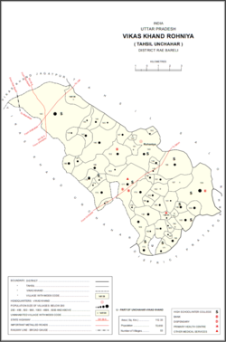 Map showing Raipur (#152) in Rohaniya CD block | |
 Raipur Location in Uttar Pradesh, India | |
| Coordinates: 25.965691°N 81.353674°E[1] | |
| Country | |
| State | Uttar Pradesh |
| District | Raebareli |
| Area | |
| • Total | 3.12 km2 (1.20 sq mi) |
| Population (2011)[2] | |
| • Total | 1,256 |
| • Density | 400/km2 (1,000/sq mi) |
| Languages | |
| • Official | Hindi |
| Time zone | UTC+5:30 (IST) |
| Vehicle registration | UP-35 |
The 1961 census recorded Raipur as comprising 8 hamlets, with a total population of 572 people (284 male and 288 female), in 137 households and 136 physical houses.[4] The area of the village was given as 771 acres.[4]
The 1981 census recorded Raipur as having a population of 837 people, in 182 households, and having an area of 312.03 hectares.[3] The main staple foods were listed as wheat and rice.[3]
References
- "Geonames Search". Do a radial search using these coordinates here.
- "Census of India 2011: Uttar Pradesh District Census Handbook - Rae Bareli, Part A (Village and Town Directory)" (PDF). Census 2011 India. pp. 365–74. Retrieved 10 October 2021.
- Census 1981 Uttar Pradesh: District Census Handbook Part XIII-A: Village & Town Directory, District Rae Bareli (PDF). 1982. pp. 228–9. Retrieved 10 October 2021.
- Census 1961: District Census Handbook, Uttar Pradesh (39 - Raebareli District) (PDF). Lucknow. 1965. pp. cxii-cxiii of section "Salon Tahsil". Retrieved 10 October 2021.
This Raebareli district location article is a stub. You can help Wikipedia by expanding it. |
Другой контент может иметь иную лицензию. Перед использованием материалов сайта WikiSort.org внимательно изучите правила лицензирования конкретных элементов наполнения сайта.
WikiSort.org - проект по пересортировке и дополнению контента Википедии