world.wikisort.org - India
Padum (also known as Padam) is a town named after Padmasambhava. It is the only town and administrative centre in Zanskar, Kargil district of Ladakh, India. It was historically one of the two main capitals of the Zanskar Kingdom, the other being Zangla. It is 235 km away via the link road from Kargil city (National Highway No. 01D).
This article needs additional citations for verification. (April 2018) |
Padum
Padam | |
|---|---|
Town | |
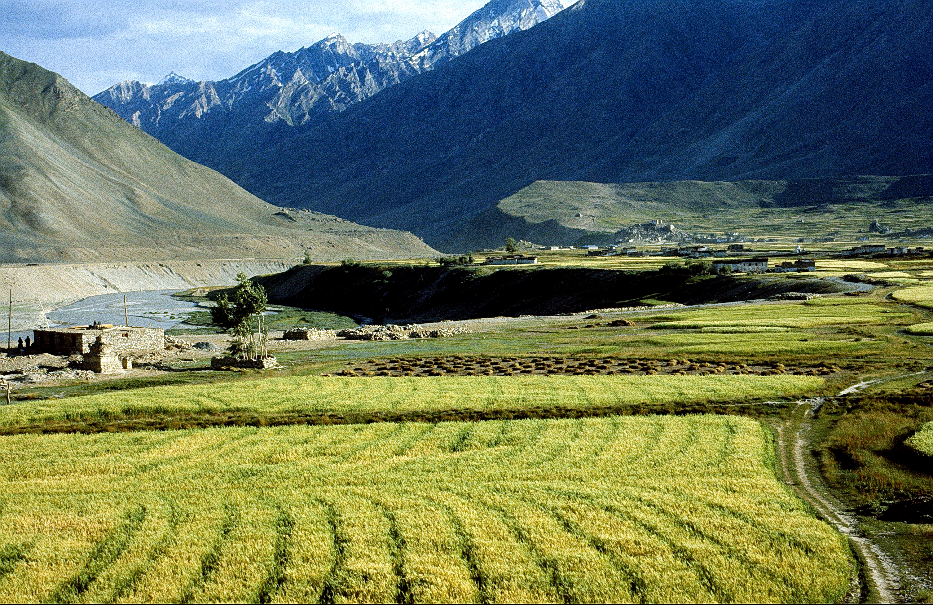
 View of Padum town in Kargil district, Ladakh, India. | |
 Padum Location in Ladakh, India  Padum Padum (India) | |
| Coordinates: 33°27′50″N 76°52′43″E | |
| Country | |
| Union Territory | Ladakh |
| District | Kargil |
| Tehsil | Zanskar |
| Government | |
| • Type | Autonomous Hill Development Council |
| • Body | LAHDC, Kargil |
| Elevation | 3,669 m (12,037 ft) |
| Population (2011) | |
| • Total | 1,550 |
| Languages | |
| • Official | Ladakhi, Hindi, Tibetan |
| Time zone | UTC+5:30 (IST) |
| Vehicle registration | LA 01 XXXX |
| Website | http://www.kargil.nic.in/ |
Description
The present population of Padum town is about 2000 people.[1] The traditional heart of the village is below the gompa and Palace khar (now in ruins) where two large chortens stand above old buildings. A road was constructed in 1980 from NH1 at Kargil over Pensi La which is 235 km away. The 145 km road to Darcha passing through Shinkula pass is now operational , which connects to Manali- Leh Highway. Padum has several hotels, homestays and restaurants meant for tourists. Padum has a post office, internet cafes and telephone booths.
Geography
Padum is at the centre of the tri armed Zanskar valley.[2] It has an average elevation of 3,657 metres (11,998 feet).[contradictory] There are several villages to the north-east of Padum leading to Karsha monastery.
People
Padum is largely inhabited by people of Tibetan descent who follow Tibetan Buddhism, but there is a sizable Muslim population (accounting for ~40% of the town's population and growing steadily), mainly Balti, who have been present in Padum since the 17th century.
Town

The sub-divisional capital Padum is a town of the Zanskar sub-division or tehsil in the Kargil district of Ladakh state, India. The Zanskar River flows through the valley from its source at the Drang Drung glacier of the Pensi La.The Zanskar River joins the Lungnak River near Pibiting village.
A number of notable Buddhist monasteries are located near Padum including Bardan Monastery and Karsha Monastery and the newly built Dalai Lama Photang. The Phugtal Monastery is accessible from here. It is a day's trek from Dorzang, the end of the road leading from Padum.[3]
Access
By Bus: The bus operates during the tourist season between 1 June and 30 September only, after this period the Manali-Leh NH21 highway is normally closed. The other roads including the highway from Leh to Srinagar via Kargil, remain open until the end of October. Despite heavy blizzards, the road from Leh to Nubra valley over the extremely high Khardung La is kept open throughout the year.
The Nimmu–Padam–Darcha road is being made which runs right through Padam. The road to Darcha via Purne is now ready and its half of the length is now 2 lane-tarmac, remaining being upgraded.
See also
- India-China Border Roads
- Line of Actual Control
- List of disputed territories of India
References
- Osada et al (2000), p. 298.
- Osada et al (2000), p. 298.
- "Phugtal Monastery". Archived from the original on 19 November 2015. Retrieved 19 November 2015.
Bibliography
- Janet Rizvi. (1996). Ladakh: Crossroads of High Asia. Second Edition. Oxford University Press, Delhi. ISBN 0-19-564546-4.
- Osada et al. (2000). Mapping the Tibetan World. Yukiyasu Osada, Gavin Allwright, and Atsushi Kanamaru. Reprint: 2004. Kotan Publishing, Tokyo. ISBN 0-9701716-0-9.
- Schettler, Margaret & Rolf (1981). Kashmir, Ladakh & Zanskar. Lonely Planet Publications. South Yarra, Victoria, Australia. ISBN 0-908086-21-0.
External links
Capital: Kargil; Leh | |||||||||||||||||||
| State symbols |
| ||||||||||||||||||
| History |
| ||||||||||||||||||
| Administration |
| ||||||||||||||||||
| Geography |
| ||||||||||||||||||
| Human settlements | |||||||||||||||||||
| Culture |
| ||||||||||||||||||
| Tourism and wildlife |
| ||||||||||||||||||
| Transport |
| ||||||||||||||||||
| Infrastructure |
| ||||||||||||||||||
| See also |
| ||||||||||||||||||
На других языках
[de] Padum
Padum (auch Padam) ist der größte Ort und das Verwaltungszentrum des zum Distrikt Kargil gehörigen Tehsil Zanskar im indischen Unionsterritorium Ladakh. Padum ist von Kargil etwa 240 km entfernt.- [en] Padum
[ru] Падам
Падам или Падум — город и административный центр Занскар техсил в Каргиле, Ладакх, Индия. Расположен в 240 км от Каргила.Другой контент может иметь иную лицензию. Перед использованием материалов сайта WikiSort.org внимательно изучите правила лицензирования конкретных элементов наполнения сайта.
WikiSort.org - проект по пересортировке и дополнению контента Википедии