world.wikisort.org - India
Koilwar (also spelt Koelwar) is a nagar panchayat town and corresponding community development block in Bhojpur district in the Indian state of Bihar. As of 2011, the population of Koilwar town was 17,725, in 2,893 households.[1] It lies on the Arrah-Patna railway route. It is one of the 14 blocks under Bhojpur district.
Koilwar | |
|---|---|
town | |
 Koilwar Location in Bihar, India  Koilwar Koilwar (India) | |
| Coordinates: 25°34′40″N 84°47′40″E | |
| Country | |
| State | Bihar |
| District | Bhojpur |
| Area | |
| • Total | 5.6 km2 (2.2 sq mi) |
| Population (2011)[1] | |
| • Total | 17,725 |
| • Density | 3,200/km2 (8,200/sq mi) |
| Languages | |
| • Official | Bhojpuri, Hindi |
| Time zone | UTC+5:30 (IST) |
| ISO 3166 code | IN-BR |
| Website | bhojpur |
Geography
Koilwar is located at 25°34′N 84°47′E. It has an average elevation of 39 metres (128 ft). It is situated on the bank of Son River.[2]
Koilwar Bridge
Koilwar Bridge is situated on the River Sone; its steel rail road bridge called as Abdul Bari Bridge made before independence, is shown in the film Gandhi. The Koelwar bridge across the Sone river was built by the British in 1862. A two lane road (NH 30) runs just under the rail tracks. Sand mining near the pillars of this old bridge has created structural problems recently.
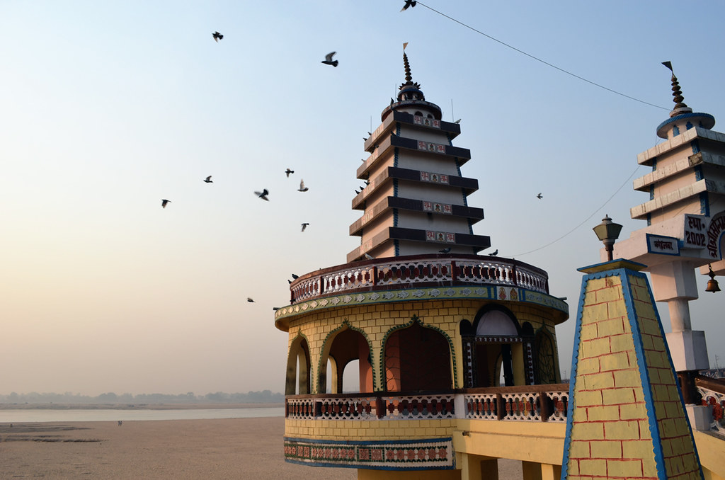
A famous Shiv Temple is the moonlight of the village. On every 14 January and on the eve of Mahashivratri a fair takes place near the temple.
New Koilwar Bridge
Demographics
| Year | Pop. | ±% |
|---|---|---|
| 1981 | 7,936 | — |
| 1991 | 10,253 | +29.2% |
| 2001 | 19,928 | +94.4% |
| 2011 | 17,725 | −11.1% |
| Source: 2011 Census of India[1] | ||
In the 2001 India census,[3] Koilwar had a population of 19,925. Males constitute 61% of the population and females 39%. Koilwar has an average literacy rate of 55%, lower than the national average of 59.5%. Male literacy is 55%, female literacy 54%. 19% of the population is under 6 years of age.
Economy
The main commodities produced in Koilwar are paneer and tilkut.[1]
Transport
The Koilwar town is very well connected by roads, highways and Rail routes to various cities like Patna, Danapur, Bihta, Arrah, Buxar in Bihar; and Mughalsarai and Varanasi in Uttar Pradesh.
Roads
- Patna-Arrah-Buxar (NH-922)
- Arrah-Chhapra Bridge
- Sakaddi-Nasriganj (SH-81)
Railway
- Koilwar railway station: KWR (0 km)
- Arrah Junction (14 km)
- Bihta railway station (8 km)
- Patna Junction railway station (35 km)
Airway
- Patna Airport (36 km)
- Bihta Airport (14 km)
List of villages
The list of 68 villages in Koilwar Block (under Arrah Tehsil) is as follows:[1] (GP is Gram Panchayat).
| Village name | Land area (hectares) | Population (in 2011) |
|---|---|---|
| Amma Narbirpur | 474 | 1,945 |
| Babhnauli | 29 | 464 |
| Bahiyara | 280 | 2,250 |
| Bakar Nagar | 78 | 0 |
| Bhadwar (GP) | 266 | 7,807 |
| Bhagwatpur | 87 | 1,792 |
| Bhopatpur | 58 | 1,001 |
| Birampur (GP) | 527 | 5,907 |
| Bishunpur | 159 | 2,128 |
| Bishunpura | 107 | 1,536 |
| Chanda (GP) | 191 | 2,804 |
| Chandi | 347 | 5,953 |
| Chandwa | 66 | 1,672 |
| Chhitampur | 134 | 0 |
| Daulatpur (GP) | 220 | 3,568 |
| Deoria | 116 | 806 |
| Dhan Diha | 669 | 5,861 |
| Dhandiha (GP) | 304 | 1,278 |
| Dumaria | 84 | 1,398 |
| Farhangpur | 331 | 3,119 |
| Giddha (GP) | 393 | 5,634 |
| Golakpur | 137 | 1,778 |
| Gopalpur (GP) | 84 | 1,753 |
| Guri | 117 | 865 |
| Gyanpur | 192 | 2,841 |
| Haripur | 121 | 2,859 |
| Imadpur | 65 | 0 |
| Jahanpur | 223 | 1,934 |
| Jalpura | 115 | 1,071 |
| Jalpura Tapa (GP) | 1,107 | 12,168 |
| Jamalpur | 197 | 4,876 |
| Jogta (GP) | 286 | 6,378 |
| Kaem Nagar (GP) | 400 | 8,554 |
| Kamalu Chak | 31 | 0 |
| Kazi Chak | 40 | 1,669 |
| Khangaon (GP) | 1,123 | 10,711 |
| Khesrahiya (GP) | 93 | 1,490 |
| Kiratpura | 266 | 4,999 |
| Kishunpura | 136 | 2,165 |
| Kosihan | 83 | 913 |
| Kulharia (GP) | 417 | 7,201 |
| Lodipur | 178 | 1,753 |
| Mahui | 624 | 378 |
| Majhauwan | 145 | 1,336 |
| Makhdumpur | 316 | 0 |
| Makhdumpur Semra | 483 | 1,179 |
| Mana Chak | 40 | 979 |
| Manikpur | 217 | 3,859 |
| Manpur | 72 | 822 |
| Mathurapur (GP) | 153 | 2,126 |
| Milki | 76 | 0 |
| Mirapur | 102 | 0 |
| Mohaddi Chak | 170 | 2,472 |
| Mohkampur | 223 | 1,429 |
| Mokhalsa | 206 | 3,108 |
| Narbirpur (GP) | 73 | 4,616 |
| Narhi | 166 | 3,909 |
| Pachaina | 108 | 1,971 |
| Pachrukhia | 119 | 2,214 |
| Purdilganj | 100 | 1,279 |
| Rajapur (GP) | 236 | 3,043 |
| Raundh Santpur | 87 | 0 |
| Sadasibpur Urf Sabdalpur | 368 | 0 |
| Sakaddi (GP) | 506 | 8,294 |
| Sirari Chak | 66 | 0 |
| Sirpalpur | 86 | 1,269 |
| Sirpalpur | 134 | 2,140 |
| Songhatta | 266 | 2,849 |
| Sundarpur | 140 | 963 |
| Sundra | 128 | 1,314 |
| Suraudha | 546 | 0 |
References
- "Census of India 2011: Bihar District Census Handbook - Bhojpur, Part A (Village and Town Directory)". Census 2011 India. pp. 46, 63, 81–83, 90, 92, 348–379, 753, 808–23. Retrieved 25 October 2020.
- "Koelwar, India Page". Bihar. Falling Rain Genomics. Retrieved 10 March 2009.
- "Census of India 2001: Data from the 2001 Census, including cities, villages and towns (Provisional)". Census Commission of India. Archived from the original on 16 June 2004. Retrieved 1 November 2008.
This article related to a location in Bihar is a stub. You can help Wikipedia by expanding it. |
Другой контент может иметь иную лицензию. Перед использованием материалов сайта WikiSort.org внимательно изучите правила лицензирования конкретных элементов наполнения сайта.
WikiSort.org - проект по пересортировке и дополнению контента Википедии