world.wikisort.org - India
Kalu Khera is a village in Asoha block of Unnao district, Uttar Pradesh, India. It is located on a major district road and has one primary school and one medical clinic. In 2011, its population was 1,888, in 355 households.[2]
Kalu Khera
Kālu Khera | |
|---|---|
Village | |
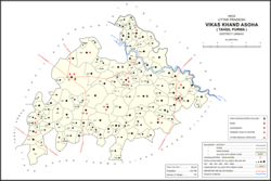 Map showing Kalu Khera (#452) in Asoha CD block | |
 Kalu Khera Location in Uttar Pradesh, India | |
| Coordinates: 26.554791°N 80.909915°E[1] | |
| Country India | |
| State | Uttar Pradesh |
| District | Unnao |
| Area | |
| • Total | 1.01 km2 (0.39 sq mi) |
| Population (2011)[2] | |
| • Total | 1,888 |
| • Density | 1,900/km2 (4,800/sq mi) |
| Languages | |
| • Official | Hindi |
| Time zone | UTC+5:30 (IST) |
| Vehicle registration | UP-35 |
The 1961 census recorded Kalu Khera (under the spelling "Kaloo Khera") as comprising one hamlet, with a total population of 515 (265 male and 250 female), in 93 households and 88 physical houses. It had a medical clinic at the time. The village then had two grain mills and two small manufacturers of ceramics. The P.L.K.P. Higher Secondary School in Kalu Khera, established in 1942, was in 1961 recorded as having a faculty of 12 teachers (all male) and a student body of 255 (also all male).[3] The area of the village was given as 253 acres.
References
- Search for "Kalu Khera" here https://geonames.nga.mil/namesgaz/.
{{cite web}}: Missing or empty|title=(help) - "Census of India 2011: Uttar Pradesh District Census Handbook - Unnao, Part A (Village and Town Directory)". Census 2011 India. pp. 323–47. Retrieved 9 July 2021.
- Census 1961: District Census Handbook, Uttar Pradesh (37 - Unnao District) (PDF). Lucknow. 1965. pp. 133, xcviii-xcviv of section "Purwa Tehsil", cxxvi–cxxvii. Retrieved 9 July 2021.
This Unnao district location article is a stub. You can help Wikipedia by expanding it. |
Другой контент может иметь иную лицензию. Перед использованием материалов сайта WikiSort.org внимательно изучите правила лицензирования конкретных элементов наполнения сайта.
WikiSort.org - проект по пересортировке и дополнению контента Википедии