world.wikisort.org - India
Pahasa is a village in Asoha block of Unnao district, Uttar Pradesh, India.[2] It has one primary school and one medical clinic.[2] As of 2011, its population is 1,355, in 271 households.[2]
Pahasa
Pahāsa | |
|---|---|
Village | |
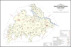 Map showing Pahasa (#448) in Asoha CD block | |
 Pahasa Location in Uttar Pradesh, India | |
| Coordinates: 26.568666°N 80.917446°E[1] | |
| Country India | |
| State | Uttar Pradesh |
| District | Unnao |
| Area | |
| • Total | 3.78 km2 (1.46 sq mi) |
| Population (2011)[2] | |
| • Total | 1,355 |
| • Density | 360/km2 (930/sq mi) |
| Languages | |
| • Official | Hindi |
| Time zone | UTC+5:30 (IST) |
| Vehicle registration | UP-35 |
The 1961 census recorded Pahasa as comprising 2 hamlets, with a total population of 540 (280 male and 260 female), in 165 households and 120 physical houses.[3] The area of the village was given as 923 acres.[3]
References
- Search for "Pahasa" here https://geonames.nga.mil/namesgaz/.
{{cite web}}: Missing or empty|title=(help) - "Census of India 2011: Uttar Pradesh District Census Handbook - Unnao, Part A (Village and Town Directory)". Census 2011 India. pp. 323–47. Retrieved 9 July 2021.
- Census 1961: District Census Handbook, Uttar Pradesh (37 - Unnao District) (PDF). Lucknow. 1965. pp. xcviii-xcviv of section "Purwa Tehsil". Retrieved 9 July 2021.
Текст в блоке "Читать" взят с сайта "Википедия" и доступен по лицензии Creative Commons Attribution-ShareAlike; в отдельных случаях могут действовать дополнительные условия.
Другой контент может иметь иную лицензию. Перед использованием материалов сайта WikiSort.org внимательно изучите правила лицензирования конкретных элементов наполнения сайта.
Другой контент может иметь иную лицензию. Перед использованием материалов сайта WikiSort.org внимательно изучите правила лицензирования конкретных элементов наполнения сайта.
2019-2026
WikiSort.org - проект по пересортировке и дополнению контента Википедии
WikiSort.org - проект по пересортировке и дополнению контента Википедии