world.wikisort.org - India
Maharani Khera is a village in Hilauli block of Unnao district, Uttar Pradesh, India.[2] As of 2011, its population is 2,683, in 502 households, and it has one primary school and no healthcare facilities.[2]
Maharani Khera
Mahārāni Khera | |
|---|---|
Village | |
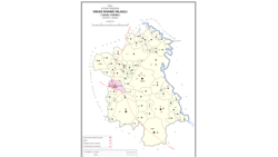 Map showing Maharani Khera (#635) in Hilauli CD block | |
 Maharani Khera Location in Uttar Pradesh, India | |
| Coordinates: 26.445599°N 80.91417°E[1] | |
| Country India | |
| State | Uttar Pradesh |
| District | Unnao |
| Area | |
| • Total | 4.602 km2 (1.777 sq mi) |
| Population (2011)[2] | |
| • Total | 2,683 |
| • Density | 580/km2 (1,500/sq mi) |
| Languages | |
| • Official | Hindi |
| Time zone | UTC+5:30 (IST) |
| Vehicle registration | UP-35 |
The 1961 census recorded Maharani Khera (here spelled "Mahrani Khera") as comprising 6 hamlets, with a total population of 942 (511 male and 431 female), in 210 households and 180 physical houses.[3] The area of the village was given as 1,218 acres.[3]
References
- Search for "Maharani Khera" here https://geonames.nga.mil/namesgaz/.
{{cite web}}: Missing or empty|title=(help) - "Census of India 2011: Uttar Pradesh District Census Handbook - Unnao, Part A (Village and Town Directory)". Census 2011 India. pp. 373–89. Retrieved 11 July 2021.
- Census 1961: District Census Handbook, Uttar Pradesh (37 - Unnao District) (PDF). Lucknow. 1965. pp. cxiv-cxv of section "Purwa Tehsil". Retrieved 11 July 2021.
This Unnao district location article is a stub. You can help Wikipedia by expanding it. |
Текст в блоке "Читать" взят с сайта "Википедия" и доступен по лицензии Creative Commons Attribution-ShareAlike; в отдельных случаях могут действовать дополнительные условия.
Другой контент может иметь иную лицензию. Перед использованием материалов сайта WikiSort.org внимательно изучите правила лицензирования конкретных элементов наполнения сайта.
Другой контент может иметь иную лицензию. Перед использованием материалов сайта WikiSort.org внимательно изучите правила лицензирования конкретных элементов наполнения сайта.
2019-2026
WikiSort.org - проект по пересортировке и дополнению контента Википедии
WikiSort.org - проект по пересортировке и дополнению контента Википедии