world.wikisort.org - India
East Jaintia Hills district is a district with its headquarters at Khliehriat in Meghalaya state of India. The district was carved out of Jaintia Hills district on 31 July 2012.
East Jaintia Hills district
Pait Wah | |
|---|---|
District of Meghalaya | |
 Lukha River | |
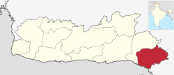 Location in Meghalaya | |
 East Jaintia Hills district | |
| Country | |
| State | Meghalaya |
| Headquarters | Khliehriat |
| Government | |
| • Vidhan Sabha constituencies | 3 |
| Area | |
| • Total | 2,040 km2 (790 sq mi) |
| Population (2011) | |
| • Total | 122,939 |
| • Density | 60/km2 (160/sq mi) |
| Demographics | |
| • Literacy | 53% |
| Time zone | UTC+05:30 (IST) |
| Major highways | NH-6 |
| Website | eastjaintiahills |
Khliehriat and Saipung are the two community and rural development blocks of the district.[1]
History
East Jaintia Hills District was carved out of the erstwhile Jaintia Hills District on 31 July 2012. Khliehriat, the district headquarters, was created as an administrative unit on August 14, 1976 and was upgraded to a civil sub division on May 27, 1982 before finally becoming the district headquarters.[2]
Geography
The total area of the district is 2,115 km2 (817 sq mi). The district comprises 2 community and rural development blocks viz. Khliehriat C&RD Block, and Saipung C&RD Block with the following boundaries:
- North - Assam and West Jaintia Hills District
- South - Bangladesh and Assam
- East - Assam
- West - West Jaintia Hills District
Divisions
East Jaintia Hills district is divided into two blocks, namely:[3]
| Name | Headquarters | Population | Location |
| Khliehriat | Khliehriat |  | |
| Saipung | Saipung |  |
Demographics
Mainly inhabited by the Pnar (also known as Jaintia), Khynriam and the Biates, East Jaintia Hills has a population of 1,22,939. Scheduled Tribes make up 118,158 (96.11%) of the population.[5]
At the time of the 2011 census, 81.39% of the population spoke Pnar, 9.04% Biate, 6.30% Khasi and 3.16% War as their first language.[6]
References
- "East Jaintia Hills".
- "The Sentinel". Archived from the original on 3 March 2016. Retrieved 30 March 2014.
- Meghalaya Administrative Divisions (PDF) (Map). The Registrar General & Census Commissioner, India, New Delhi, Ministry of Home Affairs, Government of India. 2011. Retrieved 29 September 2011.
- "Population by Religion - Meghalaya". censusindia.gov.in. Office of the Registrar General & Census Commissioner, India. 2011. Archived from the original on 27 September 2015.
- "District Census Meghalaya - Jaintia Hills" (PDF). censusindia.gov.in. Office of the Registrar General & Census Commissioner, India. 2011. Archived (PDF) from the original on 14 November 2016.
- 2011 Census of India, Population By Mother Tongue
External links
На других языках
[de] East Jaintia Hills
Der Distrikt East Jaintia Hills ist ein Distrikt im indischen Bundesstaat Meghalaya. Verwaltungssitz ist der Ort Khliehriat.- [en] East Jaintia Hills district
Другой контент может иметь иную лицензию. Перед использованием материалов сайта WikiSort.org внимательно изучите правила лицензирования конкретных элементов наполнения сайта.
WikiSort.org - проект по пересортировке и дополнению контента Википедии