world.wikisort.org - India
Southwest Khasi Hills is an administrative district in the state of Meghalaya in India.
Southwest Khasi Hills district | |
|---|---|
District of Meghalaya | |
 Southwest Khasi Hills district Location in Meghalaya | |
| Coordinates (Mawkyrwat): 25.3°N 91.2°E | |
| Country | India |
| State | Meghalaya |
| Headquarters | Mawkyrwat |
| Area | |
| • Total | 1,341 km2 (518 sq mi) |
| Population (2011) | |
| • Total | 110,152 |
| • Density | 82/km2 (210/sq mi) |
| Demographics | |
| • Literacy | 76.84 |
| Time zone | UTC+05:30 (IST) |
| Website | southwestkhasihills |
History
The Southwest Khasi Hills district was carved out of the West Khasi Hills district on 3 August 2012.[1]
Geography
The district headquarters is located at Mawkyrwat. The district occupies an area of 1,341 km². The district is compose all the villages of two Community & Rural Development Blocks viz. Ranikor and Mawkyrwat are Community & Rural Development Block, including 18 (Eighteen) Villages under Warsan Lyngdoh Gram Sevak Circle of Nongstoin in Community & Rural Development Block.
Administrative divisions
South West Khasi Hills district is divided into two blocks
| Name | Headquarters | Population | Location |
| Mawkyrwat | Mawkyrwat |  | |
| Ranikor | Ranikor | 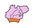 |
References
- Official circular regarding Mawkyrwat Archived 2013-11-05 at the Wayback Machine
External links
Places adjacent to South West Khasi Hills district | ||||||||||||||||
|---|---|---|---|---|---|---|---|---|---|---|---|---|---|---|---|---|
| ||||||||||||||||
На других языках
[de] South West Khasi Hills
Der Distrikt South West Khasi Hills ist ein Distrikt im indischen Bundesstaat Meghalaya. Verwaltungssitz ist der Ort Mawkyrwat (1666 Einwohner).- [en] South West Khasi Hills district
Текст в блоке "Читать" взят с сайта "Википедия" и доступен по лицензии Creative Commons Attribution-ShareAlike; в отдельных случаях могут действовать дополнительные условия.
Другой контент может иметь иную лицензию. Перед использованием материалов сайта WikiSort.org внимательно изучите правила лицензирования конкретных элементов наполнения сайта.
Другой контент может иметь иную лицензию. Перед использованием материалов сайта WikiSort.org внимательно изучите правила лицензирования конкретных элементов наполнения сайта.
2019-2025
WikiSort.org - проект по пересортировке и дополнению контента Википедии
WikiSort.org - проект по пересортировке и дополнению контента Википедии