world.wikisort.org - India
Baksa district (/ˈbʌksə/ or /ˈbæksə/) is an administrative district in the Bodoland Territorial Region of Assam, one of the North-Eastern states of India. The administrative headquarters is at Mushalpur. Manas National Park is a part of this district.
Baksa district | |
|---|---|
District of Assam | |
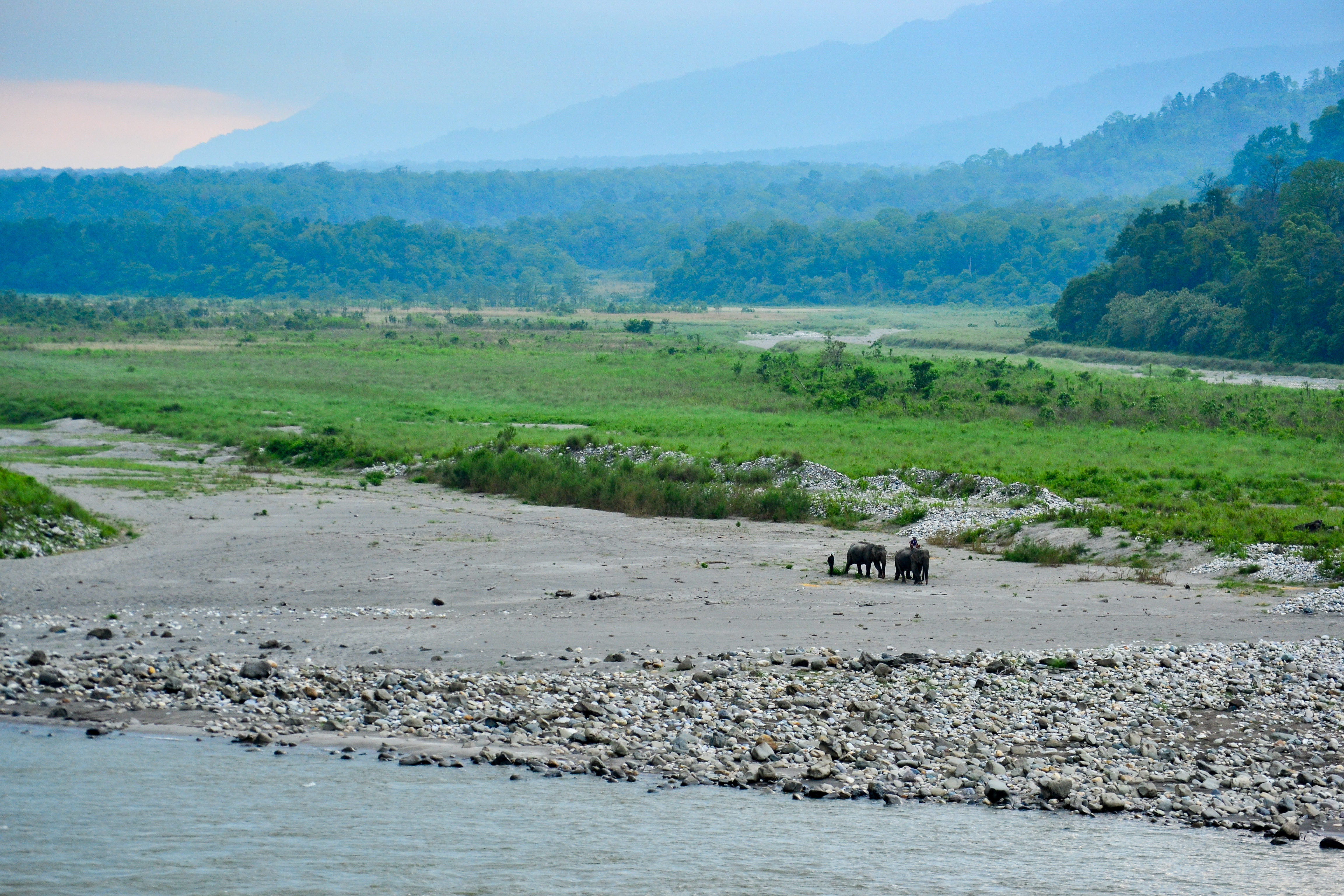 View of Bhutan Himalayas from Manas National Park | |
 Baksa district Location in Assam | |
| Coordinates: 26.6935° N, 91.5984° E | |
| Country | |
| State | |
| Territorial Region | |
| Headquarters | Mushalpur |
| Government | |
| • Lok Sabha constituencies | Kokrajhar |
| • Vidhan Sabha constituencies | Tamulpur, Barama, Chapaguri |
| Area | |
| • Total | 1,573 km2 (607 sq mi) |
| Population (2011) | |
| • Total | 560,925 |
| • Density | 360/km2 (920/sq mi) |
| Time zone | UTC+5:30 (Indian Standard Time) |
| Website | baksa |
History
Baksa was notified as one of the districts of Bodoland Territorial Region in October 2003 while it started functioning from 1 June 2004[1] when naturalist-bureaucrat Dr Anwaruddin Choudhury of the Assam Civil Service took charge as its founding Deputy Commissioner[citation needed]. It started working from PWD Inspection Bungalow of Barama on the NH 31 until it was shifted to Mushalpur in late 2010[vague].
It was created from parts of Barpeta, Nalbari and Kamrup districts.[1]
On 23 January 2022, Tamulpur district was created by separating Tamulpur sub-division of Baksa district.[2]
Geography
This district is bounded by Bhutan in the north, Udalguri district in the east, Barpeta, Nalbari and Kamrup districts in the south and Chirang district in the west. Area of the district is 2,400 km2 (930 sq mi).[3]
National protected area
- Manas National Park (Part)
Administration
Mushalpur town is the headquarters of the district.
Divisions
The district has three sub-divisions: Mushalpur, Salbari and Tamulpur. These sub-divisions are further divided into 13 revenue circles: Baksa, Barama, Tamulpur, Goreswar, Baganpara, Ghograpar, Barnagar, Bajali, Jalah, Patharighat, Rangia, Sarupeta and Tihu.
Three Vidhan Sabha constituencies of this district are Tamulpur, Barama and Chapaguri. All of these are part of Kokrajhar Lok Sabha constituency.
Demographics
| Year | Pop. | ±% p.a. |
|---|---|---|
| 1901 | 71,620 | — |
| 1911 | 81,666 | +1.32% |
| 1921 | 95,160 | +1.54% |
| 1931 | 127,011 | +2.93% |
| 1941 | 167,589 | +2.81% |
| 1951 | 197,889 | +1.68% |
| 1961 | 309,224 | +4.56% |
| 1971 | 476,655 | +4.42% |
| 1991 | 769,402 | +2.42% |
| 2001 | 857,947 | +1.10% |
| 2011 | 950,075 | +1.03% |
| source:[4] | ||
According to the 2011 census Baksa district has a population of 950,075.[6] This gives it a ranking of 458th in India (out of a total of 640).[6] The district has a population density of 475 inhabitants per square kilometre (1,230/sq mi) .[6] Its population growth rate over the decade 2001-2011 was 11.17%.[6] Baksa has a sex ratio of 967 females for every 1000 males,[6] and a literacy rate of 70.53%. The residual Baksa district has a population of 560,925. Scheduled Castes and Tribes made up 30,837 (5.50%) and 209,686 (37.38%) of the population respectively.[6]
According to the 2011 census, 38.34% of the population spoke Assamese, 36.33% Boro, 17.69% Bengali, 2.42% Nepali, 1.61% Sadri and 1.47% Kurukh as their first language.[7]
Education
Major educational institutions of Baksa district are:
- Salbari Higher Secondary school, Salbari
- Bagadhar Brahma Kishan College, Jalah
- Barama College, Barama
- Goreswar College, Goreswar
- Mushalpur College, Mushalpur
- Tamulpur College, Tamulpur
- Koklabari chapaguri College, Simla Hazua
- Barama Higher Secondary school, Barama
- Baksa Polytechnic, Belguri Pathar
- Gyanpeeth Degree College, Nikashi
- Baksa College, Baganpara
- Bathwou Ashram Foraisali, Barama
- Koklabari Girls' High School, Simla
- Kumarikata Junior College, Kumarikata
- Kendriya Vidyalaya, Tamulpur
- Ekalavya Model Residential School, Dalbari
- Anchali Higher Secondary School, Anchali
- Jawahar Navodaya Vidyalaya, Mushalpur
Tourism
Places of interest

A major part of the world-famous Manas National Park is located in this district. The park is well known for its Wild Water Buffaloes and Golden Langurs.[8] Bogamati, a famous picnic spot with picturesque beauties is located in Baksa. Bhangtar is the other scenic location situated close to Bhutan border.
See also
- State of Assam
- Tamulpur sub-division
- Mushalpur sub-division
- Salbari sub-division
References
- Law, Gwillim (25 September 2011). "Districts of India". Statoids. Retrieved 11 October 2011.
- "Assam Govt Forms Tamulpur As New District In State". www.sentinelassam.com. 24 January 2021. Retrieved 24 January 2022.
- "Assam state website – Baksa district". Archived from the original on 9 April 2009. Retrieved 25 June 2008.
- Decadal Variation In Population Since 1901
- "Baksa District religions". Census2011. Retrieved 4 July 2017.
- "District Census 2011". Census2011.co.in. 2011. Retrieved 30 September 2011.
- "C-16 Population By Mother Tongue - Baksa". censusindia.gov.in. Retrieved 16 July 2021.
- Gee, E.P. (1964). The Wild Life of India. Collins, London.
External links
Places adjacent to Baksa district | ||||||||||||||||
|---|---|---|---|---|---|---|---|---|---|---|---|---|---|---|---|---|
| ||||||||||||||||
Capital: Dispur | |||||||||||
| State symbols |
| ||||||||||
| Topics |
| ||||||||||
| History |
| ||||||||||
| Administration |
| ||||||||||
| Districts and divisions |
| ||||||||||
| Geography |
| ||||||||||
| Culture |
| ||||||||||
| Arts, literature, music and cinema |
| ||||||||||
| People |
| ||||||||||
| Notable surnames |
| ||||||||||
| Urban areas | |||||||||||
| |||||||||||
На других языках
[de] Baksa (Distrikt)
Der Distrikt Baksa (assamesisch বাক্সা জিলা) ist ein Distrikt im indischen Bundesstaat Assam. Verwaltungssitz ist Mushalpur. Der Distrikt gehört zur Region Bodoland.- [en] Baksa district
[ru] Бакса (округ)
Бакса (ассам. বাক্সা জিলা; англ. Baksa) — округ в индийском штате Ассам. Административный центр — город Мушалпур. Площадь округа — 2400 км². По данным всеиндийской переписи 2001 года население территории составляло 862 560 человек.Другой контент может иметь иную лицензию. Перед использованием материалов сайта WikiSort.org внимательно изучите правила лицензирования конкретных элементов наполнения сайта.
WikiSort.org - проект по пересортировке и дополнению контента Википедии