world.wikisort.org - Germany
Kranichfeld is a town in the Weimarer Land district, in Thuringia. It is situated on the river Ilm, 18 km southeast of Erfurt, and 16 km southwest of Weimar.
Kranichfeld | |
|---|---|
Town | |
 Coat of arms | |
Location of Kranichfeld within Weimarer Land district 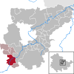 | |
 Kranichfeld  Kranichfeld | |
| Coordinates: 50°51′0″N 11°12′0″E | |
| Country | Germany |
| State | Thuringia |
| District | Weimarer Land |
| Municipal assoc. | Kranichfeld |
| Subdivisions | 3 |
| Government | |
| • Mayor (2016–22) | Enno Dörnfeld[1] (CDU) |
| Area | |
| • Total | 23.08 km2 (8.91 sq mi) |
| Elevation | 301 m (988 ft) |
| Population (2020-12-31)[2] | |
| • Total | 3,340 |
| • Density | 140/km2 (370/sq mi) |
| Time zone | UTC+01:00 (CET) |
| • Summer (DST) | UTC+02:00 (CEST) |
| Postal codes | 99446–99448 |
| Dialling codes | 036450 |
| Vehicle registration | AP |
| Website | www.kranichfeld.de |
History
Within the German Empire (1871-1918), Kranichfeld was part of the Grand Duchy of Saxe-Weimar-Eisenach.
References
- Gewählte Bürgermeister - aktuelle Landesübersicht, Freistaat Thüringen, accessed 14 July 2021.
- "Bevölkerung der Gemeinden, erfüllenden Gemeinden und Verwaltungsgemeinschaften in Thüringen Gebietsstand: 31.12.2020". Thüringer Landesamt für Statistik (in German). June 2021.

This Weimarer Land location article is a stub. You can help Wikipedia by expanding it. |
На других языках
- [en] Kranichfeld
[ru] Кранихфельд (город)
Кранихфельд (нем. Kranichfeld) — город в Германии, в земле Тюрингия.Текст в блоке "Читать" взят с сайта "Википедия" и доступен по лицензии Creative Commons Attribution-ShareAlike; в отдельных случаях могут действовать дополнительные условия.
Другой контент может иметь иную лицензию. Перед использованием материалов сайта WikiSort.org внимательно изучите правила лицензирования конкретных элементов наполнения сайта.
Другой контент может иметь иную лицензию. Перед использованием материалов сайта WikiSort.org внимательно изучите правила лицензирования конкретных элементов наполнения сайта.
2019-2026
WikiSort.org - проект по пересортировке и дополнению контента Википедии
WikiSort.org - проект по пересортировке и дополнению контента Википедии