world.wikisort.org - Germany
Hohenfelden is a municipality in the Weimarer Land district of Thuringia, Germany.
Hohenfelden | |
|---|---|
Municipality | |
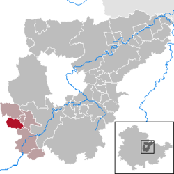
Location of Hohenfelden within Weimarer Land district  | |
 Hohenfelden  Hohenfelden | |
| Coordinates: 50°52′43″N 11°9′39″E | |
| Country | Germany |
| State | Thuringia |
| District | Weimarer Land |
| Municipal assoc. | Kranichfeld |
| Government | |
| • Mayor (2020–26) | Thomas Morche[1] |
| Area | |
| • Total | 8.43 km2 (3.25 sq mi) |
| Elevation | 328 m (1,076 ft) |
| Population (2020-12-31)[2] | |
| • Total | 384 |
| • Density | 46/km2 (120/sq mi) |
| Time zone | UTC+01:00 (CET) |
| • Summer (DST) | UTC+02:00 (CEST) |
| Postal codes | 99448 |
| Dialling codes | 036450 |
| Vehicle registration | AP |
| Website | hohenfelden.de |
History
Within the German Empire (1871–1918), the northern part of Hohenfelden belonged to the Grand Duchy of Saxe-Weimar-Eisenach, while the southern part belonged to the Duchy of Saxe-Meiningen.
References
- Gewählte Bürgermeister - aktuelle Landesübersicht, Freistaat Thüringen, accessed 14 July 2021.
- "Bevölkerung der Gemeinden, erfüllenden Gemeinden und Verwaltungsgemeinschaften in Thüringen Gebietsstand: 31.12.2020". Thüringer Landesamt für Statistik (in German). June 2021.
На других языках
- [en] Hohenfelden
[ru] Хоэнфельден
Хоэнфельден (нем. Hohenfelden) — коммуна в Германии, в земле Тюрингия.Текст в блоке "Читать" взят с сайта "Википедия" и доступен по лицензии Creative Commons Attribution-ShareAlike; в отдельных случаях могут действовать дополнительные условия.
Другой контент может иметь иную лицензию. Перед использованием материалов сайта WikiSort.org внимательно изучите правила лицензирования конкретных элементов наполнения сайта.
Другой контент может иметь иную лицензию. Перед использованием материалов сайта WikiSort.org внимательно изучите правила лицензирования конкретных элементов наполнения сайта.
2019-2025
WikiSort.org - проект по пересортировке и дополнению контента Википедии
WikiSort.org - проект по пересортировке и дополнению контента Википедии
