world.wikisort.org - Germany
Helsa is a municipality and village in the district of Kassel, in Hesse, Germany. The municipality is situated in the Losse valley amongst the hills of the Kaufunger Wald, approx. 15 km east of Kassel.
Helsa | |
|---|---|
Municipality | |
 Coat of arms | |
Location of Helsa within Kassel district 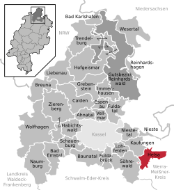 | |
 Helsa  Helsa | |
| Coordinates: 51°16′N 09°41′E | |
| Country | Germany |
| State | Hesse |
| Admin. region | Kassel |
| District | Kassel |
| Government | |
| • Mayor (2020–26) | Andreas Schönemann[1] |
| Area | |
| • Total | 25.77 km2 (9.95 sq mi) |
| Elevation | 427 m (1,401 ft) |
| Population (2020-12-31)[2] | |
| • Total | 5,677 |
| • Density | 220/km2 (570/sq mi) |
| Time zone | UTC+01:00 (CET) |
| • Summer (DST) | UTC+02:00 (CEST) |
| Postal codes | 34298 |
| Dialling codes | 05605 (Helsa), 05602 (Eschenstruth, St. Ottilien), 05604 (Wickenrode) |
| Vehicle registration | KS |
| Website | www.gemeinde-helsa.de |
Division of the municipality
The municipality consists of the villages, Eschenstruth (including Settlement Waldhof), Helsa, St. Ottilien and Wickenrode.
References
- Direkt gewählte (Ober-) Bürgermeister/-innen der hessischen Städte und Gemeinden, accessed 6 July 2021.
- "Bevölkerung in Hessen am 31.12.2020 nach Gemeinden". Hessisches Statistisches Landesamt (in German). June 2021.
External links
- Official site (in German)
Towns and municipalities in Kassel district | ||
|---|---|---|
 | ||
This Hesse location article is a stub. You can help Wikipedia by expanding it. |
На других языках
- [en] Helsa
[ru] Хельза
Хельза (нем. Helsa) — коммуна в Германии, в земле Гессен. Подчиняется административному округу Кассель. Входит в состав района Кассель. Население составляет 5552 человека (на 31 декабря 2010 года).[1] Занимает площадь 25,77 км². Официальный код — 06 6 33 012.Текст в блоке "Читать" взят с сайта "Википедия" и доступен по лицензии Creative Commons Attribution-ShareAlike; в отдельных случаях могут действовать дополнительные условия.
Другой контент может иметь иную лицензию. Перед использованием материалов сайта WikiSort.org внимательно изучите правила лицензирования конкретных элементов наполнения сайта.
Другой контент может иметь иную лицензию. Перед использованием материалов сайта WikiSort.org внимательно изучите правила лицензирования конкретных элементов наполнения сайта.
2019-2026
WikiSort.org - проект по пересортировке и дополнению контента Википедии
WikiSort.org - проект по пересортировке и дополнению контента Википедии