world.wikisort.org - France
Serra-di-Fiumorbo is a commune in the Haute-Corse department of France on the island of Corsica.
This article may be expanded with text translated from the corresponding article in French. (December 2008) Click [show] for important translation instructions.
|
Serra-di-Fiumorbo | |
|---|---|
Commune | |
 The town hall in Serra-di-Fiumorbo | |
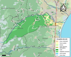 Soil types in the commune | |
Location of Serra-di-Fiumorbo  | |
 Serra-di-Fiumorbo  Serra-di-Fiumorbo | |
| Coordinates: 41°59′10″N 9°20′12″E | |
| Country | France |
| Region | Corsica |
| Department | Haute-Corse |
| Arrondissement | Corte |
| Canton | Fiumorbo-Castello |
| Government | |
| • Mayor (2020–2026) | Jean-Noël Profizi[1] |
| Area 1 | 43.2 km2 (16.7 sq mi) |
| Population | 337 |
| • Density | 7.8/km2 (20/sq mi) |
| Time zone | UTC+01:00 (CET) |
| • Summer (DST) | UTC+02:00 (CEST) |
| INSEE/Postal code | 2B277 /20240 |
| Elevation | 0–1,560 m (0–5,118 ft) (avg. 456 m or 1,496 ft) |
| 1 French Land Register data, which excludes lakes, ponds, glaciers > 1 km2 (0.386 sq mi or 247 acres) and river estuaries. | |
The Aglia runs through the commune from west to east, to join the Abatesco, which defines the northern boundary of the commune.
Population
| Year | Pop. | ±% |
|---|---|---|
| 1962 | 266 | — |
| 1968 | 292 | +9.8% |
| 1975 | 214 | −26.7% |
| 1982 | 201 | −6.1% |
| 1990 | 205 | +2.0% |
| 1999 | 620 | +202.4% |
| 2008 | 304 | −51.0% |
See also
References
- "Répertoire national des élus: les maires". data.gouv.fr, Plateforme ouverte des données publiques françaises (in French). 2 December 2020.
- "Populations légales 2019". The National Institute of Statistics and Economic Studies. 29 December 2021.
Wikimedia Commons has media related to Serra-di-Fiumorbo.
This Haute-Corse geographical article is a stub. You can help Wikipedia by expanding it. |
На других языках
- [en] Serra-di-Fiumorbo
[es] Serra-di-Fiumorbo
Serra-di-Fiumorbo (en idioma corso Urnasu) es una comuna y población de Francia, en la región de Córcega, departamento de Alta Córcega.[ru] Серра-ди-Фьюморбо
Серра-ди-Фьюморбо (фр. Serra-di-Fiumorbo, корс. Sarra di Fiumorbu) — коммуна во Франции, находится в регионе Корсика. Департамент коммуны — Верхняя Корсика. Входит в состав кантона Прунелли-ди-Фьюморбо. Округ коммуны — Корте.Текст в блоке "Читать" взят с сайта "Википедия" и доступен по лицензии Creative Commons Attribution-ShareAlike; в отдельных случаях могут действовать дополнительные условия.
Другой контент может иметь иную лицензию. Перед использованием материалов сайта WikiSort.org внимательно изучите правила лицензирования конкретных элементов наполнения сайта.
Другой контент может иметь иную лицензию. Перед использованием материалов сайта WikiSort.org внимательно изучите правила лицензирования конкретных элементов наполнения сайта.
2019-2026
WikiSort.org - проект по пересортировке и дополнению контента Википедии
WikiSort.org - проект по пересортировке и дополнению контента Википедии