world.wikisort.org - France
Saint-Vulbas (French pronunciation: [sɛ̃ vylba]) is a commune in the Ain department in eastern France.
 | This article may be expanded with text translated from the corresponding article in French. (December 2008) Click [show] for important translation instructions.
|
Saint-Vulbas | |
|---|---|
Commune | |
 Chapel of Marcilleux | |
 Coat of arms | |
Location of Saint-Vulbas  | |
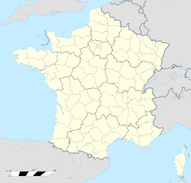  Saint-Vulbas  Saint-Vulbas | |
| Coordinates: 45°50′00″N 5°17′00″E | |
| Country | France |
| Region | Auvergne-Rhône-Alpes |
| Department | Ain |
| Arrondissement | Belley |
| Canton | Lagnieu |
| Intercommunality | Plaine de l'Ain |
| Government | |
| • Mayor (2020–2026) | Marcel Jacquin[1] |
| Area 1 | 21.44 km2 (8.28 sq mi) |
| Population | 1,246 |
| • Density | 58/km2 (150/sq mi) |
| Time zone | UTC+01:00 (CET) |
| • Summer (DST) | UTC+02:00 (CEST) |
| INSEE/Postal code | 01390 /01150 |
| Elevation | 192–227 m (630–745 ft) (avg. 207 m or 679 ft) |
| 1 French Land Register data, which excludes lakes, ponds, glaciers > 1 km2 (0.386 sq mi or 247 acres) and river estuaries. | |
Population
|
|
Geography
The town is located on the right bank of the Rhône , 205 meters above sea level, 35 kilometers northeast of Lyon , 13 kilometers from Ambérieu-en-Bugey . On its territory is the Bugey nuclear power plant as well as the Plaine de l'Ain industrial park .
The town is located in the small region of the Ain plain , between Bas-Bugey and Côtière .
See also
References
- "Répertoire national des élus: les maires". data.gouv.fr, Plateforme ouverte des données publiques françaises (in French). 2 December 2020.
- "Populations légales 2019". The National Institute of Statistics and Economic Studies. 29 December 2021.

Wikimedia Commons has media related to Saint-Vulbas.

Authority control | |
|---|---|
| General |
|
| National libraries | |

 | This Ain geographical article is a stub. You can help Wikipedia by expanding it. |
На других языках
- [en] Saint-Vulbas
[es] Saint-Vulbas
Saint-Vulbas es una comuna francesa del departamento de Ain, en la región de Auvernia-Ródano-Alpes.[ru] Сен-Вюльба
Сен-Вюльба́ (фр. Saint-Vulbas) — коммуна во Франции, находится в регионе Рона — Альпы. Департамент — Эн. Входит в состав кантона Ланьё. Округ коммуны — Белле.Текст в блоке "Читать" взят с сайта "Википедия" и доступен по лицензии Creative Commons Attribution-ShareAlike; в отдельных случаях могут действовать дополнительные условия.
Другой контент может иметь иную лицензию. Перед использованием материалов сайта WikiSort.org внимательно изучите правила лицензирования конкретных элементов наполнения сайта.
Другой контент может иметь иную лицензию. Перед использованием материалов сайта WikiSort.org внимательно изучите правила лицензирования конкретных элементов наполнения сайта.
2019-2026
WikiSort.org - проект по пересортировке и дополнению контента Википедии
WikiSort.org - проект по пересортировке и дополнению контента Википедии