world.wikisort.org - France
Châtillon-sur-Chalaronne (French pronunciation: [ʃatijɔ̃ syʁ ʃalaʁɔn], literally Châtillon on Chalaronne) is a commune in the Ain department in eastern France.
This article may be expanded with text translated from the corresponding article in French. (December 2008) Click [show] for important translation instructions.
|
Châtillon-sur-Chalaronne | |
|---|---|
Commune | |
 Town hall | |
 Coat of arms | |
Location of Châtillon-sur-Chalaronne  | |
 Châtillon-sur-Chalaronne  Châtillon-sur-Chalaronne | |
| Coordinates: 46°07′00″N 4°58′00″E | |
| Country | France |
| Region | Auvergne-Rhône-Alpes |
| Department | Ain |
| Arrondissement | Bourg-en-Bresse |
| Canton | Châtillon-sur-Chalaronne |
| Intercommunality | Dombes |
| Government | |
| • Mayor (2020–2026) | Patrick Mathias |
| Area 1 | 17.86 km2 (6.90 sq mi) |
| Population | 4,931 |
| • Density | 280/km2 (720/sq mi) |
| Time zone | UTC+01:00 (CET) |
| • Summer (DST) | UTC+02:00 (CEST) |
| INSEE/Postal code | 01093 /01400 |
| Elevation | 215–274 m (705–899 ft) (avg. 225 m or 738 ft) |
| 1 French Land Register data, which excludes lakes, ponds, glaciers > 1 km2 (0.386 sq mi or 247 acres) and river estuaries. | |
History

The town takes its name from a castle built around 1000 AD. It was formerly named Châtillon-les-Dombes.
Geography
The Chalaronne flows northwest through the commune and crosses the town.
Population
| Year | Pop. | ±% p.a. |
|---|---|---|
| 1968 | 2,678 | — |
| 1975 | 3,241 | +2.76% |
| 1982 | 3,518 | +1.18% |
| 1990 | 3,786 | +0.92% |
| 1999 | 4,137 | +0.99% |
| 2007 | 4,904 | +2.15% |
| 2012 | 4,957 | +0.22% |
| 2017 | 4,859 | −0.40% |
| Source: INSEE[2] | ||
Twin towns
- Wächtersbach (Germany)
- Colceag (Romania)
Personalities
- Saint Vincent de Paul: was curate of Châtillon and founded the Brotherhood of Charity (1617)
- Philibert Commerson: botanist, born in Châtillon in 1727
 Church
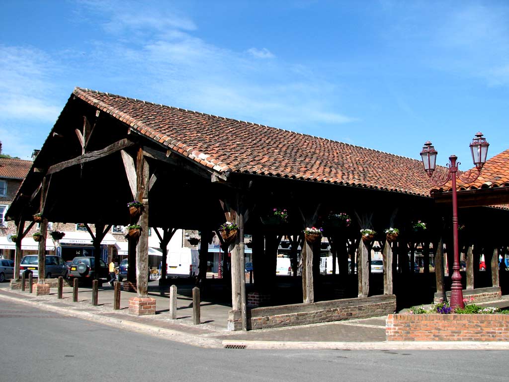
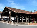 Historic market hall
 Monument Vincent de Paul


See also
References
- "Populations légales 2019". The National Institute of Statistics and Economic Studies. 29 December 2021.
- Population en historique depuis 1968, INSEE
External links
Wikimedia Commons has media related to Châtillon-sur-Chalaronne.
- Châtillon-sur-Chalaronne official website
- La Dombes and Châtillon-sur-Chalaronne
- Images by Paul C. Maurice
Authority control | |
|---|---|
| General | |
| National libraries | |
| Other |
|
This Ain geographical article is a stub. You can help Wikipedia by expanding it. |
На других языках
[de] Châtillon-sur-Chalaronne
Châtillon-sur-Chalaronne ist eine französische Gemeinde mit 4931 Einwohnern (Stand 1. Januar 2019) im Département Ain in der Region Auvergne-Rhône-Alpes.- [en] Châtillon-sur-Chalaronne
[ru] Шатийон-сюр-Шаларон
Шатийон-сюр-Шаларон (фр. Châtillon-sur-Chalaronne) — город и коммуна во французском департаменте Эн, округ Бурк-ан-Брес, административный центр кантона Шатийон-сюр-Шаларон.Текст в блоке "Читать" взят с сайта "Википедия" и доступен по лицензии Creative Commons Attribution-ShareAlike; в отдельных случаях могут действовать дополнительные условия.
Другой контент может иметь иную лицензию. Перед использованием материалов сайта WikiSort.org внимательно изучите правила лицензирования конкретных элементов наполнения сайта.
Другой контент может иметь иную лицензию. Перед использованием материалов сайта WikiSort.org внимательно изучите правила лицензирования конкретных элементов наполнения сайта.
2019-2026
WikiSort.org - проект по пересортировке и дополнению контента Википедии
WikiSort.org - проект по пересортировке и дополнению контента Википедии