world.wikisort.org - France
Saint-Pierre-de-Côle (French pronunciation: [sɛ̃ pjɛʁ də kol], literally Saint-Pierre of Côle; Limousin: Sent Peir de Còla) is a commune in the Dordogne department in Nouvelle-Aquitaine in southwestern France.
Saint-Pierre-de-Côle | |
|---|---|
Commune | |
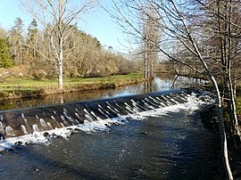
 Côle River | |
Location of Saint-Pierre-de-Côle  | |
 Saint-Pierre-de-Côle  Saint-Pierre-de-Côle | |
| Coordinates: 45°22′20″N 0°47′36″E | |
| Country | France |
| Region | Nouvelle-Aquitaine |
| Department | Dordogne |
| Arrondissement | Nontron |
| Canton | Thiviers |
| Government | |
| • Mayor (2020–2026) | Franck Besse[1] |
| Area 1 | 19.85 km2 (7.66 sq mi) |
| Population | 420 |
| • Density | 21/km2 (55/sq mi) |
| Time zone | UTC+01:00 (CET) |
| • Summer (DST) | UTC+02:00 (CEST) |
| INSEE/Postal code | 24485 /24800 |
| Elevation | 119–237 m (390–778 ft) (avg. 130 m or 430 ft) |
| 1 French Land Register data, which excludes lakes, ponds, glaciers > 1 km2 (0.386 sq mi or 247 acres) and river estuaries. | |
Geography
The river Côle flows southwestward through the middle of the commune, crosses the village and forms part of the commune's south-western border. The village straddles the D 78 road from Brantôme to Saint-Jean-de-Côle. At the centre of the village is the village square with an ancient Romanesque church which has been heavily restored and the cafe/restaurant 'La Marmite'. There is also a post office and a bakery in the village.
The village festival takes place on the first weekend in August, and there are fireworks on the river.
Population
|
|
See also
References
- "Répertoire national des élus: les maires". data.gouv.fr, Plateforme ouverte des données publiques françaises (in French). 9 August 2021.
- "Populations légales 2019". The National Institute of Statistics and Economic Studies. 29 December 2021.
Wikimedia Commons has media related to Saint-Pierre-de-Côle.
На других языках
- [en] Saint-Pierre-de-Côle
[es] Saint-Pierre-de-Côle
Saint-Pierre-de-Côle (en occitano Sent Peir de Còla) es una población y comuna francesa, situada en la región de Aquitania, departamento de Dordoña, en el distrito de Nontron y cantón de Thiviers.Текст в блоке "Читать" взят с сайта "Википедия" и доступен по лицензии Creative Commons Attribution-ShareAlike; в отдельных случаях могут действовать дополнительные условия.
Другой контент может иметь иную лицензию. Перед использованием материалов сайта WikiSort.org внимательно изучите правила лицензирования конкретных элементов наполнения сайта.
Другой контент может иметь иную лицензию. Перед использованием материалов сайта WikiSort.org внимательно изучите правила лицензирования конкретных элементов наполнения сайта.
2019-2025
WikiSort.org - проект по пересортировке и дополнению контента Википедии
WikiSort.org - проект по пересортировке и дополнению контента Википедии