world.wikisort.org - France
Saint-Clar (French pronunciation: [sɛ̃ klaʁ]; Occitan: Sent Clar) is a commune in the Gers department in southwestern France.
This article may be expanded with text translated from the corresponding article in French. (February 2012) Click [show] for important translation instructions.
|
Saint-Clar | |
|---|---|
Commune | |
 Covered market and town hall | |
 Coat of arms | |
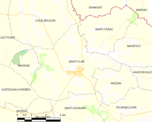
Location of Saint-Clar  | |
 Saint-Clar  Saint-Clar | |
| Coordinates: 43°53′34″N 0°46′15″E | |
| Country | France |
| Region | Occitania |
| Department | Gers |
| Arrondissement | Condom |
| Canton | Fleurance-Lomagne |
| Government | |
| • Mayor (2022–2026) | Eric Ballester[1] |
| Area 1 | 17.91 km2 (6.92 sq mi) |
| Population | 1,046 |
| • Density | 58/km2 (150/sq mi) |
| Time zone | UTC+01:00 (CET) |
| • Summer (DST) | UTC+02:00 (CEST) |
| INSEE/Postal code | 32370 /32380 |
| Elevation | 93–193 m (305–633 ft) (avg. 160 m or 520 ft) |
| 1 French Land Register data, which excludes lakes, ponds, glaciers > 1 km2 (0.386 sq mi or 247 acres) and river estuaries. | |
Geography
The river Arrats forms most of the commune's eastern border; the Auroue flows north through the western part of the commune.
History
Saint-Clar was founded in 1289 by Edward I, King of England and Duke of Aquitaine.
Structure
Its grid layout follows the standards of the typical Bastides grid. The basic architectural element is the central square boarded by arcades and stone and half-timbered houses. This square was the market place and the center of the communities’ economy.[3] The market hall (market building) in the central square was built with stone and with wooden pillars. Now it hosts the Town Hall (Place de la Mairie), which has a beautiful steeple with clock. This Town Hall was better known as “maison commune”.[4] Apart from that central square, Saint-Clar has one more arcaded square, both just a few steps away from each other. This is located in the south, in the original village, in the “castet bielh” (old quarter).
Population
| Year | Pop. | ±% p.a. |
|---|---|---|
| 1968 | 1,033 | — |
| 1975 | 987 | −0.65% |
| 1982 | 972 | −0.22% |
| 1990 | 879 | −1.25% |
| 1999 | 868 | −0.14% |
| 2007 | 983 | +1.57% |
| 2012 | 999 | +0.32% |
| 2017 | 1,015 | +0.32% |
| Source: INSEE[5] | ||
See also
References
- "Répertoire national des élus: les maires" (in French). data.gouv.fr, Plateforme ouverte des données publiques françaises. 13 September 2022.
- "Populations légales 2019". The National Institute of Statistics and Economic Studies. 29 December 2021.
- "An Introduction to Bastides (PPT), at About The Bastides". John Reps Collection. Cornell University Library. Retrieved 14 June 2016.
- "visit saint-clar gers - Site Officiel de l'Office de Tourisme Coeur de Lomagne (Saint-Clar et sa région)". www.tourisme-coeurdelomagne.com. Retrieved 20 June 2016.
- Population en historique depuis 1968, INSEE
Authority control | |
|---|---|
| General |
|
| National libraries | |
This Gers geographical article is a stub. You can help Wikipedia by expanding it. |
На других языках
[de] Saint-Clar
Saint-Clar (gaskognisch Sent Clar) ist eine französische Gemeinde mit 1.046 Einwohnern (Stand 1. Januar 2019) im Département Gers in der Region Okzitanien; sie gehört zum Arrondissement Condom und zum Gemeindeverband Bastides de Lomagne. Seine Bewohner nennen sich Saint-Clarais/Saint-Claraises.- [en] Saint-Clar
[es] Saint-Clar
Saint-Clar es una población y comuna francesa, ubicada en la región de Mediodía-Pirineos, departamento de Gers, en el distrito de Condom y cantón de Saint-Clar.[ru] Сен-Клар
Сен-Клар (фр. Saint-Clar) — коммуна во Франции, находится в регионе Юг — Пиренеи. Департамент — Жер. Административный центр кантона Сен-Клар. Округ коммуны — Кондом.Другой контент может иметь иную лицензию. Перед использованием материалов сайта WikiSort.org внимательно изучите правила лицензирования конкретных элементов наполнения сайта.
WikiSort.org - проект по пересортировке и дополнению контента Википедии