world.wikisort.org - France
Palinges (French pronunciation: [palɛ̃ʒ]) is a commune in the Saône-et-Loire department in the region of Bourgogne-Franche-Comté in eastern France.
Palinges | |
|---|---|
Commune | |
 | |
 Coat of arms | |
Location of Palinges  | |
 Palinges  Palinges | |
| Coordinates: 46°33′00″N 4°13′00″E | |
| Country | France |
| Region | Bourgogne-Franche-Comté |
| Department | Saône-et-Loire |
| Arrondissement | Charolles |
| Canton | Charolles |
| Area 1 | 36.55 km2 (14.11 sq mi) |
| Population | 1,507 |
| • Density | 41/km2 (110/sq mi) |
| Time zone | UTC+01:00 (CET) |
| • Summer (DST) | UTC+02:00 (CEST) |
| INSEE/Postal code | 71340 /71430 |
| Elevation | 251–328 m (823–1,076 ft) (avg. 270 m or 890 ft) |
| 1 French Land Register data, which excludes lakes, ponds, glaciers > 1 km2 (0.386 sq mi or 247 acres) and river estuaries. | |
Geography
The Bourbince flows south through the middle of the commune.
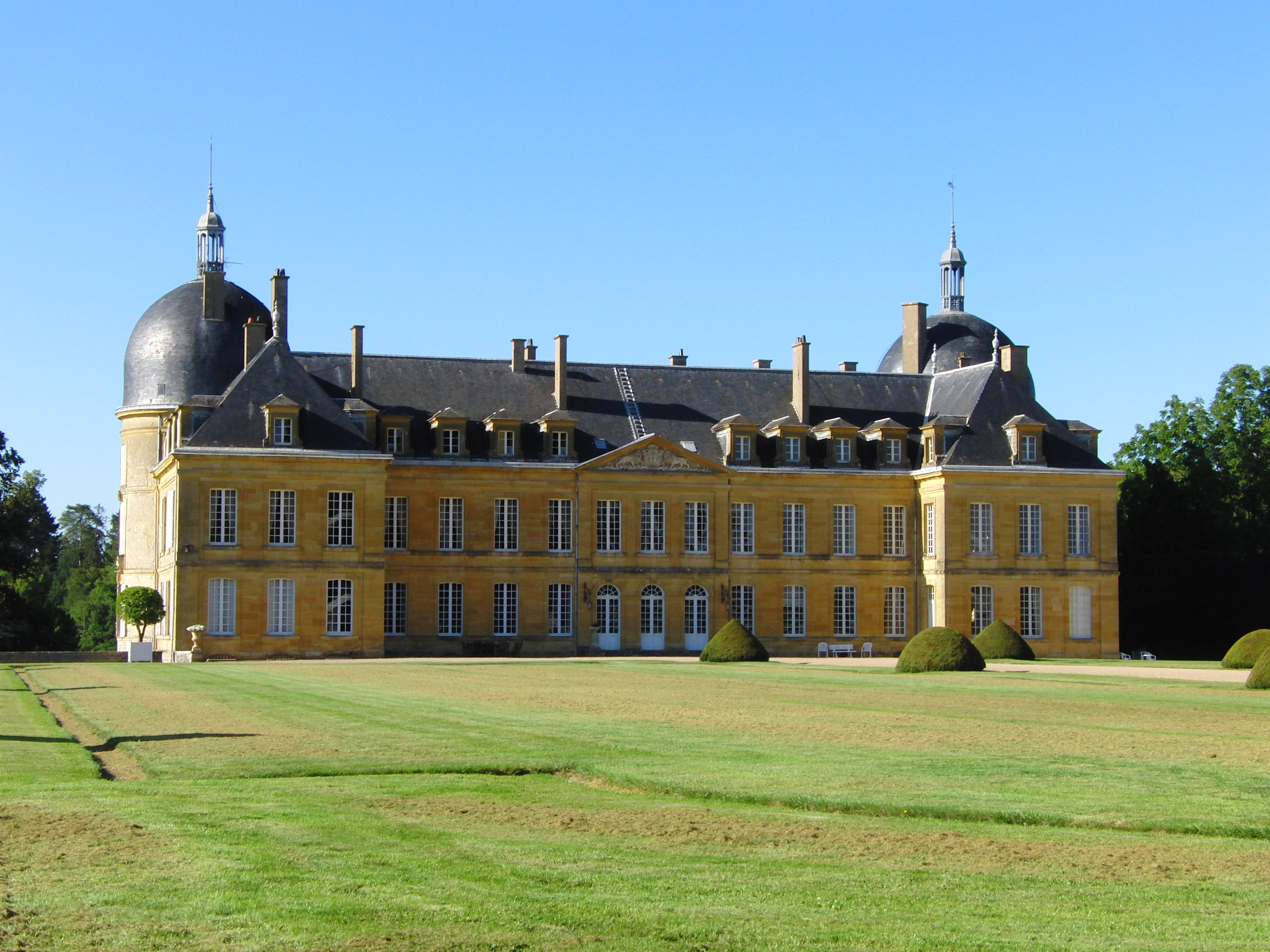
Sights
Palinges has one of the exceptional chateaus in Saône-et-Loire, the Château de Digoine.
See also
References
- "Populations légales 2019". The National Institute of Statistics and Economic Studies. 29 December 2021.
Wikimedia Commons has media related to Palinges.
Authority control | |
|---|---|
| General |
|
| National libraries | |
This Saône-et-Loire geographical article is a stub. You can help Wikipedia by expanding it. |
На других языках
[de] Palinges
Vorlage:Infobox Gemeinde in Frankreich/Wartung/abweichendes Wappen in Wikidata- [en] Palinges
Текст в блоке "Читать" взят с сайта "Википедия" и доступен по лицензии Creative Commons Attribution-ShareAlike; в отдельных случаях могут действовать дополнительные условия.
Другой контент может иметь иную лицензию. Перед использованием материалов сайта WikiSort.org внимательно изучите правила лицензирования конкретных элементов наполнения сайта.
Другой контент может иметь иную лицензию. Перед использованием материалов сайта WikiSort.org внимательно изучите правила лицензирования конкретных элементов наполнения сайта.
2019-2026
WikiSort.org - проект по пересортировке и дополнению контента Википедии
WikiSort.org - проект по пересортировке и дополнению контента Википедии