world.wikisort.org - France
Montaigut-le-Blanc (French pronunciation: [mɔ̃tɛɡy lə blɑ̃]; Occitan: Montagut) is a commune in the Creuse department in the Nouvelle-Aquitaine region in central France.
Montaigut-le-Blanc | |
|---|---|
Commune | |
Location of Montaigut-le-Blanc  | |
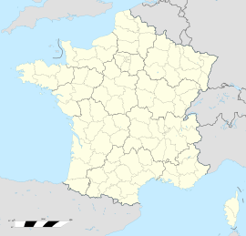  Montaigut-le-Blanc 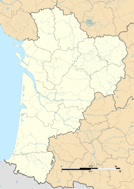 Montaigut-le-Blanc | |
| Coordinates: 46°07′19″N 1°44′09″E | |
| Country | France |
| Region | Nouvelle-Aquitaine |
| Department | Creuse |
| Arrondissement | Guéret |
| Canton | Guéret-2 |
| Intercommunality | CA Grand Guéret |
| Government | |
| • Mayor (2021–2026) | Ludivine Chatenet[1] |
| Area 1 | 17.23 km2 (6.65 sq mi) |
| Population | 411 |
| • Density | 24/km2 (62/sq mi) |
| Time zone | UTC+01:00 (CET) |
| • Summer (DST) | UTC+02:00 (CEST) |
| INSEE/Postal code | 23132 /23320 |
| Elevation | 390–510 m (1,280–1,670 ft) (avg. 437 m or 1,434 ft) |
| 1 French Land Register data, which excludes lakes, ponds, glaciers > 1 km2 (0.386 sq mi or 247 acres) and river estuaries. | |
Geography
A farming area comprising the village and several hamlets situated some 8 miles (13 km) southwest of Guéret at the junction of the D22, D52 and the D914 roads. The commune is served by a TER railway station at the nearby hamlet of La Neuville.
Population
| Year | Pop. | ±% |
|---|---|---|
| 1962 | 501 | — |
| 1968 | 537 | +7.2% |
| 1975 | 471 | −12.3% |
| 1982 | 461 | −2.1% |
| 1990 | 448 | −2.8% |
| 1999 | 396 | −11.6% |
| 2008 | 383 | −3.3% |
Sights
- The church, dating from the thirteenth century.
- The restored fifteenth-century castle.
- An eighteenth-century chapel.
See also
References
- "Répertoire national des élus: les maires" (in French). data.gouv.fr, Plateforme ouverte des données publiques françaises. 4 May 2022.
- "Populations légales 2019". The National Institute of Statistics and Economic Studies. 29 December 2021.

Wikimedia Commons has media related to Montaigut-le-Blanc (Creuse).


 | This Creuse geographical article is a stub. You can help Wikipedia by expanding it. |
На других языках
[de] Montaigut-le-Blanc (Creuse)
Montaigut-le-Blanc ist eine Gemeinde in Frankreich. Sie gehört zur Region Nouvelle-Aquitaine, zum Département Creuse, zum Guéret und zum Kanton Guéret-2. Sie grenzt im Norden an Gartempe, im Nordosten an Saint-Silvain-Montaigut, im Osten an Saint-Victor-en-Marche, im Südosten an Azat-Châtenet, im Süden an Augères, im Südwesten an Mourioux-Vieilleville und im Westen an Le Grand-Bourg. Montaigut-le-Blanc hat einen Bahnhof.- [en] Montaigut-le-Blanc, Creuse
[ru] Монтегю-ле-Блан (Крёз)
Монтегю́-ле-Блан (фр. Montaigut-le-Blanc, окс. Mont Agut / Montagut) — коммуна во Франции, находится в регионе Лимузен. Департамент коммуны — Крёз. Входит в состав кантона Сен-Вори. Округ коммуны — Гере.Текст в блоке "Читать" взят с сайта "Википедия" и доступен по лицензии Creative Commons Attribution-ShareAlike; в отдельных случаях могут действовать дополнительные условия.
Другой контент может иметь иную лицензию. Перед использованием материалов сайта WikiSort.org внимательно изучите правила лицензирования конкретных элементов наполнения сайта.
Другой контент может иметь иную лицензию. Перед использованием материалов сайта WikiSort.org внимательно изучите правила лицензирования конкретных элементов наполнения сайта.
2019-2026
WikiSort.org - проект по пересортировке и дополнению контента Википедии
WikiSort.org - проект по пересортировке и дополнению контента Википедии