world.wikisort.org - France
La Chapelle-Baloue (French pronunciation: [la ʃapɛl balu]; Occitan: La Chapèle) is a commune in the Creuse department in the Nouvelle-Aquitaine region in central France.
La Chapelle-Baloue | |
|---|---|
Commune | |
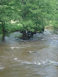
 The Sédelle river, near to La Chapelle-Baloue | |
Location of La Chapelle-Baloue  | |
 La Chapelle-Baloue  La Chapelle-Baloue | |
| Coordinates: 46°21′38″N 1°34′39″E | |
| Country | France |
| Region | Nouvelle-Aquitaine |
| Department | Creuse |
| Arrondissement | Guéret |
| Canton | Dun-le-Palestel |
| Intercommunality | CC Pays Dunois |
| Government | |
| • Mayor (2020–2026) | Béatrice GOMES |
| Area 1 | 8.68 km2 (3.35 sq mi) |
| Population | 128 |
| • Density | 15/km2 (38/sq mi) |
| Time zone | UTC+01:00 (CET) |
| • Summer (DST) | UTC+02:00 (CEST) |
| INSEE/Postal code | 23050 /23160 |
| Elevation | 261–381 m (856–1,250 ft) |
| 1 French Land Register data, which excludes lakes, ponds, glaciers > 1 km2 (0.386 sq mi or 247 acres) and river estuaries. | |
Geography
A farming area comprising the village and a few small hamlets situated at the junction of the rivers Sédelle and Brézentine, some 19 miles (31 km) northwest of Guéret at the junction of the D69 and the D72 roads. The commune lies on the pilgrimage route known as St James's Way.
Population
| Year | Pop. | ±% |
|---|---|---|
| 1962 | 236 | — |
| 1968 | 264 | +11.9% |
| 1975 | 228 | −13.6% |
| 1982 | 197 | −13.6% |
| 1990 | 151 | −23.4% |
| 1999 | 143 | −5.3% |
| 2008 | 133 | −7.0% |
Sights
- The church of Notre-Dame-de-Lorette, dating from the twelfth century.
- The chateau and some ancient fortifications.
- A fourteenth-century stone cross.
See also
References
- "Populations légales 2019". The National Institute of Statistics and Economic Studies. 29 December 2021.
Wikimedia Commons has media related to La Chapelle-Baloue.
На других языках
- [en] La Chapelle-Baloue
[ru] Ла-Шапель-Балу
Ла-Шапе́ль-Балу́ (фр. La Chapelle-Baloue, окс. La Chapèle) — коммуна во Франции, находится в регионе Лимузен. Департамент коммуны — Крёз. Входит в состав кантона Дён-ле-Палестель. Округ коммуны — Гере.Текст в блоке "Читать" взят с сайта "Википедия" и доступен по лицензии Creative Commons Attribution-ShareAlike; в отдельных случаях могут действовать дополнительные условия.
Другой контент может иметь иную лицензию. Перед использованием материалов сайта WikiSort.org внимательно изучите правила лицензирования конкретных элементов наполнения сайта.
Другой контент может иметь иную лицензию. Перед использованием материалов сайта WikiSort.org внимательно изучите правила лицензирования конкретных элементов наполнения сайта.
2019-2025
WikiSort.org - проект по пересортировке и дополнению контента Википедии
WikiSort.org - проект по пересортировке и дополнению контента Википедии