world.wikisort.org - France
Le Monêtier-les-Bains (French pronunciation: [lə mɔnɛtje le bɛ̃]; Occitan: Lo Monastièr) is a commune in the Hautes-Alpes department in southeastern France.
This article may be expanded with text translated from the corresponding article in French. (July 2014) Click [show] for important translation instructions.
|
Le Monêtier-les-Bains | |
|---|---|
Commune | |
 Le Monêtier-les-Bains | |
 Coat of arms | |
Location of Le Monêtier-les-Bains  | |
 Le Monêtier-les-Bains  Le Monêtier-les-Bains | |
| Coordinates: 44°58′37″N 6°30′34″E | |
| Country | France |
| Region | Provence-Alpes-Côte d'Azur |
| Department | Hautes-Alpes |
| Arrondissement | Briançon |
| Canton | Briançon-1 |
| Intercommunality | Briançonnais |
| Government | |
| • Mayor (2020–2026) | Jean-Marie Rey[1] |
| Area 1 | 97.87 km2 (37.79 sq mi) |
| Population | 1,060 |
| • Density | 11/km2 (28/sq mi) |
| Time zone | UTC+01:00 (CET) |
| • Summer (DST) | UTC+02:00 (CEST) |
| INSEE/Postal code | 05079 /05220 |
| Elevation | 1,397–3,659 m (4,583–12,005 ft) (avg. 1,495 m or 4,905 ft) |
| 1 French Land Register data, which excludes lakes, ponds, glaciers > 1 km2 (0.386 sq mi or 247 acres) and river estuaries. | |
Geography
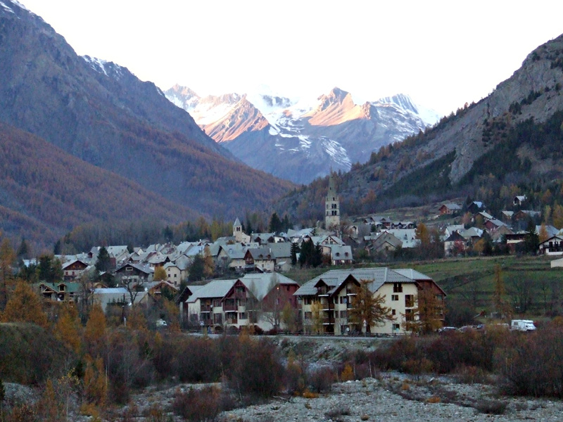
Le Monêtier-les-Bains is the highest village of the French ski resort of Serre Chevalier at 1,500m. It is situated in the Guisane Valley. Le Monêtier-Les-Bains has two hot-water springs, one at 34 °C (93 °F) and one at 38 °C (100 °F), and the village has been a thermal spa since Roman times. The village is on the periphery of the Ecrins National Park.

Climate
Le Monêtier-les-Bains has a humid continental climate (Köppen climate classification Dfb). The average annual temperature in Le Monêtier-les-Bains is 6.3 °C (43.3 °F). The average annual rainfall is 855.7 mm (33.69 in) with October as the wettest month. The temperatures are highest on average in July, at around 15.9 °C (60.6 °F), and lowest in January, at around −2.7 °C (27.1 °F). The highest temperature ever recorded in Le Monêtier-les-Bains was 34.0 °C (93.2 °F) on 3 August 1947; the coldest temperature ever recorded was −25.0 °C (−13.0 °F) on 10 January 1945.
| Climate data for Le Monêtier-les-Bains (1981–2010 averages, extremes 1935−present) | |||||||||||||
|---|---|---|---|---|---|---|---|---|---|---|---|---|---|
| Month | Jan | Feb | Mar | Apr | May | Jun | Jul | Aug | Sep | Oct | Nov | Dec | Year |
| Record high °C (°F) | 15.0 (59.0) |
16.2 (61.2) |
22.5 (72.5) |
28.0 (82.4) |
28.0 (82.4) |
33.7 (92.7) |
33.0 (91.4) |
34.0 (93.2) |
31.8 (89.2) |
27.0 (80.6) |
20.9 (69.6) |
17.0 (62.6) |
34.0 (93.2) |
| Average high °C (°F) | 3.3 (37.9) |
4.8 (40.6) |
8.2 (46.8) |
11.2 (52.2) |
16.4 (61.5) |
20.9 (69.6) |
24.3 (75.7) |
23.5 (74.3) |
19.3 (66.7) |
14.2 (57.6) |
7.8 (46.0) |
3.5 (38.3) |
13.2 (55.8) |
| Daily mean °C (°F) | −2.7 (27.1) |
−1.7 (28.9) |
1.8 (35.2) |
4.9 (40.8) |
9.5 (49.1) |
13.2 (55.8) |
15.9 (60.6) |
15.3 (59.5) |
11.8 (53.2) |
7.6 (45.7) |
1.9 (35.4) |
−1.9 (28.6) |
6.3 (43.3) |
| Average low °C (°F) | −8.8 (16.2) |
−8.3 (17.1) |
−4.6 (23.7) |
−1.4 (29.5) |
2.7 (36.9) |
5.4 (41.7) |
7.4 (45.3) |
7.1 (44.8) |
4.3 (39.7) |
1.0 (33.8) |
−4.0 (24.8) |
−7.3 (18.9) |
−0.5 (31.1) |
| Record low °C (°F) | −25.0 (−13.0) |
−24.0 (−11.2) |
−23.0 (−9.4) |
−14.0 (6.8) |
−13.0 (8.6) |
−5.2 (22.6) |
−4.5 (23.9) |
−2.0 (28.4) |
−5.5 (22.1) |
−11.5 (11.3) |
−20.0 (−4.0) |
−24.5 (−12.1) |
−25.0 (−13.0) |
| Average precipitation mm (inches) | 71.2 (2.80) |
54.8 (2.16) |
57.8 (2.28) |
70.2 (2.76) |
74.4 (2.93) |
68.2 (2.69) |
48.6 (1.91) |
56.3 (2.22) |
77.9 (3.07) |
103.4 (4.07) |
86.7 (3.41) |
86.2 (3.39) |
855.7 (33.69) |
| Average precipitation days (≥ 1.0 mm) | 7.8 | 5.9 | 7.3 | 8.0 | 9.8 | 9.3 | 7.2 | 7.5 | 7.3 | 9.0 | 7.9 | 8.3 | 95.2 |
| Source: Meteociel[3] | |||||||||||||
Population
| Year | Pop. | ±% |
|---|---|---|
| 1962 | 734 | — |
| 1968 | 806 | +9.8% |
| 1975 | 832 | +3.2% |
| 1982 | 970 | +16.6% |
| 1990 | 987 | +1.8% |
| 1999 | 1,009 | +2.2% |
| 2008 | 1,057 | +4.8% |
Skiing
Monetier's slopes are a part of the extensive Serre Chevalier ski area. There are 7 chairlifts and 4 drag lifts with the highest skiing in the domain at 2760m.
Thermal baths

Warm water presence in the Monêtier area was already appreciated during the Roman Empire, when the village was known with the name of Stabatio (healing).[4] Between 1715 and the late 19th century Monêtier was renowned for its thermal pools and facilities, which declined during the following century. From 1999 the new thermal bath of Les grands Bains was opened and, thanks to the following improvement works, Le Monêtier-les-Bains became, again, a popular destination for spa tourism.
Tour de France
The village lies on the Col du Lautaret and is regularly used in the Tour de France. It has featured recently in the tours of 1996, 1999, 2000, 2003, 2005, 2007 and 2008. In the 2011 Tour it was also passed through with about 20 km to go on the 18th stage.
See also
References
- "Répertoire national des élus: les maires". data.gouv.fr, Plateforme ouverte des données publiques françaises (in French). 2 December 2020.
- "Populations légales 2019". The National Institute of Statistics and Economic Studies. 29 December 2021.
- "Normales et records pour Le Monetier les Bains (05)". Meteociel. Retrieved 6 June 2022.
- Le Monêtier les bains, www.alpes-guide.com
External links
Authority control | |
|---|---|
| General | |
| National libraries | |
This Hautes-Alpes geographical article is a stub. You can help Wikipedia by expanding it. |
На других языках
- [en] Le Monêtier-les-Bains
[ru] Ле-Монетье-ле-Бен
Ле-Монетье́-ле-Бен (фр. Le Monêtier-les-Bains, окс. Lo Monastièr) — коммуна во Франции, находится в регионе Прованс — Альпы — Лазурный Берег. Департамент коммуны — Верхние Альпы. Главный город кантона Ле-Монетье-ле-Бен. Округ коммуны — Бриансон.Другой контент может иметь иную лицензию. Перед использованием материалов сайта WikiSort.org внимательно изучите правила лицензирования конкретных элементов наполнения сайта.
WikiSort.org - проект по пересортировке и дополнению контента Википедии