world.wikisort.org - France
Chartronges (French pronunciation: [ʃaʁtʁɔ̃ʒ] (![]() listen)) is a commune in the Seine-et-Marne department in the Île-de-France region in north-central France.
listen)) is a commune in the Seine-et-Marne department in the Île-de-France region in north-central France.
This article may be a rough translation from French. It may have been generated, in whole or in part, by a computer or by a translator without dual proficiency. (August 2022) |
Chartronges | |
|---|---|
Commune | |
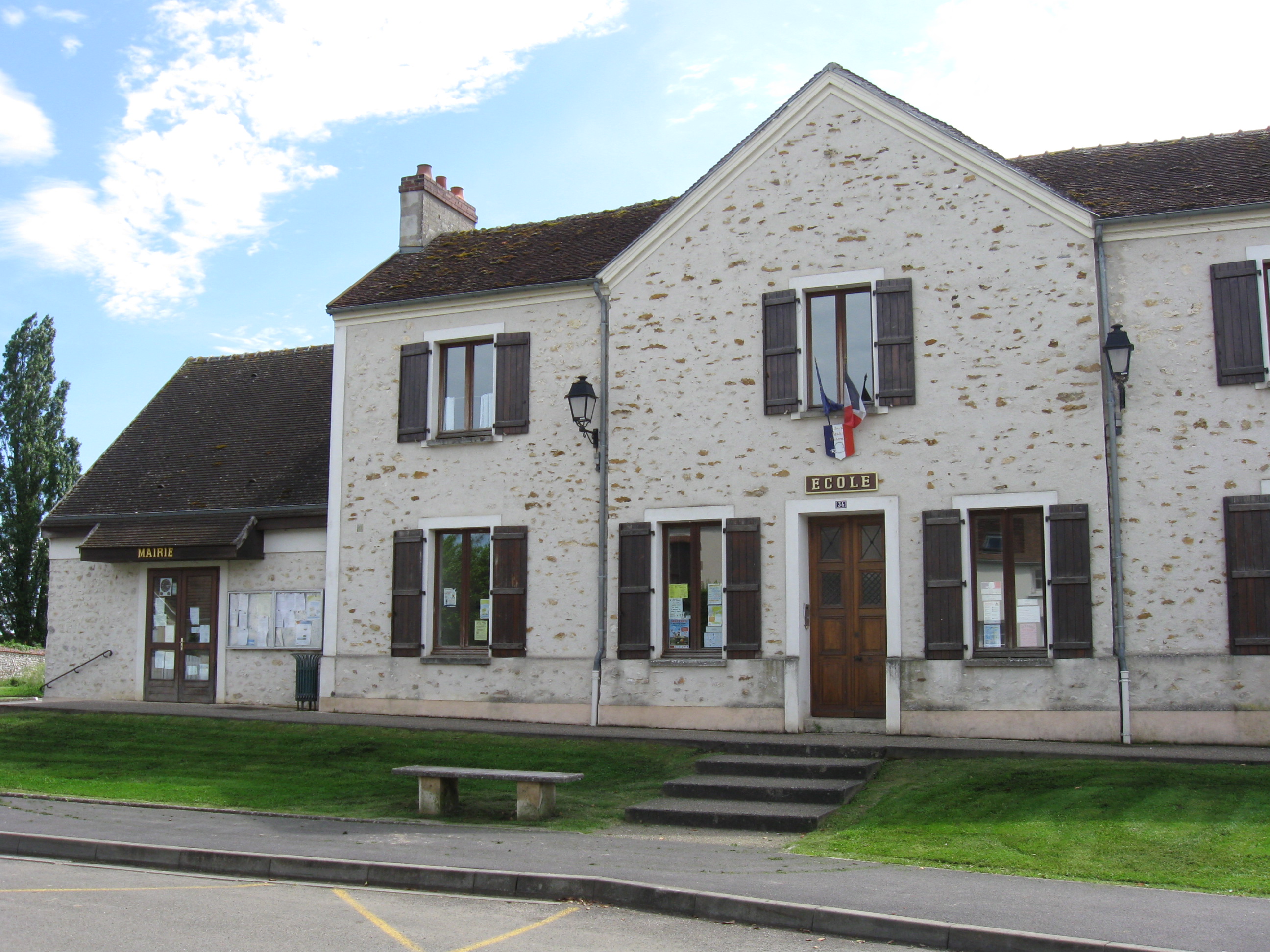 The town hall in Chartronges | |
Location of Chartronges  | |
 Chartronges  Chartronges | |
| Coordinates: 48°44′47″N 3°16′11″E | |
| Country | France |
| Region | Île-de-France |
| Department | Seine-et-Marne |
| Arrondissement | Provins |
| Canton | Coulommiers |
| Government | |
| • Mayor (2020–2026) | André Trawinski[1] |
| Area 1 | 8 km2 (3 sq mi) |
| Population | 299 |
| • Density | 37/km2 (97/sq mi) |
| Time zone | UTC+01:00 (CET) |
| • Summer (DST) | UTC+02:00 (CEST) |
| INSEE/Postal code | 77097 /77320 |
| Elevation | 147–167 m (482–548 ft) |
| 1 French Land Register data, which excludes lakes, ponds, glaciers > 1 km2 (0.386 sq mi or 247 acres) and river estuaries. | |
History
First mentioned in the 12th century as Chatonges, the church was dedicated to Saint-Pierre-aux-Liens along with several others because as early as the 11th century it depended on the abbey of Solesmes.[clarification needed] In 1789, Chartronges became part of the election of Coulommiers along with the generalité of Paris, and was run by the coutume of Meaux.
Demographics
The inhabitants are called Chartrongeais. The development of people has been understood via the population censuses performed from the municipality as of 1793. By 2006, the lawful inhabitants of these municipalities are released yearly by Insee. The census is currently based in a yearly selection of advice, successively regarding most of the civic lands within a period of time of five decades. To get municipalities with much less than 10,000 inhabitants, a census poll since that the full populace is completed each and every five decades, the lawful inhabitants of their years now being projected by interpolation or extrapolation. For your municipality, the very first methodical census decreasing below the brand-new strategy has been completed in 2007. In the previous census of 2018, the town had 295 inhabitants.
Climate
This section may require copy editing. (July 2022) |
The town benefits from the degraded subtropical weather of the regions of these Center and North. As stated by the typology of ponds in France outlined this season. It impacts the full Paris Basin using an expansion in the direction of the southwest, for example, each one of the municipalities of all Seine-et-Marne.
The climatic variables that made it feasible to determine that typology contain six factors for eight and temperature to precipitation, the worth of that correspond with the monthly information to get 1971-2000 standard. The aforementioned chief variables characterizing the municipality are exhibited from the box reverse. With weather modification, these factors have evolved. This growth could be understood in the closest historic Météo-France meteorological channel, Melun - Villaroche, that will be 46 kilometers as the crow flies, in which the typical yearly fever is 11.2 °C for 1981- 2010 1 1 in 11.6 °C to 1991-2020
Natura 2000 community
The Natura 2000 system is just a European social system of unprocessed internet sites of environmental interest attracted upward from your" Habitats" and also"Birds" Directives. At the fields with the system, Member States undertake to keep the kinds of species and habitats concerned at a favourable condition of conservation, during administrative, regulatory or contractual steps. A Natura 2000 web page was set up from the municipality underneath the" Habitats Directive". Even the "Rivière du Vannetin", using a region of 63.3, a very first category Fishfarming lake situated at a nonetheless assorted agricultural circumstance. And wide-ranging, but that includes maintained especially rich all-natural ecosystems to your Île de France location. This water-course hosts inhabitant of Lamproie p Planer and also Chabot. The lake loach is also detected on the website.
Typology
Chartronges can be actually a rural municipality, as it's a component of this municipalities using minimal or extremely small frequency, in the significance of the civic density section of insee. Additionally, the municipality is a portion of this appeal region of Paris, where it's a municipality from the summit. This region comprises 1,929 municipalities.
Localities and quarters
The town has fifty-four administrative internet sites recorded 2-2 for example Féraubryas a portion of their aerodrome of all Ferté-Gaucher.
Land usage
The structure of this municipality, as represented at the database Western job biophysical land Corine Land Cover (CLC), is indicated with the significance of the agricultural property (93.4 percent in 2018), also a percentage equal compared to this of 1990 (93.4 percent). The in-depth breakdown in 2018 can be just as follows: arable land (93 percent), synthetic green distances, non-agricultural (3.5 percent), metropolitan regions (3 percent), high-income agricultural regions (0.4 percent).
At an identical period, the Institut Paris location, a metropolitan planning bureau for its Ile de France location, has put a worldwide stock of property usage from the Ile de France, termed the MOS, upgraded frequently because it's the very first version in 1982. Made out of aerial pics, the Mos distinguishes agricultural, natural and forest locations in addition to metropolitan regions (home, infrastructure and gear, economical tasks, etc.) in accordance with some classification of upward to eighty-one places, separate from which of Corine Land protect. The institute also supplies programs to picture by the aerial image the development of land usage from the municipality amongst 1949 and also 2018.
Planning
In 2019, the city experienced a community urban prepare underneath revision. The regulatory Regulations and also the associated bylaw might be consulted around the Geoportal of the town preparation.
Accommodation
In 2017, the entire quantity of dwellings from the municipality has been 114, 100 percent of them private dwellings such as townhouses, farmhouses, pavilions, etc. Of those dwellings, 91.2 percent were primary residences, 6.1 percent second homes and 2.6 percent empty dwellings. The talk of taxation households possessing their principal dwelling was 89.4 percent in opposition to 7.7 percent of renters along with 2.9 percent put at no cost.
See also
References
- "Répertoire national des élus: les maires" (in French). data.gouv.fr, Plateforme ouverte des données publiques françaises. 13 September 2022.
- "Populations légales 2019". The National Institute of Statistics and Economic Studies. 29 December 2021.
External links
- 1999 Land Use, from IAURIF (Institute for Urban Planning and Development of the Paris-Île-de-France région) (in English)
На других языках
[de] Chartronges
Chartronges ist eine französische Gemeinde mit 299 Einwohnern (Stand: 1. Januar 2019) im Département Seine-et-Marne in der Region Île-de-France. Sie gehört zum Arrondissement Provins und zum Kantons Coulommiers. Die Einwohner werden Chartrongeais genannt.[1]- [en] Chartronges
Другой контент может иметь иную лицензию. Перед использованием материалов сайта WikiSort.org внимательно изучите правила лицензирования конкретных элементов наполнения сайта.
WikiSort.org - проект по пересортировке и дополнению контента Википедии