world.wikisort.org - France
Chambles (French pronunciation: [ʃɑ̃bl]) is a commune in the Loire department in central France.
Chambles | |
|---|---|
Commune | |
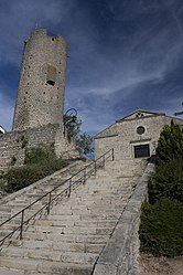
 Tower and staircase | |
 Coat of arms | |
Location of Chambles  | |
 Chambles  Chambles | |
| Coordinates: 45°26′34″N 4°14′20″E | |
| Country | France |
| Region | Auvergne-Rhône-Alpes |
| Department | Loire |
| Arrondissement | Montbrison |
| Canton | Saint-Just-Saint-Rambert |
| Intercommunality | CA Loire Forez |
| Government | |
| • Mayor (2020–2026) | Pierre Giraud[1] |
| Area 1 | 18.9 km2 (7.3 sq mi) |
| Population | 1,036 |
| • Density | 55/km2 (140/sq mi) |
| Time zone | UTC+01:00 (CET) |
| • Summer (DST) | UTC+02:00 (CEST) |
| INSEE/Postal code | 42042 /42170 |
| Elevation | 360–741 m (1,181–2,431 ft) (avg. 640 m or 2,100 ft) |
| 1 French Land Register data, which excludes lakes, ponds, glaciers > 1 km2 (0.386 sq mi or 247 acres) and river estuaries. | |
The town has a surface of 18.90km ² and a city hall altitude of 620 meters. Its latitude is 45.44 degrees north, and longitude, 4.24 degrees, east.
In 1999, Chamble's population was about 762. It increased to 877 in 2003 and 914 in 2007.
Housing was 174 in 1968, 288 in 1975, 377 in 1982, 406 in 1999 and 464 in 2007.
Population
|
|
See also
References
- "Répertoire national des élus: les maires". data.gouv.fr, Plateforme ouverte des données publiques françaises (in French). 2 December 2020.
- "Populations légales 2019". The National Institute of Statistics and Economic Studies. 29 December 2021.
Wikimedia Commons has media related to Chambles.
Текст в блоке "Читать" взят с сайта "Википедия" и доступен по лицензии Creative Commons Attribution-ShareAlike; в отдельных случаях могут действовать дополнительные условия.
Другой контент может иметь иную лицензию. Перед использованием материалов сайта WikiSort.org внимательно изучите правила лицензирования конкретных элементов наполнения сайта.
Другой контент может иметь иную лицензию. Перед использованием материалов сайта WikiSort.org внимательно изучите правила лицензирования конкретных элементов наполнения сайта.
2019-2025
WikiSort.org - проект по пересортировке и дополнению контента Википедии
WikiSort.org - проект по пересортировке и дополнению контента Википедии