world.wikisort.org - France
Bassignac-le-Bas (French pronunciation: [basiɲak lə ba]; Occitan: Bassinhac de Debas) is a commune in the Corrèze department in the Nouvelle-Aquitaine region of south-central France.[3]
Bassignac-le-Bas | |
|---|---|
Commune | |
 Coat of arms | |
Location of Bassignac-le-Bas  | |
 Bassignac-le-Bas  Bassignac-le-Bas | |
| Coordinates: 45°01′12″N 1°51′12″E | |
| Country | France |
| Region | Nouvelle-Aquitaine |
| Department | Corrèze |
| Arrondissement | Tulle |
| Canton | Argentat-sur-Dordogne |
| Government | |
| • Mayor (2020–2026) | Jean-Pierre Lasserre[1] |
| Area 1 | 12.29 km2 (4.75 sq mi) |
| Population | 87 |
| • Density | 7.1/km2 (18/sq mi) |
| Time zone | UTC+01:00 (CET) |
| • Summer (DST) | UTC+02:00 (CEST) |
| INSEE/Postal code | 19017 /19430 |
| Elevation | 145–517 m (476–1,696 ft) (avg. 250 m or 820 ft) |
| 1 French Land Register data, which excludes lakes, ponds, glaciers > 1 km2 (0.386 sq mi or 247 acres) and river estuaries. | |
The inhabitants of the commune are known as Bassignacois or Bassignacoises.[4]
Geography
Bassignac-le-Bas is located some 30 km south-east of Brive-la-Gaillarde and 10 km south-west of Argentat. Access to the commune is by the D116 which comes from Argentat in the north-east and passes along the riverbank through the commune before continuing south to join the D940 at Beaulieu-sur-Dordogne. The D41 from Beaulieu-sur-Dordogne to La Chapelle-Saint-Géraud passes through the south-west of the commune. The D136 comes from Brivezac across the river and passes through the commune eastwards to join the D41 in the east of the commune. Apart from the village there are the hamlets of Vaurs, Recoudier, Le Peuch, Culagne, Chaviolle, La Gendrie, Le Gasquet, Brette, and La Laurie in the commune. The commune is mixed forest and farmland.[5][6]
The Dordogne river forms the western and northern borders of the commune as it flows south to eventually join the Garonne at Bayon-sur-Gironde. The Ruisseau de la Borie flows from a small lake in the east of the commune westwards to join the Dordogne. The Ruisseau de Layssot forms the north-eastern border of the commune as it flows north to join the Dordogne. The Ruisseau de Chauvac forms the southern border of the commune as it flows west to join the Dordogne.[5][6]
Neighbouring communes and villages[5] | ||||||||||||||||
|---|---|---|---|---|---|---|---|---|---|---|---|---|---|---|---|---|
| ||||||||||||||||
History
Bassignac-le-Bas appears as Baßignac le Bas on the 1750 Cassini Map[7] and as Bafignac leBas on the 1790 version.[8]
Heraldry
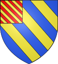 |
The official status of the blazon remains to be determined.
Blazon:
|
Administration
This list is incomplete; you can help by adding missing items. (April 2021) |
List of Successive Mayors[9]
| From | To | Name |
|---|---|---|
| 2001 | 2026 | Jean-Pierre Lasserre[10] |
Demography
In 2017 the commune had 91 inhabitants.
|
| ||||||||||||||||||||||||||||||||||||||||||||||||||||||||||||||||||||||||||||||||||||||||||||||||||||||||||||||||||
| Source: EHESS[11] and INSEE[12] | |||||||||||||||||||||||||||||||||||||||||||||||||||||||||||||||||||||||||||||||||||||||||||||||||||||||||||||||||||
Culture and heritage
Religious heritage
The Parish Church of Saint Martin contains three items that are registered as historical objects:
- A Statue: Sainte Fauste (15th century)
 [13]
[13] - A Group Sculpture: Virgin of Pity (15th century)[14]
- A Bronze Bell (1611)[15]
See also
References
- "Répertoire national des élus: les maires". data.gouv.fr, Plateforme ouverte des données publiques françaises (in French). 2 December 2020.
- "Populations légales 2019". The National Institute of Statistics and Economic Studies. 29 December 2021.
- INSEE commune file
- Inhabitants of Corrèze (in French)
- Bassignac-le-Bas on Google Maps
- Bassignac-le-Bas on the Géoportail from National Geographic Institute (IGN) website (in French)
- Baßignac le Bas on the 1750 Cassini Map
- Bafignac leBas on the 1790 Cassini Map
- List of Mayors of France (in French)
- Village de Bassignac-le-Bas, annuaire-mairie.fr (in French)
- Des villages de Cassini aux communes d'aujourd'hui: Commune data sheet Bassignac-le-Bas, EHESS. (in French)
- Population en historique depuis 1968, INSEE
- Ministry of Culture, Palissy PM19000847 Statue: Sainte Fauste
 (in French)
 - Ministry of Culture, Palissy PM19000845 Group Sculpture: Virgin of Pity (in French)
- Ministry of Culture, Palissy PM19000539 Bronze Bell (in French)
На других языках
- [en] Bassignac-le-Bas
[ru] Бассиньяк-ле-Ба
Бассинья́к-ле-Ба (фр. Bassignac-le-Bas, окс. Bassinhac de Debas) — коммуна во Франции, находится в регионе Лимузен. Департамент — Коррез. Входит в состав кантона Меркёр. Округ коммуны — Тюль.Другой контент может иметь иную лицензию. Перед использованием материалов сайта WikiSort.org внимательно изучите правила лицензирования конкретных элементов наполнения сайта.
WikiSort.org - проект по пересортировке и дополнению контента Википедии