world.wikisort.org - Finland
Puumala (Finnish: [ˈpuːmɑlɑ]; literally translated the "place of cougar") is a municipality of Finland. It is located in the Southern Savonia region. The municipality has a population of 2,119 (31 December 2021)[7] and covers an area of 1,237.75 square kilometres (477.90 sq mi) of which 443.17 km2 (171.11 sq mi) is water.[2] The population density is 2.67 inhabitants per square kilometre (6.9/sq mi).
Puumala | |
|---|---|
Municipality | |
| Puumalan kunta Puumala kommun | |
 | |
 Coat of arms | |
| Motto(s): Saimaan kaunein, Suomen kuumin. (English: The most beautiful in Saimaa, the most hottest in Finland.[1] | |
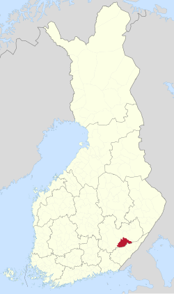 Location of Puumala in Finland | |
| Coordinates: 61°31.5′N 028°11′E | |
| Country | |
| Region | Southern Savonia |
| Sub-region | Mikkeli sub-region |
| Charter | 1868 |
| Government | |
| • Municipal manager | Matias Hildén |
| Area (2018-01-01)[2] | |
| • Total | 1,237.75 km2 (477.90 sq mi) |
| • Land | 794.53 km2 (306.77 sq mi) |
| • Water | 443.17 km2 (171.11 sq mi) |
| • Rank | 102nd largest in Finland |
| Population (2021-12-31)[3] | |
| • Total | 2,119 |
| • Rank | 256th largest in Finland |
| • Density | 2.67/km2 (6.9/sq mi) |
| Population by native language | |
| • Finnish | 98.9% (official) |
| • Swedish | 0.1% |
| • Others | 1% |
| Population by age | |
| • 0 to 14 | 6.8% |
| • 15 to 64 | 49.2% |
| • 65 or older | 44% |
| Time zone | UTC+02:00 (EET) |
| • Summer (DST) | UTC+03:00 (EEST) |
| Municipal tax rate[6] | 19.5% |
| Website | www.puumala.fi |
The municipality is unilingually Finnish.
The main road route through the region is route 62, which connects to Mikkeli to the north and Imatra to the south. Until the year 1995 a cable ferry connected the two sides of Puumalansalmi-strait. In 1995, a 781-metre-long (2,562 ft) bridge replaced the ferry. The bridge is a very dominant structure when looking Puumala town center from a distance.
Puumala has relatively good services compared to the amount of population. In the town center is situated a post office, an Alko store, a kiosk, several supermarkets and a few restaurants. The reason for the survival of these entrepreneurs is the arrival of summer inhabitants who triple the population of Puumala during the season.
In June 1788, Swedish soldiers wearing uniforms of the Imperial Russian Army, staged an attack against the town. This would allow King Gustav III to declare a defensive war against the Russian Empire, as Swedish law prohibited starting offensive wars without approval by the Riksdag.
The subject of Puumala's coat of arms refers to the local history: in the Treaty of Åbo in 1743, Puumala became a border parish, but due to its strategic location, the narrow Puumalansalmi has been the scene of several battles since the 16th century, which the flaming bombshells on the coat of arms refer to. The coat of arms was designed by Tapio Vallioja, and the Puumala municipal council approved it at its meeting on September 24, 1962. The Ministry of the Interior approved the coat of arms for use on April 18, 1963.[8][9]
The Puumala virus is named after this place as it was first isolated from samples from the Puumala area.
Gallery


References
- YLE: Mikä on sinun kotikuntasi iskulause? (in Finnish)
- "Area of Finnish Municipalities 1.1.2018" (PDF). National Land Survey of Finland. Retrieved 30 January 2018.
- "Preliminary population structure by area, 2021M01*-2021M12*". StatFin (in Finnish). Statistics Finland. Retrieved 2 February 2022.
- "Population according to language and the number of foreigners and land area km2 by area as of 31 December 2008". Statistics Finland's PX-Web databases. Statistics Finland. Retrieved 29 March 2009.
- "Population according to age (1-year) and sex by area and the regional division of each statistical reference year, 2003–2020". StatFin. Statistics Finland. Retrieved 2 May 2021.
- "List of municipal and parish tax rates in 2021" (PDF). Tax Administration of Finland. 1 December 2020. Retrieved 10 April 2021.
- "VÄESTÖTIETOJÄRJESTELMÄ REKISTERITILANNE 31.1.2012" (in Finnish and Swedish). Population Register Center of Finland. Archived from the original on 3 October 2013. Retrieved 11 February 2014.
- Suomen kunnallisvaakunat (in Finnish). Suomen Kunnallisliitto. 1982. p. 157. ISBN 951-773-085-3.
- "Sisäasiainministeriön vahvistamat kaupunkien, kauppaloiden ja kuntien vaakunat I:12 Puumala" (in Finnish). Kansallisarkiston digitaaliarkisto. Retrieved July 27, 2022.
External links
![]() Media related to Puumala at Wikimedia Commons
Media related to Puumala at Wikimedia Commons
- Municipality of Puumala – Official website
Places adjacent to Puumala | ||||||||||||||||
|---|---|---|---|---|---|---|---|---|---|---|---|---|---|---|---|---|
| ||||||||||||||||
Municipalities of South Savo | ||
|---|---|---|
| Municipalities |
|  |
| Former municipalities |
| |
| ||
This Eastern Finland location article is a stub. You can help Wikipedia by expanding it. |
На других языках
[de] Puumala
Puumala [.mw-parser-output .IPA a{text-decoration:none}ˈpuːmɑlɑ] ist eine Gemeinde in Südostfinnland. Sie liegt rund 300 Kilometer nordöstlich der Hauptstadt Helsinki im Saimaa-Seengebiet.- [en] Puumala
Другой контент может иметь иную лицензию. Перед использованием материалов сайта WikiSort.org внимательно изучите правила лицензирования конкретных элементов наполнения сайта.
WikiSort.org - проект по пересортировке и дополнению контента Википедии