world.wikisort.org - Finland
Taipalsaari is a municipality of Finland. It is located in the province of Southern Finland and is part of the South Karelia region. The municipality has a population of 4,593 (31 December 2021)[2] and covers an area of 761.94 square kilometres (294.19 sq mi) of which 416.88 km2 (160.96 sq mi) is water.[1] The population density is 13.31 inhabitants per square kilometre (34.5/sq mi). Neighbouring municipalities are Lappeenranta, Lemi, Puumala, Ruokolahti and Savitaipale. The municipality is unilingually Finnish.
Taipalsaari | |
|---|---|
Municipality | |
| Taipalsaaren kunta Taipalsaari kommun | |
 Taipalsaari in October 2017 | |
 Coat of arms | |
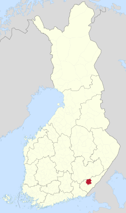 Location of Taipalsaari in Finland | |
| Coordinates: 61°09.5′N 028°04′E | |
| Country | |
| Region | South Karelia |
| Sub-region | Lappeenranta sub-region |
| Charter | 1571 |
| Government | |
| • Municipal manager | Jari Willman |
| Area (2018-01-01)[1] | |
| • Total | 761.94 km2 (294.19 sq mi) |
| • Land | 345.07 km2 (133.23 sq mi) |
| • Water | 416.88 km2 (160.96 sq mi) |
| • Rank | 224th largest in Finland |
| Population (2021-12-31)[2] | |
| • Total | 4,593 |
| • Rank | 182nd largest in Finland |
| • Density | 13.31/km2 (34.5/sq mi) |
| Population by native language | |
| • Finnish | 97.2% (official) |
| • Swedish | 0.1% |
| • Others | 2.7% |
| Population by age | |
| • 0 to 14 | 15% |
| • 15 to 64 | 58.6% |
| • 65 or older | 26.4% |
| Time zone | UTC+02:00 (EET) |
| • Summer (DST) | UTC+03:00 (EEST) |
| Municipal tax rate[5] | 21% |
| Climate | Dfc |
| Website | www.taipalsaari.fi |
The average temperature during the summer months on Taipalsaari is the highest among Finnish municipalities.[6]
References
- "Area of Finnish Municipalities 1.1.2018" (PDF). National Land Survey of Finland. Retrieved 30 January 2018.
- "Preliminary population structure by area, 2021M01*-2021M12*". StatFin (in Finnish). Statistics Finland. Retrieved 2 February 2022.
- "Population according to language and the number of foreigners and land area km2 by area as of 31 December 2008". Statistics Finland's PX-Web databases. Statistics Finland. Retrieved 29 March 2009.
- "Population according to age (1-year) and sex by area and the regional division of each statistical reference year, 2003–2020". StatFin. Statistics Finland. Retrieved 2 May 2021.
- "List of municipal and parish tax rates in 2021" (PDF). Tax Administration of Finland. 1 December 2020. Retrieved 10 April 2021.
- "Vietätkö sinä suvesi Suomen lämpimimmässä kunnassa? – Katso tilastot" (in Finnish). MTV Uutiset. Retrieved September 15, 2021.
External links
![]() Media related to Taipalsaari at Wikimedia Commons
Media related to Taipalsaari at Wikimedia Commons
- Municipality of Taipalsaari – Official website (in Finnish)
- GoTaipalsaari – Tourist information
- goSaimaa.com – travel information
Places adjacent to Taipalsaari | ||||||||||||||||
|---|---|---|---|---|---|---|---|---|---|---|---|---|---|---|---|---|
| ||||||||||||||||
Municipalities of South Karelia | ||
|---|---|---|
| Municipalities |
|  |
| Former municipalities |
| |
| ||
| Authority control |
|
|---|
This Southern Finland location article is a stub. You can help Wikipedia by expanding it. |
На других языках
- [en] Taipalsaari
[ru] Тайпалсаари
Тайпалсаари (фин. Taipalsaari) — община в провинции Южная Карелия, губерния Южная Финляндия, Финляндия. Общая площадь территории — 761,95 км², из которых 416,88 км² — вода.Другой контент может иметь иную лицензию. Перед использованием материалов сайта WikiSort.org внимательно изучите правила лицензирования конкретных элементов наполнения сайта.
WikiSort.org - проект по пересортировке и дополнению контента Википедии