world.wikisort.org - Finland
Karijoki (Swedish: Bötom) is a municipality of Finland.
Karijoki
Bötom | |
|---|---|
Municipality | |
| Karijoen kunta Bötoms kommun | |
 Karijoki in 1990 | |
 Coat of arms | |
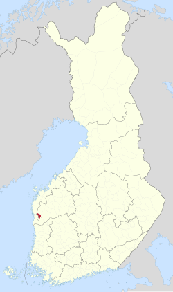 Location of Karijoki in Finland | |
| Coordinates: 62°18.5′N 021°42.5′E | |
| Country | |
| Region | South Ostrobothnia |
| Sub-region | Suupohja sub-region |
| Government | |
| • Municipal manager | Marko Keski-Sikkilä |
| Area (2018-01-01)[1] | |
| • Total | 186.54 km2 (72.02 sq mi) |
| • Land | 185.77 km2 (71.73 sq mi) |
| • Water | 0.78 km2 (0.30 sq mi) |
| • Rank | 267th largest in Finland |
| Population (2021-12-31)[2] | |
| • Total | 1,192 |
| • Rank | 290th largest in Finland |
| • Density | 6.42/km2 (16.6/sq mi) |
| Population by native language | |
| • Finnish | 97.8% (official) |
| • Swedish | 2.2% |
| • Others | 0.1% |
| Population by age | |
| • 0 to 14 | 11.4% |
| • 15 to 64 | 52.4% |
| • 65 or older | 36.3% |
| Time zone | UTC+02:00 (EET) |
| • Summer (DST) | UTC+03:00 (EEST) |
| Municipal tax rate[5] | 22.5% |
| Website | www.karijoki.fi |
It is part of the South Ostrobothnia region. The population of Karijoki is 1,192 (December 31, 2021),[2] which makes it the smallest municipality in South Ostrobothnia in terms of population. The municipality covers an area of 185.77 km2 (71.73 sq mi) of which 0.78 km2 (0.30 sq mi) is inland water (January 1, 2018).[1] The population density is 6.42/km2 (16.6/sq mi).
The municipality is unilingually Finnish.
A neanderthal cave, the Wolf cave, was found in the Pyhävuori mountains in Karijoki in 1997.
Villages
- Alakylä
- Karijoen kirkonkylä
- Myrkky
- Ylikylä
Notable individuals
- Aarne Ahola, Knight of the Mannerheim Cross No. 71
- Antti Rajamäki, former sprinter
- Erkki Rankaviita, folk musician
- Knut Sonck, dean
- Paul Norrback, accordionist and composer
- Pentti Lund. ice hockey player
- Susanna Rajamäki, athlete
References
- "Area of Finnish Municipalities 1.1.2018" (PDF). National Land Survey of Finland. Retrieved 30 January 2018.
- "Preliminary population structure by area, 2021M01*-2021M12*". StatFin (in Finnish). Statistics Finland. Retrieved 2 February 2022.
- "Population according to language and the number of foreigners and land area km2 by area as of 31 December 2008". Statistics Finland's PX-Web databases. Statistics Finland. Retrieved 29 March 2009.
- "Population according to age (1-year) and sex by area and the regional division of each statistical reference year, 2003–2020". StatFin. Statistics Finland. Retrieved 2 May 2021.
- "List of municipal and parish tax rates in 2021" (PDF). Tax Administration of Finland. 1 December 2020. Retrieved 10 April 2021.
External links
![]() Media related to Karijoki at Wikimedia Commons
Media related to Karijoki at Wikimedia Commons
- Karijoen kunta – The official website of the municipality
Places adjacent to Karijoki | ||||||||||||||||
|---|---|---|---|---|---|---|---|---|---|---|---|---|---|---|---|---|
| ||||||||||||||||
Municipalities of South Ostrobothnia | ||
|---|---|---|
| Municipalities |  | |
| Former municipalities |
| |
| ||
| Authority control |
|
|---|
This Western Finland location article is a stub. You can help Wikipedia by expanding it. |
На других языках
- [en] Karijoki
[ru] Карийоки
Карийоки (фин. Karijoki) — община в провинции Южная Остроботния, Финляндия. Общая площадь территории — 186,55 км², из которых 0,78 км² — вода.Текст в блоке "Читать" взят с сайта "Википедия" и доступен по лицензии Creative Commons Attribution-ShareAlike; в отдельных случаях могут действовать дополнительные условия.
Другой контент может иметь иную лицензию. Перед использованием материалов сайта WikiSort.org внимательно изучите правила лицензирования конкретных элементов наполнения сайта.
Другой контент может иметь иную лицензию. Перед использованием материалов сайта WikiSort.org внимательно изучите правила лицензирования конкретных элементов наполнения сайта.
2019-2026
WikiSort.org - проект по пересортировке и дополнению контента Википедии
WikiSort.org - проект по пересортировке и дополнению контента Википедии