world.wikisort.org - Czech
Strmilov (German: Tremles) is a town in Jindřichův Hradec District in the South Bohemian Region of the Czech Republic. It has about 1,400 inhabitants.
Strmilov | |
|---|---|
Town | |
 Strmilov during winter | |
 Flag  Coat of arms | |
 Strmilov Location in the Czech Republic | |
| Coordinates: 49°9′52″N 15°12′11″E | |
| Country | |
| Region | South Bohemian |
| District | Jindřichův Hradec |
| First mentioned | 1255 |
| Government | |
| • Mayor | Martin Novák |
| Area | |
| • Total | 30.61 km2 (11.82 sq mi) |
| Elevation | 545 m (1,788 ft) |
| Population (2022-01-01)[1] | |
| • Total | 1,445 |
| • Density | 47/km2 (120/sq mi) |
| Time zone | UTC+1 (CET) |
| • Summer (DST) | UTC+2 (CEST) |
| Postal code | 378 53 |
| Website | www |
Administrative parts
Villages of Česká Olešná, Leština, Malý Jeníkov and Palupín are administrative parts of Strmilov.
Geography
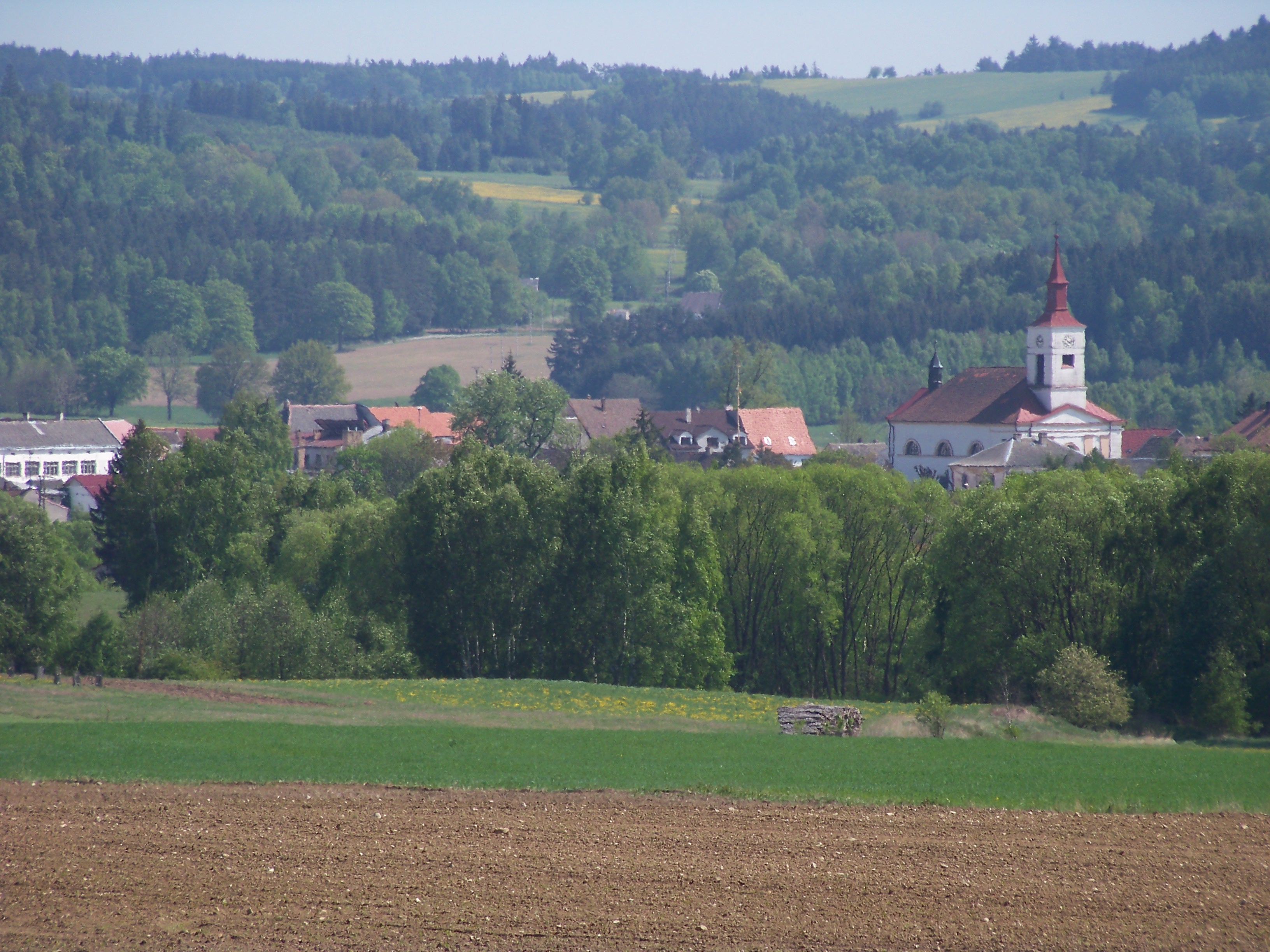
Strmilov is located about 13 km (8 mi) east of Jindřichův Hradec. It lies on the border between the Javořice Highlands, where most of the built-up area is located, and the Křemešník Highlands. The town is situated along the Hamerský stream. The built-up area is surrounded by fields and forests with several small fish ponds.
Strmilov lies on the border of historical lands of Moravia and Bohemia; a confluence of two brooks near Strmilov is the westernmost point of Moravia.
History
The original settlement was probably established at the beginning of 13th century. The first written mention of Strmilov is from 1255. In 1294, it was already titled as a market village. In 1385, it is referred to as a market town.[2]
In 1945, the German population was expelled according to the Beneš decrees.
Sights
The landmark of the town is the Church of Saint Giles. It was built in the Empire style in 1843–1849.[3]
Twin towns – sister cities
Strmilov is twinned with:[4]
 Trubschachen, Switzerland
References
- "Population of Municipalities – 1 January 2022". Czech Statistical Office. 2022-04-29.
- "Historie města: 13.–19. století" (in Czech). Město Strmilov. Retrieved 2021-09-02.
- "Kostel sv. Jiljí" (in Czech). National Heritage Institute. Retrieved 2022-06-20.
- "Partnerská obec Trubschachen" (in Czech). Město Strmilov. Retrieved 2020-08-21.
External links
- Official website (in Czech)
| Authority control: National libraries |
|---|
На других языках
[de] Strmilov
Strmilov (deutsch Tremles) ist eine Stadt in Tschechien. Sie gehört zum Okres Jindřichův Hradec und liegt 15 km östlich von Jindřichův Hradec in 545 m ü. M. an der Grenze zwischen Böhmen und Mähren. Durch den Ort fließt der Hamerský potok.- [en] Strmilov
Другой контент может иметь иную лицензию. Перед использованием материалов сайта WikiSort.org внимательно изучите правила лицензирования конкретных элементов наполнения сайта.
WikiSort.org - проект по пересортировке и дополнению контента Википедии