world.wikisort.org - China
Xuelin Wa Ethnic Township (simplified Chinese: 雪林佤族乡; traditional Chinese: 雪林佤族鄉; pinyin: Xuělín Wǎzú Xiāng) is an ethnic township in Lancang Lahu Autonomous County, Yunnan, China. As of the 2017 census it had a population of 12,738 and an area of 247.11-square-kilometre (95.41 sq mi).
Xuelin Wa Ethnic Township
雪林佤族乡 | |
|---|---|
Ethnic township | |
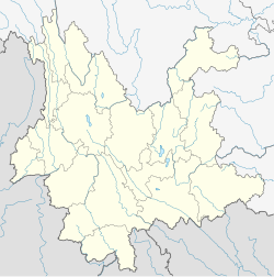
 Xuelin Wa Ethnic Township Location in Yunnan. | |
| Coordinates: 23°01′31″N 99°33′30″E | |
| Country | People's Republic of China |
| Province | Yunnan |
| Prefecture-level city | Pu'er City |
| Autonomous county | Lancang Lahu Autonomous County |
| Area | |
| • Total | 247.11 km2 (95.41 sq mi) |
| Population (2017) | |
| • Total | 12,738 |
| • Density | 52/km2 (130/sq mi) |
| Time zone | UTC+08:00 (China Standard) |
| Postal code | 665605 |
| Area code | 0879 |
Administrative division
As of 2016, the township is divided into seven villages:
- Xuelin (雪林村)
- Mangdeng (芒登村)
- Xiaomangling (小芒令村)
- Nanpan (南盼村)
- Zuodu (左都村)
- Damangling (大芒令村)
- Yongguang (永广村)
Geography
The Xuelin Wa Ethnic Township is a border township lies at the northwestern Lancang Lahu Autonomous County. The township shares a border with Mongmao Township of Myanmar to the west, Mujia Township to the east, Cangyuan Va Autonomous County to the north, and Ximeng Va Autonomous County to the south.[1]
The Gelang River (格浪河) and Gelang Longdai River (格浪龙代河) flow through the township.[1]
Economy
The region's economy is based on agriculture.[1] The main crops of the region are grain, followed by corn and buckwheat.[1]
Demographics
| Year | Pop. | ±% |
|---|---|---|
| 2004 | 12,003 | — |
| 2017 | 12,738 | +6.1% |
| Source: [1] | ||
As of 2017, the National Bureau of Statistics of China estimates the township's population now to be 12,738.
| Ethnic groups in 2004[1] | ||
|---|---|---|
| Ethnicity | Population | Percentage |
| Lahu | 391 | 3.3% |
| Han | 50 | 0.4% |
| Wa | 11507 | 95.9% |
| Other | 55 | 0.5% |
Transportation
The National Highway G214 passes across the township north to south.
References
- Shi Chunyun 2007, p. 58.
Bibliography
- Shi Chunyun, ed. (2007). "Administrative divisions" 行政区划. 《澜沧拉祜族自治县概况》 [General Situation of Lancang Lahu Autonomous County] (in Chinese). Beijing: Nationalities Publishing House. ISBN 978-7-105-08556-9.
Другой контент может иметь иную лицензию. Перед использованием материалов сайта WikiSort.org внимательно изучите правила лицензирования конкретных элементов наполнения сайта.
WikiSort.org - проект по пересортировке и дополнению контента Википедии