world.wikisort.org - China
Longsheng Various Nationalities (Gezu) Autonomous County (simplified Chinese: 龙胜各族自治县; traditional Chinese: 龍勝各族自治縣; pinyin: Lóngshèng Gèzú Zìzhìxiàn; Zhuang: Lungzhingz Gakcuz Swciyen; usually referred to as "Longsheng County" 龙胜县; 龍勝縣) is a county in the northeast of Guangxi, China, bordering Hunan Province to the north. It is under the administration of Guilin City. The county covers 2,538 km2 (980 sq mi), and as of 2019 it had a census registered population of 186,000. The county has six towns and four townships under its jurisdiction, the county seat is the town of Longsheng.
Longsheng County
龙胜县 Lungzhingz Yen Lungsheng | |
|---|---|
Autonomous county | |
| Longsheng Various Nationalities Autonomous County 龙胜各族自治县 Lungzhingz Gakcuz Swciyen | |
 | |
 Longsheng Location of the seat in Guangxi | |
| Coordinates: 25°47′53″N 110°00′40″E | |
| Country | People's Republic of China |
| Autonomous region | Guangxi |
| Prefecture-level city | Guilin |
| Area | |
| • Total | 2,537 km2 (980 sq mi) |
| Time zone | UTC+8 (China Standard) |
Administrative divisions
As of 2020, Longsheng Various Nationalities Autonomous County has six towns and four townships under its jurisdiction.[1] The county seat is Longsheng Town.[citation needed]
| Name | Chinese character[1] | Area (Km2)[citation needed] | Population (2018)[citation needed] | Notes |
|---|---|---|---|---|
| Longsheng | 龙胜镇 | 320 | 37,000 | |
| Piaoli | 瓢里镇 | 207.82 | 14,944 | |
| Sanmen | 三门镇 | 327.88 | 14,500 | |
| Longji | 龙脊镇 | 273.34 | 16,000 | |
| Pingdeng | 平等镇 | 365 | 28,800 | |
| Lejiang | 乐江镇 | 227.88 | 19039 | |
| Sishui Township | 泗水乡 | 167.8 | 13,000 | |
| Jiangdi Township | 江底乡 | 251.17 | 8,900 | |
| Madi Township | 马堤乡 | 141.48 | 15,100 | |
| Weijiang Township | 伟江乡 | 170.6 | 9,700 |
Geography
Longsheng Various Nationalities Autonomous County is located in northeastern Guangxi. Longsheng Various Nationalities Autonomous County shares a border with Rong'an County and Sanjiang Dong Autonomous County to the southwest, Tongdao Dong Autonomous County to the northwest, Xing'an County and Ziyuan County to the east, Chengbu Miao Autonomous County to the north, and Lingchuan County and Lingui District to the south.
Mountains
There are more than 21 mountains over 1,500 metres (4,900 ft) above sea level in Longsheng Various Nationalities Autonomous County.[2] The highest point in the count is the Great South Mountain (Chinese: 大南山) which stands 1,940 metres (6,360 ft) above sea level.[2] The lowest point is Shimentang (石门塘), which, at 163 metres (535 ft) above sea level.[2]
Rivers and Streams
There are over 480 rivers and streams in Longsheng Various Nationalities Autonomous County.[2] Sang River is the largest river in the county.[2]
Climate
Longsheng Various Nationalities Autonomous County enjoys a subtropical humid monsoon climate, with an average annual temperature of 18.1 °C (64.6 °F), total annual rainfall of 1,500-millimetre (59 in) to 2,400-millimetre (94 in), and a frost-free period of 314 days. The warmest temperature recorded in Longsheng Various Nationalities Autonomous County, on July 30, 1962, is 39.5 °C (103.1 °F). Its record low temperature is −4.8 °C (23.4 °F) observed on January 30, 1977.
| Climate data for Longsheng (1981−2010) | |||||||||||||
|---|---|---|---|---|---|---|---|---|---|---|---|---|---|
| Month | Jan | Feb | Mar | Apr | May | Jun | Jul | Aug | Sep | Oct | Nov | Dec | Year |
| Record high °C (°F) | 25.9 (78.6) |
30.0 (86.0) |
35.1 (95.2) |
35.7 (96.3) |
34.9 (94.8) |
37.0 (98.6) |
38.9 (102.0) |
38.0 (100.4) |
37.5 (99.5) |
35.5 (95.9) |
31.2 (88.2) |
27.0 (80.6) |
38.9 (102.0) |
| Average high °C (°F) | 12.0 (53.6) |
14.0 (57.2) |
17.9 (64.2) |
23.7 (74.7) |
27.5 (81.5) |
30.1 (86.2) |
31.9 (89.4) |
32.6 (90.7) |
30.4 (86.7) |
25.6 (78.1) |
20.6 (69.1) |
15.3 (59.5) |
23.5 (74.2) |
| Daily mean °C (°F) | 7.9 (46.2) |
10.0 (50.0) |
13.6 (56.5) |
18.8 (65.8) |
22.6 (72.7) |
25.4 (77.7) |
26.8 (80.2) |
26.6 (79.9) |
24.1 (75.4) |
19.7 (67.5) |
14.8 (58.6) |
9.8 (49.6) |
18.3 (65.0) |
| Average low °C (°F) | 5.2 (41.4) |
7.4 (45.3) |
10.6 (51.1) |
15.5 (59.9) |
19.1 (66.4) |
22.2 (72.0) |
23.5 (74.3) |
23.1 (73.6) |
20.3 (68.5) |
16.1 (61.0) |
11.1 (52.0) |
6.3 (43.3) |
15.0 (59.1) |
| Record low °C (°F) | −2.9 (26.8) |
−1.9 (28.6) |
−1.2 (29.8) |
4.2 (39.6) |
9.3 (48.7) |
12.5 (54.5) |
17.1 (62.8) |
17.6 (63.7) |
12.4 (54.3) |
4.1 (39.4) |
0.6 (33.1) |
−3.7 (25.3) |
−3.7 (25.3) |
| Average precipitation mm (inches) | 58.8 (2.31) |
80.0 (3.15) |
106.1 (4.18) |
151.7 (5.97) |
262.2 (10.32) |
282.2 (11.11) |
213.4 (8.40) |
150.6 (5.93) |
71.0 (2.80) |
66.2 (2.61) |
66.6 (2.62) |
41.6 (1.64) |
1,550.4 (61.04) |
| Average relative humidity (%) | 80 | 80 | 80 | 81 | 83 | 84 | 84 | 83 | 80 | 80 | 78 | 77 | 81 |
| Source: China Meteorological Data Service Center[3] | |||||||||||||
Demographics
By the end of 2019, there were 186,000 people lived in Longsheng Various Nationalities Autonomous County, among them, 150,300 are agricultural population and 127,600 are ethnic minorities.[4]
Ethnic groups
There are five nationalities in Longsheng Various Nationalities Autonomous County: the Miao, Yao, Dong, Zhuang and Han.[4] According to 2010 census, the county is mostly populated by ethnic Dong (26.5%), with a sizeable population of ethnic Zhuang (22%), Yao (17%) and Miao (15%).[citation needed]
Dong people
The Dong people of Longsheng County are largely concentrated in 23 villages throughout the county.[5]
Miao people
The Miao people of Longsheng County are largely concentrated in 13 villages throughout the county: Niutou (Chinese: 牛头), Zhangjia (Chinese: 张家), Longjia (Chinese: 龙家), Lishi (Chinese: 里市), Dongsheng (Chinese: 东升), Yangwan (Chinese: 洋湾), Furong (Chinese: 芙蓉), Bunong (Chinese: 布弄), Zhongdong (Chinese: 中洞), Limu (Chinese: 里木), Conglin (Chinese: 从林), Dawan (Chinese: 大湾), and Liangping (Chinese: 凉坪).[5]
Yao people
The Yao people of Longsheng County are largely concentrated in 13 villages throughout the county.[5] In the eastern part, the Yao live in the villages of Zhonglu (Chinese: 中禄), Dazhai (Chinese: 大寨), Xiaozhai (Chinese: 小寨), Pannei (Chinese: 潘内), Ximen (Chinese: 细门), Zhoujia (Chinese: 周家), Jianxin (Chinese: 建新), Lijiang (Chinese: 李江), and Qinling (Chinese: 秦岭).[5] In the northern part, the Yao live in the villages of Liuli (Chinese: 琉璃) and Tongluo (Chinese: 铜锣).[5] In the southern part, the Yao live in the villages of Tonglie (Chinese: 同列) and Tandi (Chinese: 滩底).[5]
The subgroups of the Yao people of Longsheng County include the Pan Yao (Chinese: 盘瑶), Red Yao (Chinese: 红瑶) (Younuo), and the Flowery Yao (Chinese: 花瑶).[citation needed]
Zhuang people
The Zhuang people of Longsheng County are largely concentrated in 17 villages in the western portion of the county: Longji (Chinese: 龙脊), Ping'an (Chinese: 平安), Jinjiang (Chinese: 金江), Haijiang (Chinese: 海江), Baishi (Chinese: 白石), Daliu (Chinese: 大柳), Shuangdong (Chinese: 双洞), Jinjie (Chinese: 金结), Pingye (Chinese: 平也), Dayun (Chinese: 大云), Jiaozhou (Chinese: 交州), Liuman (Chinese: 六漫), Silong (Chinese: 思陇), Meidong (Chinese: 梅洞), Menghua (Chinese: 孟化), Hongzhai (Chinese: 洪寨), and Huaqiao (Chinese: 花桥).[5]
Language
Mandarin is the official language.[citation needed] Local residents exclusively speak native languages at home.[citation needed]
Religion
The Miao, Yao, Dong and Zhuang people believe in animism and worship ancestors.[citation needed] Buddhism and Taoism are widespread religions of Han Chinese in Longsheng Various Nationalities Autonomous County.[citation needed]
Transport
The China National Highway 321, commonly referred to as "G321", is a southeast-northwest highway passing through the county's downtown, commercial, and industrial districts in the western part of Longsheng Various Nationalities Autonomous County.[citation needed]
The G65 Baotou–Maoming Expressway, more commonly known as "Bao-Mao Expressway", runs from the northwest to southeast of Longsheng Various Nationalities Autonomous County.[citation needed]
Tourism
Longsheng Various Nationalities Autonomous County is known worldwide for the Longsheng Rice Terraces.[citation needed] Major tourist destinations include Yulongtan Scenic Spot (玉龙滩旅游风景区), Huaping National Nature Reserve (花坪国家级自然保护区), Baimian Yao Village (白面瑶寨), Longsheng Hot Spring (龙胜温泉), Weijiang Rice Terraces (伟江梯田), and Xiabilin Waterfall (下碧林瀑布).[citation needed] The county boasts many cultural and historical relics, including the Shunfeng Bridge (顺风桥; also known as "Red Army Bridge") and the Pan Village Wind-rain Bridge (潘寨风雨桥).[citation needed]
Gallery
- Longsheng
 Rice terraces
 Way up to the rice terraces
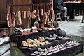 Souvenirs
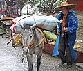 Transport
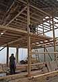 Building a house
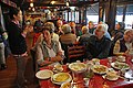 Restaurant on the way up
 Cook
Cook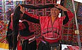 Yao women showing their hairstyle


References
- 2020年统计用区划代码 [2020 Statistical Division Codes] (in Chinese). National Bureau of Statistics of China. 2020. Archived from the original on 2021-03-28. Retrieved 2021-03-28.
- Yang Tongming 2007, p. 2.
- 中国地面气候标准值月值(1981-2010) (in Simplified Chinese). China Meteorological Data Service Center. Retrieved 7 November 2022.
- 龙胜各族自治县人口与民族情况. glls.gov.cn (in Chinese). 20 May 2020. Retrieved 15 November 2020.
{{cite news}}: CS1 maint: url-status (link) - 第一节 人口 [Section 1 Population]. gxdqw.com (in Chinese). Archived from the original on 2016-03-04. Retrieved 2021-03-28.
Bibliography
- Yang Tongming, ed. (2007). 《龙胜各族自治县概况》 [General Situation of Longsheng Various Nationalities Autonomous County] (in Chinese). Beijing: Nationalities Publishing House. ISBN 978-7-105-08630-6.
Authority control | |
|---|---|
| General | |
| National libraries | |
На других языках
- [en] Longsheng Various Nationalities Autonomous County
[fr] Xian autonome de diverses nationalités de Longsheng
Le Xian autonome de diverses nationalités de Longsheng (龙胜各族自治县 ; pinyin : Lóngshèng gèzú Zìzhìxiàn) est une subdivision administrative de la région autonome du Guangxi en Chine. Il est placé sous la juridiction de la ville-préfecture de Guilin, à environ deux heures de route.[ru] Луншэнский многонациональный автономный уезд
Луншэнский многонациональный автономный уезд (кит. упр. 龙胜各族自治县, пиньинь Lóngshèng gèzú zìzhìxiàn) — автономный уезд городского округа Гуйлинь Гуанси-Чжуанского автономного района (КНР).Другой контент может иметь иную лицензию. Перед использованием материалов сайта WikiSort.org внимательно изучите правила лицензирования конкретных элементов наполнения сайта.
WikiSort.org - проект по пересортировке и дополнению контента Википедии