world.wikisort.org - China
Fuyun County (Chinese: 富蕴县) as the official romanized name, also transliterated from Uyghur as Koktokay County (Uighur: كوكتوقاي ناھىيىسى; Chinese: 可可托海县; Kazakh: كوكتوعاي اۋدانى), is a county situated in the Xinjiang Uyghur Autonomous Region and is under the administration of the Altay Prefecture. It has an area of 32,237 km² with a population of 80,000. The seat of Fuyun County is in Ku Ertix Town (库额尔齐斯镇). The Koktokay National Geopark is in Koktokay Town (可可托海镇). The Postcode of Fuyun County is 836100. The county is served by Fuyun Koktokay Airport.
This article needs additional citations for verification. (September 2021) |
Fuyun County
富蕴县 كوكتوقاي ناھىيىسى كوكتوعاي اۋدانى | |
|---|---|
County | |
 | |
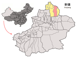 Location of Fuyun County (red) in Altay Prefecture (yellow) and Xinjiang | |
 Fuyun Location of the seat in Xinjiang | |
| Coordinates: 47°13′N 89°39′E | |
| Country | People's Republic of China |
| Region | Xinjiang |
| Prefecture | Altay |
| Township-level divisions | 3 towns 6 townships 3 ethnic townships |
| County seat | Ku Ertix (库额尔齐斯镇) |
| Area | |
| • Total | 32,237 km2 (12,447 sq mi) |
| Dimensions | |
| • Length | 413 km (257 mi) |
| • Width | 180 km (110 mi) |
| Highest elevation | 3,863 m (12,674 ft) |
| Lowest elevation | 430 m (1,410 ft) |
| Population | |
| • Total | 80,000 |
| • Density | 2.5/km2 (6.4/sq mi) |
| Time zone | UTC+8 (China Standard) |
| Postal code | 836100 |
| Fuyun County | |||||||||||
|---|---|---|---|---|---|---|---|---|---|---|---|
| Chinese name | |||||||||||
| Simplified Chinese | 富蕴县 | ||||||||||
| Traditional Chinese | 富蘊縣 | ||||||||||
| |||||||||||
| Alternative Chinese name | |||||||||||
| Simplified Chinese | 可可托海县 | ||||||||||
| Traditional Chinese | 可可託海縣 | ||||||||||
| |||||||||||
| Uyghur name | |||||||||||
| Uyghur | كوكتوقاي ناھىيىسى | ||||||||||
| |||||||||||
| Kazakh name | |||||||||||
| Kazakh | كوكتوعاي اۋدانى | ||||||||||
Administrative divisions
Town (镇 / بازارلىق / قالاشىع)
- Ku'ertix Town (库额尔齐斯镇 / قۇئېرتىش بازىرى / قۋەرتىس قالاشىعى), Koktokay Town (可可托海镇 / كوكتوقاي بازىرى / كوكتوعاي قالاشىعى ), Shakurti Town (恰库尔图镇 / چاقۇرت بازىرى / شاكۇرتى قالاشىعى), Dure Town (杜热镇 / دۇرە بازىرى / دۇرە قالاشىعى ), Karatüngke Town (喀拉通克镇 / قارا تۇڭكې بازىرى / قارا توڭكە قالاشىعى)
Township (乡 / يېزا / اۋىل)
- Turgun Township (吐尔洪乡 / تۇرغۇن يېزىسى / تۇرعىن اۋىلى), Kürti Township (库尔特乡 / كۇرتى يېزىسى / كۇرتى اۋىلى ), Temeki Township (铁买克乡 / تېمېكى يېزىسى / تەمەكى اۋىلى), Kara Bulgin Township (喀拉布勒根乡 / قارا بۇلغىن يېزىسى / قارا بۇلعىن اۋىلى), Kizilshilik (克孜勒希力克乡 / قىزىلشىلىك يېزىسى / قىزىلشىلىك اۋىلى)
Demographics
Geography
| Climate data for Fuyun County (1971−2000) | |||||||||||||
|---|---|---|---|---|---|---|---|---|---|---|---|---|---|
| Month | Jan | Feb | Mar | Apr | May | Jun | Jul | Aug | Sep | Oct | Nov | Dec | Year |
| Record high °C (°F) | 5.1 (41.2) |
7.7 (45.9) |
24.5 (76.1) |
31.0 (87.8) |
34.7 (94.5) |
39.2 (102.6) |
42.2 (108.0) |
38.7 (101.7) |
35.2 (95.4) |
28.4 (83.1) |
18.2 (64.8) |
10.0 (50.0) |
42.2 (108.0) |
| Average high °C (°F) | −12.1 (10.2) |
−7.9 (17.8) |
0.7 (33.3) |
14.9 (58.8) |
22.5 (72.5) |
27.7 (81.9) |
29.3 (84.7) |
28.2 (82.8) |
22.3 (72.1) |
13.1 (55.6) |
0.7 (33.3) |
−9.2 (15.4) |
10.9 (51.5) |
| Daily mean °C (°F) | −20.4 (−4.7) |
−17.1 (1.2) |
−7.0 (19.4) |
7.5 (45.5) |
14.7 (58.5) |
20.3 (68.5) |
22.0 (71.6) |
20.1 (68.2) |
13.9 (57.0) |
5.2 (41.4) |
−6.6 (20.1) |
−16.6 (2.1) |
3.0 (37.4) |
| Average low °C (°F) | −26.0 (−14.8) |
−23.8 (−10.8) |
−13.4 (7.9) |
−0.8 (30.6) |
7.0 (44.6) |
12.5 (54.5) |
14.7 (58.5) |
12.3 (54.1) |
6.3 (43.3) |
−1.1 (30.0) |
−11.6 (11.1) |
−21.8 (−7.2) |
−3.7 (25.4) |
| Record low °C (°F) | −49.8 (−57.6) |
−46.5 (−51.7) |
−40.7 (−41.3) |
−17.7 (0.1) |
−5.9 (21.4) |
−0.3 (31.5) |
4.7 (40.5) |
0.6 (33.1) |
−6.0 (21.2) |
−19.3 (−2.7) |
−41.8 (−43.2) |
−47.5 (−53.5) |
−49.8 (−57.6) |
| Average precipitation mm (inches) | 8.9 (0.35) |
6.9 (0.27) |
9.4 (0.37) |
13.6 (0.54) |
16.7 (0.66) |
19.6 (0.77) |
32.1 (1.26) |
14.5 (0.57) |
15.5 (0.61) |
15.2 (0.60) |
21.8 (0.86) |
15.3 (0.60) |
189.5 (7.46) |
| Average precipitation days (≥ 0.1 mm) | 7.1 | 6.4 | 7.4 | 6.5 | 6.5 | 6.7 | 8.2 | 6.6 | 5.9 | 6.4 | 8.7 | 8.7 | 85.1 |
| Average relative humidity (%) | 76 | 75 | 73 | 51 | 43 | 44 | 48 | 46 | 49 | 58 | 72 | 78 | 59 |
| Mean monthly sunshine hours | 168.5 | 188.3 | 241.5 | 267.5 | 315.9 | 321.8 | 320.2 | 306.8 | 265.1 | 215.1 | 154.6 | 135.7 | 2,901 |
| Percent possible sunshine | 61 | 65 | 66 | 66 | 68 | 68 | 67 | 70 | 71 | 64 | 55 | 51 | 65 |
| Source: China Meteorological Administration[2] | |||||||||||||
See also
- Ospan Batyr
References
- 3-7 各地、州、市、县(市)分民族人口数 [3-7 Population by Nationality by Prefecture, State, City and County (City)]. tjj.xinjiang.gov.cn (in Chinese). Statistical Bureau of Xinjiang Uyghur Autonomous Region. 2020-06-10. Archived from the original on 2020-11-01. Retrieved 2021-06-11.
- China Meteorological Administration
This Xinjiang location article is a stub. You can help Wikipedia by expanding it. |
На других языках
- [en] Fuyun County
[ru] Кёктокай (уезд)
Уезд Кёктокай (уйг. كۆكتوقاي ناھىيىسى; Köktoqay nahiyisi, каз. كوكتوعاي اۋدانى; Көктоғай ауданы) или уезд Фуюнь (кит. упр. 富蕴县, пиньинь Fùyùn xiàn) — уезд в округе Алтай Синьцзян-Уйгурского автономного района КНР. Название в переводе с уйгурского и казахского означает «зелёная чаща». Административный центр — посёлок Куиртыш.Текст в блоке "Читать" взят с сайта "Википедия" и доступен по лицензии Creative Commons Attribution-ShareAlike; в отдельных случаях могут действовать дополнительные условия.
Другой контент может иметь иную лицензию. Перед использованием материалов сайта WikiSort.org внимательно изучите правила лицензирования конкретных элементов наполнения сайта.
Другой контент может иметь иную лицензию. Перед использованием материалов сайта WikiSort.org внимательно изучите правила лицензирования конкретных элементов наполнения сайта.
2019-2026
WikiSort.org - проект по пересортировке и дополнению контента Википедии
WikiSort.org - проект по пересортировке и дополнению контента Википедии