world.wikisort.org - Cape_Verde
Praia is a concelho (municipality) of Cape Verde. It is situated in the southern part of the island of Santiago. Its seat is the city Praia, the capital of Cape Verde. Its area is 120.6 km2 (46.6 sq mi), and its population was 131,719 at the 2010 census.[2] The municipality consists of one freguesia (civil parish), Nossa Senhora da Graça. The city hall is located in the Platô part of the city.
Praia | |
|---|---|
Municipality | |
 Praia's City Hall | |
 Flag  Seal | |
 | |
| Coordinates: 14.95°N 23.52°W | |
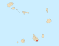
| Country | Cape Verde |
| Island | Santiago |
| Area | |
| • Total | 102.6 km2 (39.6 sq mi) |
| Population (2010)[1] | |
| • Total | 131,719 |
| • Density | 1,300/km2 (3,300/sq mi) |
| ID | 74 |
| Website | Official website |
History
Praia is one of the oldest municipalities in Cape Verde. It was created in the 18th century, when the then town of Praia de Santa Maria received town status and became the new capital of the Portuguese dominion of Cape Verde. Throughout history, its municipal territory has been successively reduced due to demographic increases.
By the end of the 19th century, the Municipality of Praia occupied the southern half of the island, while the northern half was the (larger than present) Municipality of Santa Catarina. In 1971, the two northernmost parishes of the Municipality were split off to become the Municipality of Santa Cruz,[3] and the parish of São Salvador do Mundo became part of the municipality of Santa Catarina.[4] In 1994, two more northern parishes of the Municipality were split off to become the Municipality of São Domingos.[5] In 2005, two western parishes of the Municipality were split off to become the Municipality of Ribeira Grande de Santiago.[6]
Subdivisions
The municipality is divided into the following localities for statistical reasons:[7]
- Achada Eugénio Lima
- Achada Grande Frente
- Achada Grande Tras
- Achada Limpo
- Achada Mato/Covão Mendes
- Achada Palha de Se
- Achada Santo António
- Achada São Filipe
- Achadinha
- Achadinha Pires
- Agostinho Alves
- Água Funda
- Bairro Craveiro Lopes
- Bela Vista
- Bom Coi Sul
- Caiada
- Calabaceira
- Cambudjane
- Chã de Areia
- Cidadela Cova Minhoto
- Coqueiro Castelão
- Fazenda
- Fig de Água
- Gonçalo Afonso
- João Bom
- Lem Cachorro
- Lem Dias
- Lem Ferreira
- Matão
- Monte Gonçalo Afonso
- Monte Ilhéu
- Monte Pensamento
- Monte Vaca
- Monte Vermelho
- Monteagarro
- Paiol
- Palmarejo
- Palmarejo Grande
- Palmarejo Santiago
- Pedregal
- Pensamento
- Pizarra/Sarrado
- Platô
- Ponta de Água
- Ponta do Sol
- Portete de Cima
- Praia Negra
- Prainha
- Quebra Canela
- Ribeira São Filipe
- Ribeirinha
- Safende
- São Francisco
- São Francisco de Baixo
- São Jorginho
- São Martinho Pequeno
- São Pedro Latada
- São Tomé
- Simão Ribeiro
- Terra Branca
- Tira Chapéu
- Tira Chapéu Industrial
- Trindade
- Vale Palmarejo
- Várzea
- Veneza
- Vera Cruz
- Vila Nova
- Zona do Aeroporto
- Zona Enavi
Demography
| Year | Population |
|---|---|
| 1940[8] | 18,208 |
| 1950[8] | 17,179 |
| 1960[8] | 24,872 |
| 1970[8] | 39,911 |
| 1980[8] | 57,748 |
| 1990[8] | 71,276 |
| 2000[8] | 106,348 |
| 2010[2] | 131,719 |
| 2017[9] | 159,050 |
Politics
At the federal level, Praia belongs to the constituency of Santiago South. Since 2008, the Movement for Democracy (MpD) is the ruling party of the municipality. The results of the latest elections, in 2016:[10]
| Party | Municipal Council | Municipal Assembly | ||
|---|---|---|---|---|
| Votes% | Seats | Votes% | Seats | |
| MpD | 62.74 | 9 | 62.18 | 14 |
| PAICV | 32.43 | 0 | 32.43 | 7 |
| UCID | 1.77 | 0 | 2.24 | 0 |
| PP | 0.61 | 0 | 0.68 | 0 |
| PTS | 0.26 | 0 | 0.30 | 0 |
Presidents
- José Ulisses Correia e Silva (MpD, 2006-2008 and 2013-2016)
- Oscar Santos (MpD, since August 2016-2020)
- Francisco Carvalho (PAICV, since April 2020)
References
- "2010 Census results". Instituto Nacional de Estatística Cabo Verde (in Portuguese). 24 November 2016.
- 2010 Census Summary
- Conselho de Santa Cruz. Inventário dos recursos turísticos, p. 12
- Picos: a terra e a gente, Emanuel de Jesus Monteiro Vaz Fernandes, ISE, 2005, p. 27-29
- Lei nº 96/IV/93, p. 74
- Lei nº 63/VI/2005, p. 25
- "2010 Census results Santiago". Instituto Nacional de Estatística Cabo Verde (in Portuguese). 24 November 2016.
- Source: Statoids
- "Cape Verde Population Statistics". citypopulation.de.
- Official results local elections 2016, Boletim Oficial I Série, Número 53, 23 September 2016
External links
- https://web.archive.org/web/20070928203332/http://www.cmpraia.cv/
- ANMCV (Associação Nacional dos Municípios Cabo-Verdianos - National Association of the Capeverdean Municipalities)
City of Praia | ||
|---|---|---|
| Neighbourhoods |
|   |
| Geographical features |
| |
| Education |
| |
| Landmarks |
| |
| Culture |
| |
| Sports |
| |
| Transportation | ||
| Media |
| |
| History |
| |
| Authority control |
|
|---|
Другой контент может иметь иную лицензию. Перед использованием материалов сайта WikiSort.org внимательно изучите правила лицензирования конкретных элементов наполнения сайта.
WikiSort.org - проект по пересортировке и дополнению контента Википедии