world.wikisort.org - Canada
Salaberry-de-Valleyfield is a city in southwestern Quebec, Canada, in the Regional County Municipality of Beauharnois-Salaberry.
Salaberry-de-Valleyfield | |
|---|---|
City | |
 The old canal of Beauharnois in downtown Valleyfield | |
 Coat of arms Logo | |
| Nickname: The Venice of Quebec | |
| Motto: Ubi lux ibi labor | |
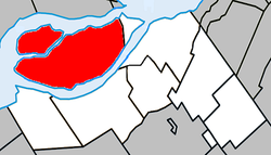 Location within Beauharnois-Salaberry RCM | |
 Salaberry-de-Valleyfield Location in southern Quebec | |
| Coordinates: 45°15′N 74°08′W[1] | |
| Country | |
| Province | |
| Region | Montérégie |
| RCM | Beauharnois-Salaberry |
| Founded | 1874 |
| Constituted | April 24, 2002 |
| Named for | Charles-Michel d'Irumberry de Salaberry |
| Boroughs | List of boroughs
|
| Government | |
| • Type | Mayor-council government |
| • Mayor | Miguel Lemieux |
| • Federal riding | Salaberry—Suroît |
| • Prov. riding | Beauharnois |
| Area | |
| • City | 125.50 km2 (48.46 sq mi) |
| • Land | 107.21 km2 (41.39 sq mi) |
| • Water | 19.78 km2 (7.64 sq mi) |
| • Metro | 523.1 km2 (202.0 sq mi) |
| Population (2019)[4] | |
| • City | 42,410 |
| • Density | 395.5/km2 (1,024/sq mi) |
| • Metro | 67,089 |
| • Metro density | 143.3/km2 (371/sq mi) |
| • Pop 2016-2019 | |
| • Dwellings | 19,356 |
| Demonym(s) | Campivallensien, Campivallensienne (fr) Campivallensian (en) |
| Time zone | UTC−5 (EST) |
| • Summer (DST) | UTC−4 (EDT) |
| Postal code(s) | J6S, J6T, J7X |
| Area code(s) | 450 and 579 |
| Highways | |
| Website | www |
The population as of 2019 was 42,410.[6] Situated on Grande-Île, an island in the Saint Lawrence River, it is bordered at its western end by Lake Saint Francis, with the Saint Lawrence to the north and the Beauharnois Canal to its south. The Port of Valleyfield is on the canal.
The historic downtown is a major touristic centre for the area.
Due to the presence of Lake St. Francis (St. Lawrence River), St. Francis Bay in downtown, and of numerous rivers and canals all over the town, the city is nicknamed "The Venice of Quebec".
History
The actual city was founded in 1874, the first mayor was Moise Plante. The first settlers arrived in 1798. At that moment, the settlement was named Pointe-du-Lac (Lake Point). The colony was then renamed Saranac, then Sainte-Cécile. Salaberry-de-Valleyfield was officially named in 1874 after Colonel Charles de Salaberry who served with the British army during the War of 1812. "Valleyfield" came from the Valleyfield Mills, a paper mill south of Edinburgh in Scotland.
The city is the seat of the Roman Catholic Diocese of Valleyfield, founded in 1892.
Salaberry-de-Valleyfield is also the seat of the judicial district of Beauharnois since 1901.[7]
Merger
In 2002, the city of 26,170 amalgamated with the following communities[8] (2001 Canada census figures):
- Saint-Timothée (8,299)
- Grande-Île (4,559)
Politics
The city council is composed of the mayor and eight city councillors. The municipal elections are at each 4 years, each councillor stands for his/her district.
| Function/District | 2005-2009 | 2009-2013 | 2013-2017 | 2017-2021 |
|---|---|---|---|---|
| Mayor | Denis Lapointe | Denis Lapointe | Denis Lapointe | Miguel Lemieux |
| 1 - Grande-Île | Denis Laître | Denis Laître | Denis Laître | Lyne Lefebvre |
| 2 - Nitro | Jean-Marc Rochon | Jean-Marc Rochon | Jean-Marc Rochon | Jason Grenier |
| 3 - Georges-Leduc | Claude Reid | Louise Sauvé | Louise Sauvé | Jean-Marc Rochon |
| 4 - Champlain | Robert Savard | Robert Savard | Jean-Luc Pomerleau | France Chenail |
| 5 - La Baie | Roger Levert | Jean-Jacques Leduc | François Labossière | Guillaume Massicotte |
| 6 - Robert-Cauchon | Jacques Smith | Jacques Smith | Jacques Smith | Jacques Smith |
| 7 - Jules-Léger | Pierre-Paul Messier | Pierre-Paul Messier | Patrick Rancourt | Patrick Rancourt |
| 8 - Saint-Timothée | Normand Amesse | Normand Amesse | Normand Amesse | Normand Amesse |
Climate
Salaberry-de-Valleyfield has a humid continental climate (Dfb) with warm summers and long, cold, and snowy winters.
| Climate data for Salaberry-de-Valleyfield | |||||||||||||
|---|---|---|---|---|---|---|---|---|---|---|---|---|---|
| Month | Jan | Feb | Mar | Apr | May | Jun | Jul | Aug | Sep | Oct | Nov | Dec | Year |
| Record high °C (°F) | 14.0 (57.2) |
16.0 (60.8) |
23.0 (73.4) |
30.0 (86.0) |
35.0 (95.0) |
34.4 (93.9) |
35.6 (96.1) |
36.5 (97.7) |
35.0 (95.0) |
28.9 (84.0) |
22.5 (72.5) |
17.0 (62.6) |
36.5 (97.7) |
| Average high °C (°F) | −5.4 (22.3) |
−3.3 (26.1) |
2.3 (36.1) |
11.2 (52.2) |
18.7 (65.7) |
23.8 (74.8) |
26.1 (79.0) |
25.3 (77.5) |
20.6 (69.1) |
12.8 (55.0) |
5.8 (42.4) |
−1.4 (29.5) |
11.4 (52.5) |
| Daily mean °C (°F) | −9.6 (14.7) |
−7.8 (18.0) |
−2.2 (28.0) |
6.3 (43.3) |
13.3 (55.9) |
18.7 (65.7) |
21.1 (70.0) |
20.2 (68.4) |
15.6 (60.1) |
8.6 (47.5) |
2.2 (36.0) |
−5.1 (22.8) |
6.8 (44.2) |
| Average low °C (°F) | −13.8 (7.2) |
−12.3 (9.9) |
−6.7 (19.9) |
1.3 (34.3) |
7.9 (46.2) |
13.5 (56.3) |
16.0 (60.8) |
15.1 (59.2) |
10.6 (51.1) |
4.3 (39.7) |
−1.4 (29.5) |
−8.8 (16.2) |
2.1 (35.8) |
| Record low °C (°F) | −38.3 (−36.9) |
−33.5 (−28.3) |
−29 (−20) |
−15.6 (3.9) |
−4.4 (24.1) |
2.2 (36.0) |
6.5 (43.7) |
1.7 (35.1) |
−2.0 (28.4) |
−8.9 (16.0) |
−21.0 (−5.8) |
−32.0 (−25.6) |
−38.3 (−36.9) |
| Average precipitation mm (inches) | 74.8 (2.94) |
59.3 (2.33) |
61.9 (2.44) |
77.3 (3.04) |
82.9 (3.26) |
94.7 (3.73) |
97.6 (3.84) |
92.5 (3.64) |
82.6 (3.25) |
92.0 (3.62) |
85.7 (3.37) |
76.8 (3.02) |
978.0 (38.50) |
| Average rainfall mm (inches) | 24.2 (0.95) |
19.9 (0.78) |
31.9 (1.26) |
70.3 (2.77) |
82.9 (3.26) |
97.4 (3.83) |
97.6 (3.84) |
92.5 (3.64) |
82.6 (3.25) |
90.6 (3.57) |
74.4 (2.93) |
33.1 (1.30) |
794.7 (31.29) |
| Average snowfall cm (inches) | 50.6 (19.9) |
39.3 (15.5) |
30.1 (11.9) |
7.2 (2.8) |
0.0 (0.0) |
0.0 (0.0) |
0.0 (0.0) |
0.0 (0.0) |
0.0 (0.0) |
1.3 (0.5) |
11.3 (4.4) |
43.7 (17.2) |
183.5 (72.2) |
| Source: Environment Canada[10] | |||||||||||||
Demographics
| Year | Pop. | ±% |
|---|---|---|
| 1991 | 27,598 | — |
| 1996 | 26,600 | −3.6% |
| 2001 | 26,170 | −1.6% |
| 2006 | 39,672 | +51.6% |
| 2011 | 40,077 | +1.0% |
| 2016 | 40,745 | +1.7% |
| 2017 | 41,578 | +2.0% |
| 2018 | 41,701 | +0.3% |
| 2019 | 42,410 | +1.7% |
Amalgamated with Saint-Timothée and Grande-Île in 2002. | ||
In the 2021 Census of Population conducted by Statistics Canada, Salaberry-de-Valleyfield had a population of 42,787 living in 20,073 of its 20,962 total private dwellings, a change of 5% from its 2016 population of 40,745. With a land area of 108.56 km2 (41.92 sq mi), it had a population density of 394.1/km2 (1,020.8/sq mi) in 2021.[12]
| 2021 | 2011 | |
|---|---|---|
| Population | 42,787 (+5.0% from 2016) | 40,077 (+1.0% from 2006) |
| Land area | 108.56 km2 (41.92 sq mi) | 107.10 km2 (41.35 sq mi) |
| Population density | 394.1/km2 (1,021/sq mi) | 374.2/km2 (969/sq mi) |
| Median age | 47.2 (M: 45.2, F: 49.6) | 47.1 (M: 45.1, F: 48.7) |
| Total private dwellings | 20,070 | 19,050 |
| Median household income | $44,510 |
| Canada Census Mother Tongue - Salaberry-de-Valleyfield, Quebec[11] Amalgamated with Saint-Timothée and Grande-Île in 2002. | ||||||||||||||||||
|---|---|---|---|---|---|---|---|---|---|---|---|---|---|---|---|---|---|---|
| Census | Total | French |
English |
French & English |
Other | |||||||||||||
| Year | Responses | Count | Trend | Pop % | Count | Trend | Pop % | Count | Trend | Pop % | Count | Trend | Pop % | |||||
2016 |
39,670 |
37,480 | 94.48% | 1,160 | 2.92% | 395 | 1.00% | 570 | 1.44% | |||||||||
2011 |
39,425 |
37,475 | 95.05% | 1,105 | 2.80% | 455 | 1.15% | 390 | 0.99% | |||||||||
2006 |
38,565 |
36,845 | 95.54% | 1,035 | 2.68% | 240 | 0.62% | 445 | 1.15% | |||||||||
2001 |
25,450 |
24,260 | 95.32% | 735 | 2.89% | 200 | 0.79% | 255 | 1.00% | |||||||||
1996 |
25,995 |
24,855 | n/a | 95.61% | 660 | n/a | 2.54% | 235 | n/a | 0.90% | 245 | n/a | 0.94% | |||||
Attractions
The Musée de Société des Deux-Rives (MUSO), which covers the economic and cultural history of the region, is located in the city.
The city houses one of the 10 minor basilicas in Quebec. Cathedral-Basilica of Saint Cecilia, built in 1934–1935, is one of the largest churches in the country.
The city has been the site of the Valleyfield Regattas since 1938. The event takes place every year at the beginning of July over a three-day period in the heart of the city on Bay Saint-François. It is an international hydroplane competition, in which power boats achieve speeds of up to 225 km/h. Attracting over 130,000 visitors per year, it also includes other cultural activities.[17]
Education
- 9 daycare facilities
- 3 pre-kindergarten centres
- 12 elementary schools (some with daycare services), of which one is English-language.
- 1 high school
- 1 adult education centre
- 1 vocational training centre
- 1 CEGEP: Collège de Valleyfield
- 1 French-language university centre
Gault Institute
The Gault Institute was created by Andrew Frederick Gault. He created this school during the time that the Gault Cotton Mills were up and running. To heat the school at one time he used underground pipes connecting from the school to the Cotton Mills since at the time there was no electricity.
Notable people
- Lise Bacon: Quebec politician.
- Line Beauchamp: Quebec politician.
- Jean-Luc Brassard: Olympic gold medalist in skiing.
- Pierre Cossette: television and Broadway producer.
- Mélodie Daoust: Olympics gold medalist in ice hockey.
- Paul-Émile Léger: Cardinal of the Catholic Church.
- Suzanne Fortier: Principal at McGill University.
- Armand Frappier: physician and microbiologist.
- Karla Homolka: serial killer.[18]
- Vladimir Katriuk (1921-2015) alleged Nazi war criminal.
- J. Albert Leduc: ice hockey player and businessman.
- Serge Marcil: politician and Minister of Employment in 1994.
- Anne Minh-Thu Quach: MP for Beauharnois—Salaberry.
- Jean Ouimet: former leader of the Green Party of Quebec.
See also
- Beauharnois-Salaberry Regional County Municipality
- Beauharnois Canal
- List of cities in Quebec
References
- "Reference number 125037 in Banque de noms de lieux du Québec". toponymie.gouv.qc.ca (in French). Commission de toponymie du Québec.
- "Affaires Municipales et Regions Quebec: Salaberry-de-Valleyfield". Archived from the original on 2012-02-05. Retrieved 2012-03-11.
- Riding history for Beauharnois—Salaberry, Quebec from the Library of Parliament
- 2011 Statistics Canada Census Profile: Salaberry-de-Valleyfield, Quebec
- 2011 Statistics Canada Census Profile: Salaberry-de-Valleyfield (Census agglomeration), Quebec. The census agglomeration consists of only Salaberry-de-Valleyfield itself. This was unchanged from the 2006 census.
- "Salaberry-de-Valleyfield - Répertoire des municipalités - Ministère des Affaires municipales et de l'Habitation". www.mamh.gouv.qc.ca. Retrieved 2019-11-28.
- Territorial Division Act. Revised Statutes of Quebec D-11.
- "Archived copy" (PDF). stat.gouv.qc.ca. Archived from the original (PDF) on 30 December 2006. Retrieved 22 May 2022.
{{cite web}}: CS1 maint: archived copy as title (link) - Tremblay, Éric (November 6, 2017). "Miguel Lemieux succède à Denis Lapointe (French Only)". Journal Saint-François.
- "Salaberry-de-Valleyfield Climate". Canadian Climate Normals 1981–2010 (in English and French). Environment Canada. 31 October 2011. Retrieved June 6, 2015.
- Statistics Canada: 1996, 2001, 2006, 2011 census
- "Population and dwelling counts: Canada, provinces and territories, and census subdivisions (municipalities), Quebec". Statistics Canada. February 9, 2022. Retrieved August 29, 2022.
- "2021 Community Profiles". 2021 Canadian Census. Statistics Canada. February 4, 2022. Retrieved 2022-04-27.
- "2011 Community Profiles". 2011 Canadian Census. Statistics Canada. March 21, 2019. Retrieved 2014-01-28.
- "2006 Community Profiles". 2006 Canadian Census. Statistics Canada. August 20, 2019.
- "2001 Community Profiles". 2001 Canadian Census. Statistics Canada. July 18, 2021.
- Home - Régates de Valleyfield
- Calvé, Mélanie (September 5, 2019). "Karla Homolka Vit Maintenant a Salaberry de Valleyfield". Viva Media. Retrieved September 5, 2019.
External links
Adjacent Municipal Subdivisions | ||||||||||||||||
|---|---|---|---|---|---|---|---|---|---|---|---|---|---|---|---|---|
| ||||||||||||||||
| Cities | |
|---|---|
| Municipalities | |
| Parish Municipalities |
|
| |
Authority control | |
|---|---|
| General | |
| National libraries | |
| Other |
|
На других языках
[de] Salaberry-de-Valleyfield
Salaberry-de-Valleyfield ist eine Stadt im Südwesten der kanadischen Provinz Québec. Sie liegt in der Verwaltungsregion Montérégie, rund 60 km südwestlich von Montreal, 35 km nördlich der Grenze zu den USA und 20 km östlich der Grenze zur Provinz Ontario. Salaberry-de-Valleyfield ist Verwaltungssitz der regionalen Grafschaftsgemeinde (municipalité régionale du comté) Beauharnois-Salaberry, hat eine Fläche von 107,10 km² und zählt 40.745 Einwohner (Stand: 2016). Die heutige Stadt entstand 2002 durch die Fusion von drei Gemeinden.- [en] Salaberry-de-Valleyfield
[ru] Салаберри-де-Валлифилд
Салаберри-де-Валлифилд (фр. Salaberry-de-Valleyfield) — город в провинции Квебек, Канада, расположен в административной области Монтережи[1]. Перепись 2006 года выявила 39 672 жителя города[2].Другой контент может иметь иную лицензию. Перед использованием материалов сайта WikiSort.org внимательно изучите правила лицензирования конкретных элементов наполнения сайта.
WikiSort.org - проект по пересортировке и дополнению контента Википедии